
It was not until late in the afternoon that my six Sherpas and I managed to escape from our predicament. Early in the morning, soon after leaving our high camp on the glacier, we had found ourselves trapped above sheer cliffs - unable to climb back up and unable to descend.
We were on the 10th day of our trek and on the third day of crossing the remote, 5800metre ( c19,000ft. ) Tilman`s Pass through the Jugal Himal into the Langtang Valley to the north of Kathmandu.
Tilman`s Pass was the final link in my traverse of the Nepal Himalaya from Kangchenjunga in the East to Dhaulagiri in the West. The pass was only infrequently crossed and Highland Sherpa, my trekking agency, did not have a guide for the route. However accounts of previous crossings did not indicate that it would be any more difficult than other high passes that I had already crossed.
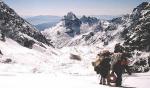
From Kathmandu we drove through ripe, golden-yellow, paddy fields and lush sub-tropical vegetation to the roadhead at the Tamang village of Chautara.
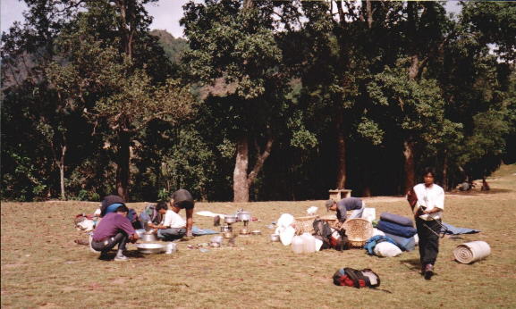 Camp
at Chautara Village
|
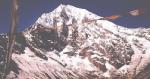
For four days we climbed up and along a broad ridgetop on primitive trails through uninhabited wilderness. Fine views obtained down to the river valleys and across to rugged, green hillsides strewn with meagre terraces and isolated dwellings. Along the northern horizon stretched the great white wall of the Jugal Himal.
 Langtang
Himal on route to Tilman's Pass
|
My six Sherpas were: Nima, sirdar, only 24 but a veteran of many previous treks with me; Phurba Tilje, also 24, our cook, and Mingma, l8, our kitchenboy, both from Nima's home village of Tashinam; Phurba, 35, our climbing guide, and his younger brother Pema, 20, a high altitude porter; Pasang, 22, a porter and tall for a Sherpa at about six feet and head and shoulders above the diminutive Phurba.
On our sixth day a narrow, rocky staircase wound up to the Jugal Panch Pokhari - a set of five small lakes - ensconced in a vast boulder-strewn amphitheatre, where we encamped near the small temple to Vishnu, a place of pilgrimage for local Hindus from the surrounding Helambu region but presently deserted.
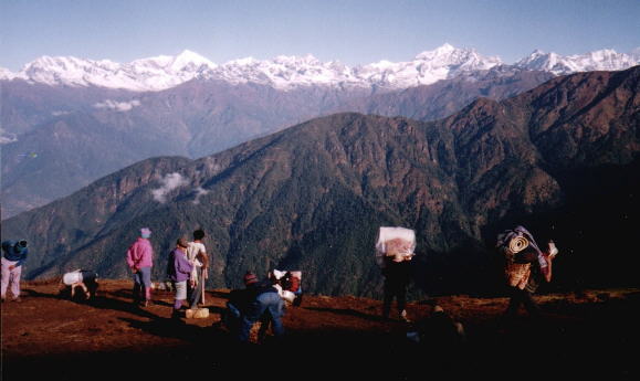
A faint and intermittent path now contoured round a succession of corries beneath a high rocky escarpment. From the crest of a final spur we gained a splendid panorama of the peaks of the Jugal Himal.
 Dorje
Lakpa on route to Tilman's Pass
|
Directly opposite, towering above great glaciers and tumbling ice-falls, were the twin summits of the dominant Dorje Lakpa; only just under 7000metres in height. Extending from Dorje Lakpa were the jagged peaks of Kanshurum, Urkinmang and Ganchenpo forming a massive barrier of rock and ice blocking our way North to the Langtang Valley.
Although we could see our way ahead up the moraines and snow of the Balephi Glacier our objective of Tilman's Pass remained concealed by a dog-leg behind the cliffs of Urkinmang.
Descending into the Balephi Khola Valley we continued down past two lochans and encamped beside a stream beneath the terminal moraine of the glacier. In the evening the summit snowfields of Dorje Lakpa flamed red in the final rays of the setting sun.
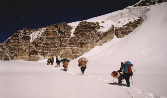
 Ascent
of Lower Balephi Glacier
to Tilman's Pass |
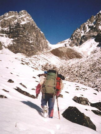
It was several hours difficult going up the snow -covered moraines next morning before the pass came into view - a narrow gap in the skyline sandwiched between high rock precipices of Urkinmang and Ganchenpo. Late in the afternoon we trampled out spaces for our tents in a level snowfield beneath the ice-cliffs falling from the upper glacier.
An awkward scramble up broken rock and loose scree on the right ( East )side by-passed the ice-cliffs and a series of narrow, suspect, snow-bridges provided a zig-zag route through a badly crevassed zone onto a broad upper neve.
 Ascent
of Upper Balephi Glacier
to Tilman's Pass |
It was then hard going through deep, soft snow and the two Phurbas took turns at breaking trail. However frequent stops were made to enjoy the spectacular view back down the glacier into the Balephi Valley.
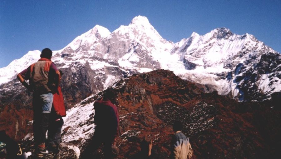
A final steep, snow -slope gained the top of the pass and a magnificent new panorama of the peaks of the Langtang Himal ranged along the Tibetan border.
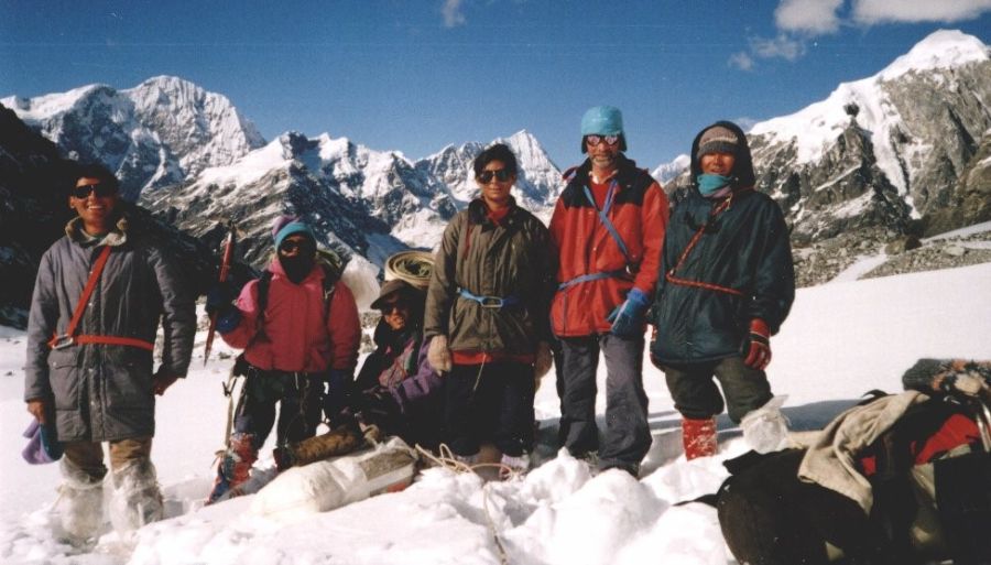
Group on Tilman's Pass
|
There were crevasses on the left and crevasses on the right but we plunged directly down the fall-line onto a small plateau where we made a second snow camp beneath the towering heights of Ganchenpo and Urkinmang. Further below, on the lower, flatter glacier was a small lake seemingly only a short distance away.
I slept soundly that night content that we had successfully crossed the pass and with the prospect of an easy, downhill journey the following day.
The two Phurbas had gone ahead and signalled us to follow down a steep snow slope. It was at the foot of the slope that our predicament began.
"Now we have to go round", announced Phurba. I was not unduly concerned. Straight line descents are uncommon and I`d had to `fiddle` my way down many mountains in Scotland and other parts of the world. The lake looked very close.
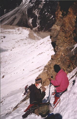 Descending
cliffs
below Tilman's Pass |
Our climbing rope had already been secured between two rocks. Loads were clipped onto the rope with carabiners and slid across to the far end.
We were still transporting two dokos ( conical wickerwork baskets for carrying loads ). Mingma had the `kitchen` doko packed with cooking and eating utensils and Pema one with our food supplies.
The food doko was too heavy and was unloaded. One sack was placed on the snow. I shouted a warning as it started to move but too late. Moving slowly at first, it gained speed, started to roll, turned on its long axis and cartwheeled out into space. The danger of our situation was apparent.
At the far end the loads were piled up. A small white kitbag, a family heirloom, a relic of the Boer War, was dislodged and also disappeared over the edge.
We were committed to continuing - there was no way of going back - certainly not carrying any loads. I was now seriously concerned about our situation. Two loads had already been lost - next time it might be a person!
We progressed across the face but without finding any way down.
Another traverse across a rock rib proved more difficult to negotiate.. Again the two Phurbas managed to secure our rope between two rock projections. However in this case an initial vertical descent was followed by a horizontal traverse.
I managed the vertical part but on transferring to the horizontal lost my footing and found myself suspended on the rope - the first time ever that I had 'come off '. Badly shaken I regained contact and inched my way to the end of the rope. It was a few minutes before I recovered enough to unclip and move on. The Sherpas said nothing but I do not think they were impressed by my performance. Mingma and Pasang followed without apparent difficulty.
The 'kitchen' doko was clipped onto the rope and sent off but jammed on the rocks. The rope was jerked to free it - the carabiner flew off the rope! For an instant the doko hung in mid-air before plunging out of sight. There was an outburst of Nepali - presumably to the effect of " how the hell did that happen? ".
Phurba produced a jumar and climbed back up. He then cut off the section of rope tied round the top rock, threaded the rope through the belay and came back across on the doubled rope enabling it to be retrieved. We were now well and truly committed to finding a way down.
Frustratingly, on the far ( western ) side of the lake we could now see easy snow and scree slopes leading from the upper glacier - obviously the way we should have come.
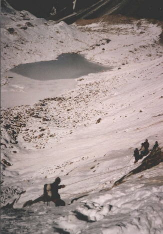 Descending
cliffs
to Glacier lake below Tilman's Pass |
A gully offered some hope of escape but Phurba soon re-emerged. " Sakdaina ",( not possible ) he declared.
Phurba and Pema then made a long rising traverse across the face. I watched anxiously as they negotiated a seemingly vertical rock step and then an exposed slab. They disappeared round the corner. It seemed an age before they re-appeared." Sakcha ", ( possible ) they shouted.
Slowly they returned hacking out better steps in the snow and ice. At one frightening moment Pema's foothold gave way but he quickly swung in the pick of his ice-axe and hauled himself back up.
" Not possible to carry loads - only personal belongings ", announced Nima. I agreed and our remaining loads - tents, mattresses, kerosene, food, - were all jettisoned to an uncertain fate down the gully.
I was apprehensive about climbing the rock step but it proved to be easy. The slab however was awkward with no good holds. I called on Phurba to keep the rope tight, spread myself over the rock and edged my way up trying not to think about the drop below. The other Sherpas followed with more aplomb and assurance.
That was the crux. Around the corner a steep snow slope, albeit an avalanche cone, swept down to the lake. It had taken us eight hours to escape from the cliffs.
From the lakeside I looked back up at the sheer wall and the vestigial, intermittent snow ledges. It looked utterly impossible that we had somehow managed to come across it.
We continued downwards over the rough, snow-covered moraines.
It was now late in the afternoon, the sun had already disappeared behind Ganchenpo, and there was no suggestion of going to look for the loads. We were still high in the mountains and the only thought was to get down as far and as fast as possible.
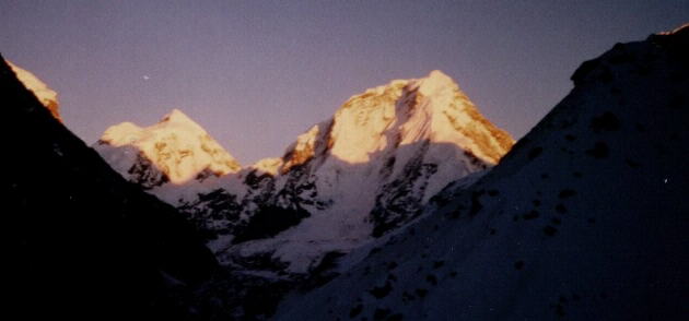 Sunset
on Dorje Lakpa
|
Another steep snow slope from the crest of a moraine brought us onto the subsidiary Langshisha Glacier and below the snowline. However it was now dark. By torchlight we stumbled on over the boulder fields and eventually came to a large shelter-stone beside a stream.
Here Phurba and Pema decided to spend the night and quickly had a fire going. I also decided to stay. Nima and the others wanted to continue on to Kyanjin, a popular trekking destination in the Langtang Valley with many lodges, and after a brief rest they set off.
It was a typical himalayan night-sky filled with countless stars - familiar constellations of Cassiopea and the Plough difficult to discern - and also bitterly cold.
At first light I shared out the remains of my emergency rations and we continued downstream through trackless scrub. Shortly our way was barred by the Langtang Khola. Ice-glazed boulders left us no option but to immerse our feet in the freezing waters to get across.
That was the final hurdle. At the yak pastures of Langshisha we met another trekking crew who provided us with some very welcome hot food. It was then a pleasant walk in warm sunshine down the meadows of the spectacularly beautiful Langtang Valley beneath its avenue of imposing himalayan peaks; Langshisha Ri, Ganchenpo, and the reigning, 7000metre, Langtang Lirung towering above the cluster of lodges at Kyanjin.
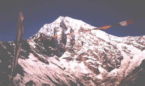 Mt.
Langtang Lirung above Kyanjin
|
After a day's rest Phurba, Pema and Mingma went back in search of the loads. Late the following evening they returned in triumph. They had succeeded in recovering almost everything. Apart from the white kitbag, which had been torn to shreds but had protected its contents, the major loss was our two stoves. I had planned to return to Kathmandu over the Ganja La high pass but this was not now possible. We were all relieved!
( The Weekend Extra, The (Glasgow) HERALD, Saturday 25th January 1997 )
Nepal Info:- Trekking & Climbing Agencies, Information Directories, etc
Himalaya Map - Nelles ( UK , USA )
Nepal Trail Map - Nelles ( UK , USA )
Everest Base Camp Map ( UK , USA )
Khumbu Region Map ( UK , USA )
Island Peak - Climbing Map ( UK , USA )