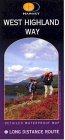
The Munros - Scotland's Highest Mountains Scottish Highlands Hillwalking Guide

 The Scottish Highlands


Monadh Liath
The High Mountains of Britain & Ireland The Cairngorms


Geal Charn in the Monadh Liath Mountains

Geal Charn in the Monadh Liath Mountains


Geal Charn in the Monadh Liath Mountains

Geal Charn in the Monadh Liath Mountains


Geal Charn in the Monadh Liath Mountains

Geal Charn in the Monadh Liath Mountains


Geal Charn in the Monadh Liath Mountains

Geal Charn in the Monadh Liath Mountains


Cairn on Geal Charn in the Monadh Liath Mountains

Cairn on Geal Charn

in the Monadh Liath Mountains


Map of Geal Charn in the Monadh Liath Mountains

Map of Geal Charn in the Monadh Liath Mountains


Route Map of Geal Charn in the Monadh Liath Mountains

Route Map of Geal Charn


GEAL CHARN - ROUTE DESCRIPTION:

Location: Strathspey
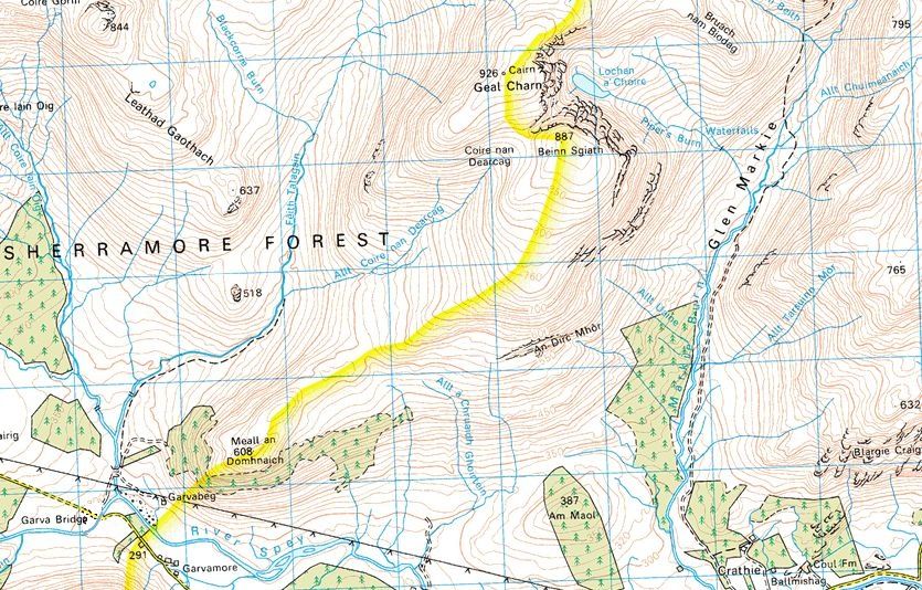
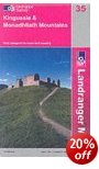
Map: OS Landranger 35 (GH561988)
Distance: 11 miles (17.5km)
Time: 6 hours
Terrain: tracks and paths

While the peaks of the Monadhliath mountains give enjoyable ascents, the approaches mostly involve ploughing through a moorland of peat hags and bog. It may offer solitude, nature in the raw and big skies, but it doesn’t give the Monadhliath a good name among Munro-baggers.
At the very western end, Geal Charn manages to avoid the boggy excesses of the main massif. There's at least one river crossing, but in most conditions it's little more than a paddle requiring a spare pair of socks.
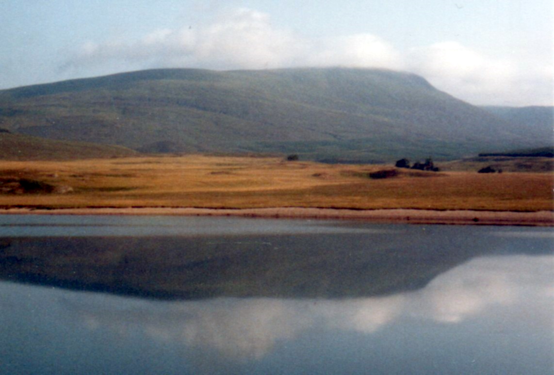
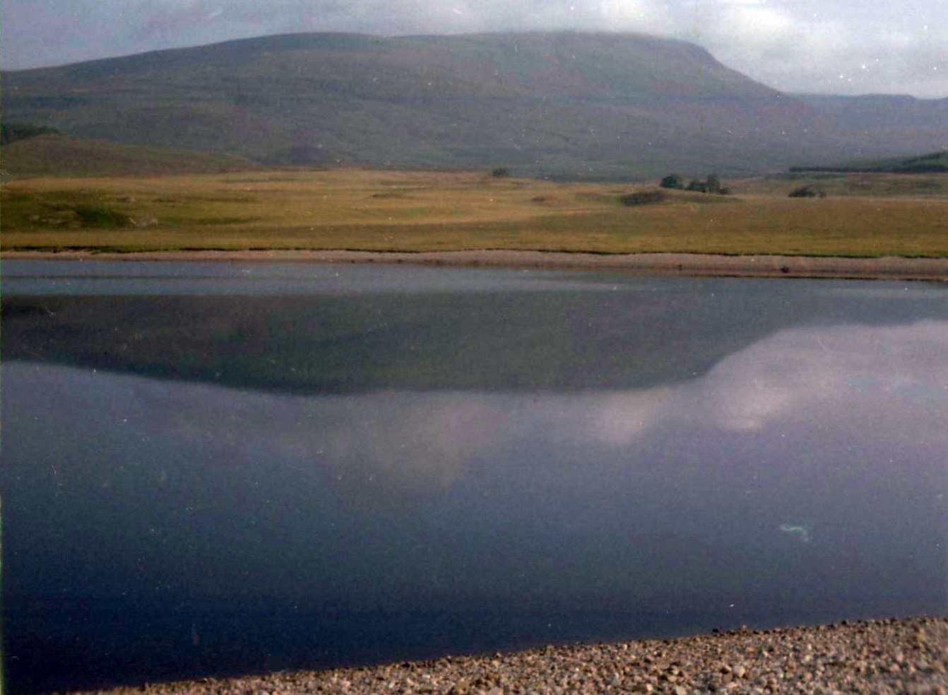
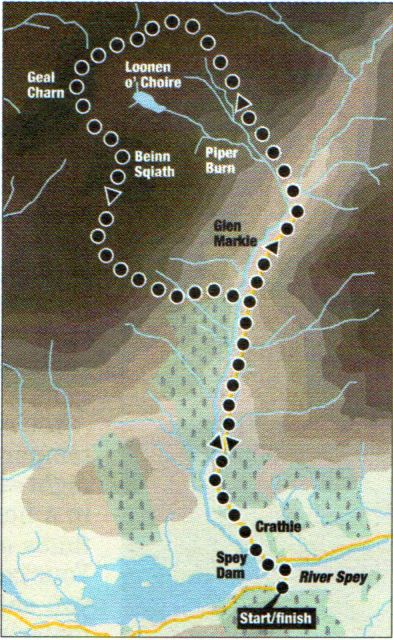
Start at the Spey Dam Reservoir on the Corrieyairack Pass road, west of Laggan.
If parking is a problem then continue beyond the bridge over the Spey and park at the right-hand bend.
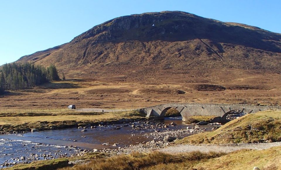
Return to the dam access track, keeping straight ahead on the old gravel track where the new one swings left to a bridge over the Markie Burn.
A pleasant ramble follows for three miles [5km] up Glen Markie, passing below the craggy southern flanks of Beinn Sgiath to the Piper's Burn, which drains the eastern corrie of Beinn Sgiath and Geal Charn.
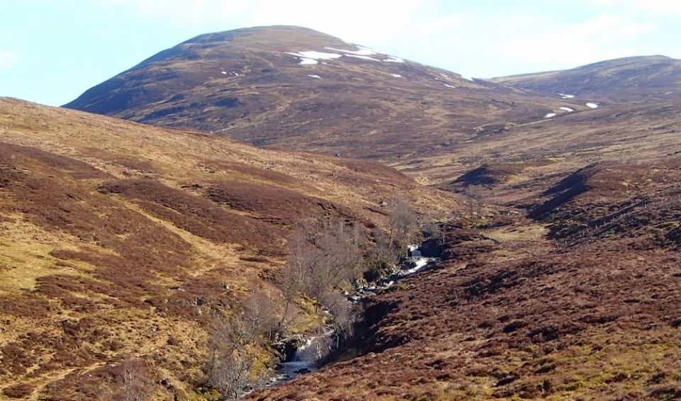
Leave the main track for a grassy one leading down to a ford over the Markie. Paddle across to reach a grassy track which leads up the right side of the Piper's Burn to a gate, where it becomes a path. If the Markie Burn can't be crossed, there is a bridge about 875 yards (800m) further on, from where the pathless north-east ridge can be gained.
The path veers off right away from Geal Charn's cliff-lined corrie and ascends to the north-east ridge. A gentle ascent over rock and springy 
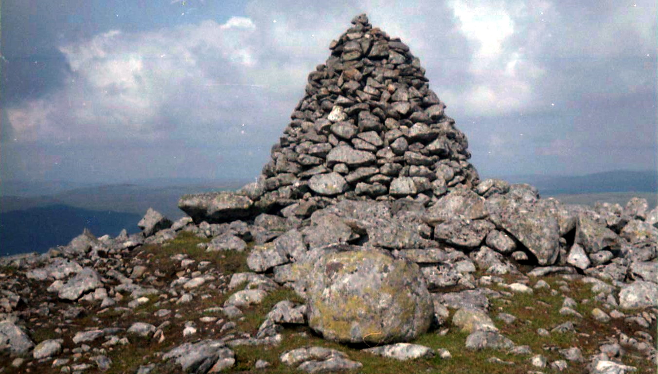
moss leads through a line of fence posts to the summit cairn (2240ft/683m) with its views of Binnein Shios and Binnein Shuas to the west.
The best return in good visibility is via Beinn Sgiath, although it doesn't avoid a paddle over the Markie. Head south then south-east over mossy ground to a “window” between Geal Charn and Beinn Sgiath and ascend the rounded mossy plateau to a small cairn at the summit.
Descend south then south-east, keeping to the crest of the broad south-west ridge to clear the craggy ground on the southern flanks. At about the 750m contour descend south towards Dirc Mhor, then east to the forest edge, which leads down to the Markie, which is wider than higher up, making a drier crossing likelier. Follow sheep paths south beside the burn to clear the steep bracken-covered slopes and gain the track back to Spey Dam.

<< Back : Eastern HighlandsNext >>


Scottish Peaks : Scotland Index

Knoydart :: Glencoe :: Ben Nevis:: Isle of Skye :: Isle of Arran

NW Highlands :: Southern Highlands :: Central Highlands


Worldwide Mountaineering :: Adventure Travel :: Site Index

fb icon  google+ icon Linkedin icon  twitter


Travel & Guide Books & Maps:-  


Aviemore, Granton & Cairngorm Mountains OS Landranger Map

Lochnagar & Glenshee - Map Cairngorm - Map The Munros Map Western Scotland & the Western Isles OS Road Map Northern Scotland OS Road Map Southern Scotland OS Road Map

Cairn Gorm & Ben Macdhui - OS Explorer Map Aviemore, Granton & Cairngorm Mountains OS Map Inverness, Loch Ness a Strathglass - OS Landranger Map Braemar, Tomintoul & Glen Avon - OS Explorer Map Kingussie & Monadhliath Mountains Landranger OS Map: Fort Augustus, Glen Albyn, Glen Roy


Walking the Munros - Southern, Central & Western Highlands 

The High Mountains of Britain & Ireland  Munros Tables SMC  The Munros - Scotland's Highest Mountains  Scotland - Lonely Planet  NW Highlands - SMC Guide  Exploring the Far NW of Scotland  Guide to Walks in NW Highlands

Walking in Scotland - Lonely Planet Mountain: Exploring Britain's High Places  National 3 Peaks Walk Scottish Highlands Hillwalking Guide The Scottish Islands Bouldering in Scotland

Central Highlands: Six Long Distance Walks West Highland Way: Official GuideWest Highland Way: Rucksac ReadersWest Highland Way: TrailblazerThe West Highland WayWest Highland Way: Footprint MapWest Highland Way - Map West Highland Way - Map 100 Hillwalks around Glasgow

Pathfinder Guide: Fort William and Glen Coe Walks Rambler's Guide: Ben Nevis and Glen CoeGlencoe Rock & Ice Climbing The Munros: Scottish Mountaineering Club The Munros and Tops The Corbetts - SMC Munros & Corbetts Chart The High Mountains of Britain and Ireland Munro Almanac

The Munros - Scotland's highest mountains Call of the Corbetts Magic of the Munros Hamish's Mountain WalkThe Munros in WinterMy Scotland by Hamish MacInnes

Scottish Mountains - 50 Classic Routes50 More Routes on Scottish Mountains The High Mountains of Britain and Ireland Scotlands 100 Best Walks Scottish Mountains - 100 Best RoutesBig Walks of Great Britain Classic Walks in Britain & Ireland

Scottish Hill & Mountain Names Classic Mountain Scrambles in Scotland Classic Climbs - Central & Southern Highlands Mountaineering in Scotland and Undiscovered Scotland by W.H.MurrayMore Wilderness Walks Wilderness Walks Wilderness Walks 2 - Video Ski Mountaineering in Scotland

Ski Touring in ScotlandScrambles in Lochaber Rock Climbing in Scotland Rock Climbing SkillsThe FACE: Six Great Climbing Adventures Ben Nevis: Rock & Ice ClimbsGreat Snow & Ice Climbs of the British Isles100 Best Routes on Scottish Mountains One Man's Mountains - Tom Patey

A Mountaineer's Tale - W.H.MurrayDougal Haston: Philosophy of RiskThe Glens of Rannoch Southern Highlands - MapNorthern Highlands Central Highlands West Highlands Central Highlands SMCNW Highlands SMC

Scotland - Lonely PlanetScotland's Highlands & Islands - Lonley Planet Scotland's Highlands & Islands - Rough Guide Highlands & Islands of Scotland - Hidden Places Rough Guide ScotlandScottish Highlands & Islands - Rough Guide Rough Guide: Scotland Lonely Planet, Walking in ScotlandLonely Planet - Walking in Britain

50 Walks in the Scottish Highlands & Islands 100 Walks in ScotlandVisit Scotland - Touring Guide Scotland: Where to Stay - Hotels & Guest Houses Scotland: Where to Stay - Bed & Breakfast Hillwalker: The MunrosHillwalker: The Corbetts

Weather for Hillwakers & Climbers Mountain Weather Guide to the Weather Weather: Collins Gem Hillwalking Handbook for Mountain Leaders Hillwalkers Manual Hillwalkers Guide to Mountaineering First Aid on Mountains


Google Analytics


Google Analytics 

extremetracking
 eXTReMe Tracker


extremetracking