  |
The Scottish Highlands Meall Ghaordie
|
  |
| |
The Scottish Highlands Meall Ghaordie
|
|
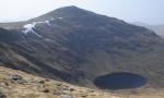
Photographs of the Munro Meall Ghaordie above Glen Lochay
and Glen Lyon in the Central Highlands of Scotland
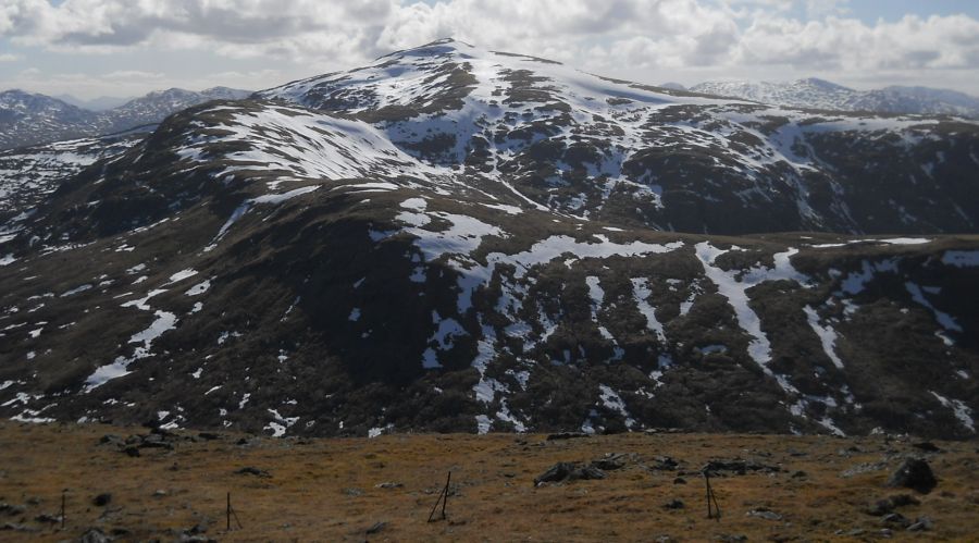
 Meall
Ghaordie ( Ghaordaidh )
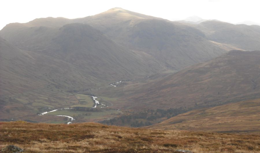
in Glen Lyon |
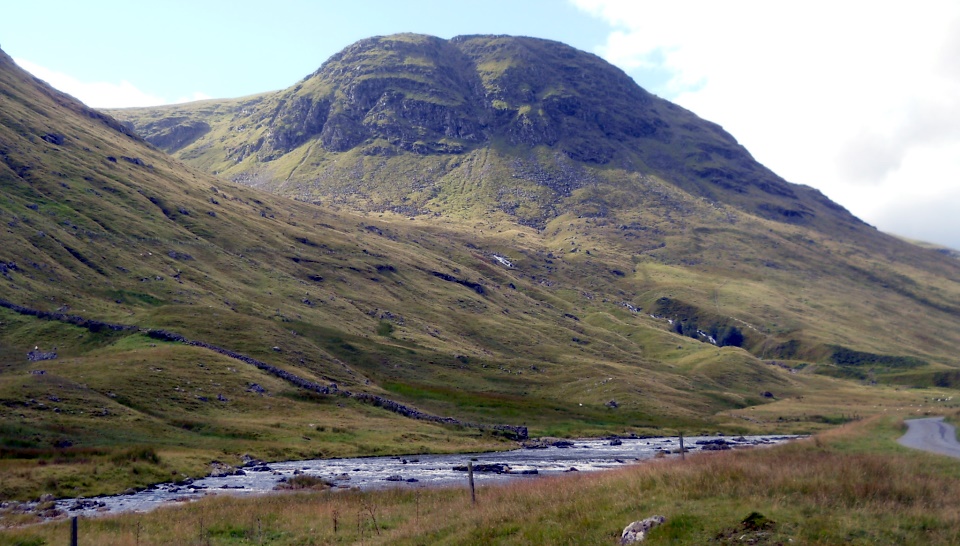
 Meall
Ghaordie ( Ghaordaidh ) - 3409ft, 1039m
- above Stronuich Reservoir in Glen Lyon |
 Meall
Ghaordie ( Ghaordaidh )
above Stronuich Reservoir in Glen Lyon |
 |
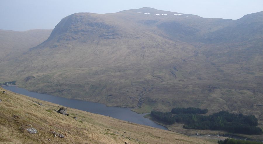
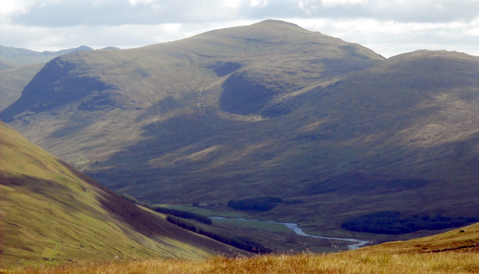 Meall
Ghaordie ( Ghaordaidh )
- 3409ft, 1039m - above Glen Lyon |
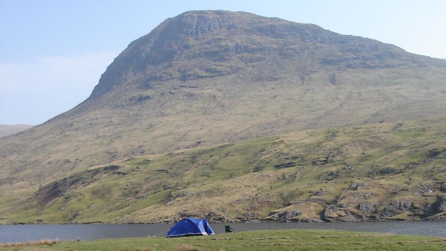
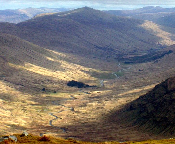 Meall
Ghaordie ( Ghaordaidh ) -
3409ft, 1039m
- above Glen Lochay |
 |
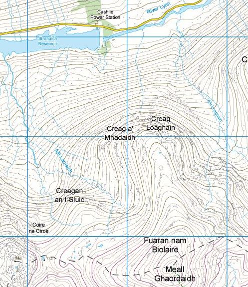 Map of
Meall
Ghaordie ( Ghaordaidh )
above Glen Lyon |
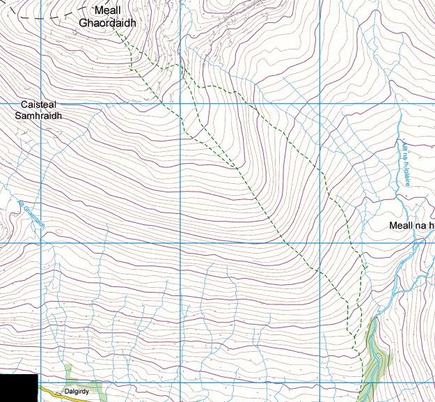 Map of
Meall
Ghaordie
above Glen Lochay |
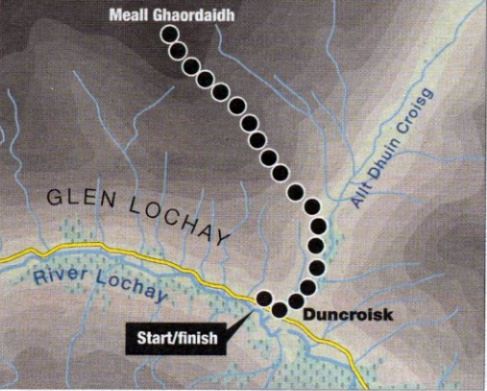 Route
Map of
Meall
Ghaordie
above Glen Lochay |
MEALL GHAORDIE - ROUTE DESCRIPTION:
MEALL GHAORDIE - ROUTE DESCRIPTION 2:
Location: Perthshire
Map: OS Landranger 51
Distance: 5 miles ( 8km )
Time: 34 hours
Grade: Easy hill walk
Glen Lochay’s Meall Ghaordie will never win any prizes for popularity but being a Munro — it stands 3409ft / 1039m high - it will never be short of visitors.
Even on a wet and blustery afternoon the hill attracts its fair share of baggers.
In summer it’s no more than a grassy plod, a good afternoon or evening stroll - even a hill such as Meall Ghaordie has its good attributes.
Meall Ghaordie is essentially a blunt nose that lifts itself above the rough moorland of the long, undulating ridge between the Lairig
Breisleich and the Lairig nan Lunn. Both passes connect Glen Lochay with Glen Lyon.
The guidebook route follows the long grassy slopes from Glen Lochay.
The route from the north, from Glen Lyon, is marginally more attractive, thanks to a couple of rocky spurs, Creag an Tulabhain and Creag Laoghain.
Once you cross the River Lyon near the Stronuich Reservoir a straightforward route follows the Allt Laoghain high into its corrie
from where grassy slopes lead to the summit cairn. An even better route from Glen Lyon crosses the river near Cashlie and follows the line of the Allt
Chiorlaich to a high bealach just west of Meall Na Cnoc-laraich. From the summit of Meall Na Cnoc-laraich a short descent then a climb up a broad
ridge takes you on to the Munro.
The Glen Lochay ascent is even more straightforward. A long trudge of some 900m from Tullich or Duncroisk follows grassy slopes, the monotony
of which is only broken by some rocky outcrops near the summit ridge.
Probably the most rewarding way to climb Meall Ghaordie is by using two cars and making the ascent of the hill part of a high-level traverse between
Glen Lochay and Glen Lyon. From the summit of Meall Ghaordie, a north-east trending ridge drops to a high bealach from where steep slopes
climb to the summit of the shapely Beinn nan Oighreag. From here another ridge stretches north above the Lairig Breisleich before dwindling
out above the Lochan na Lairig road as it descends to Bridge of Balgie.
Route:
Start and finish at the small layby at Duncrolsk in Glen Lochay ( GR: NN530362 ).
Go through the gate by the road and follow the ( often muddy ) footpath through fields on the W side of the Allt Dhuin Croisg.
Follow this path as it climbs higher past some old shielings.
Cross a fence by a stile on to open hillside and continue on the path until you reach an old sheepfank on the skyline.
From here leave the path and take a NW line up the broad and undulating ridge to more rocky slopes just below the summit.
Weave a route around the rocks and climb more steeply to the summit trig point that sits inside a large circular cairn.
Descend by the same route.
Ben Nevis | Knoydart | Isle of Skye | Isle of Arran | The West Highland Way
The Eastern Highlands | The Central Highlands | The Southern Highlands | The NW Highlands