( Note:
Click here or on above for large format copy )
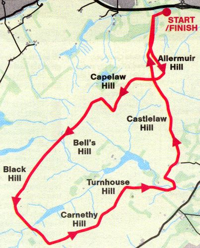
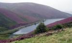
Route
Map for Pentlands
PENTLAND HILLS - ROUTE DESCRIPTION:-
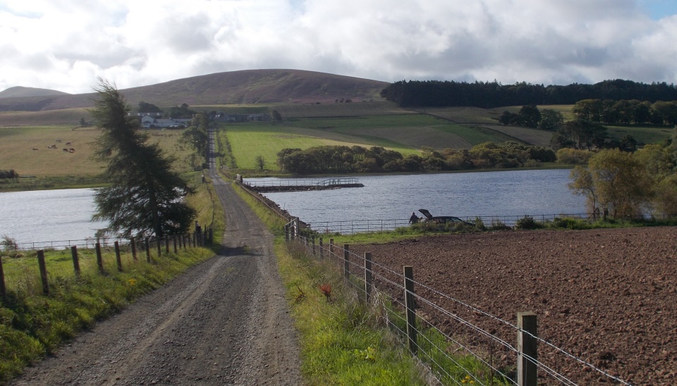
Location: Midlothian Map: OS Explorer 344 Distance: 14 miles ( 22.5km ) Time: EH3 hours Grade: Strenuous hill walk This walking tour offers a good day out in the hills, taking in 13 tops and roughly 1500m of climbing over 22km. The views over Edinburgh, the Forth and surrounding areas are well worth the effort and as you reach each peak you are well rewarded with a marvellous vista all around you. After a gentle start from the
car park around to
Swanston, we were presented
with the toughest climb of the
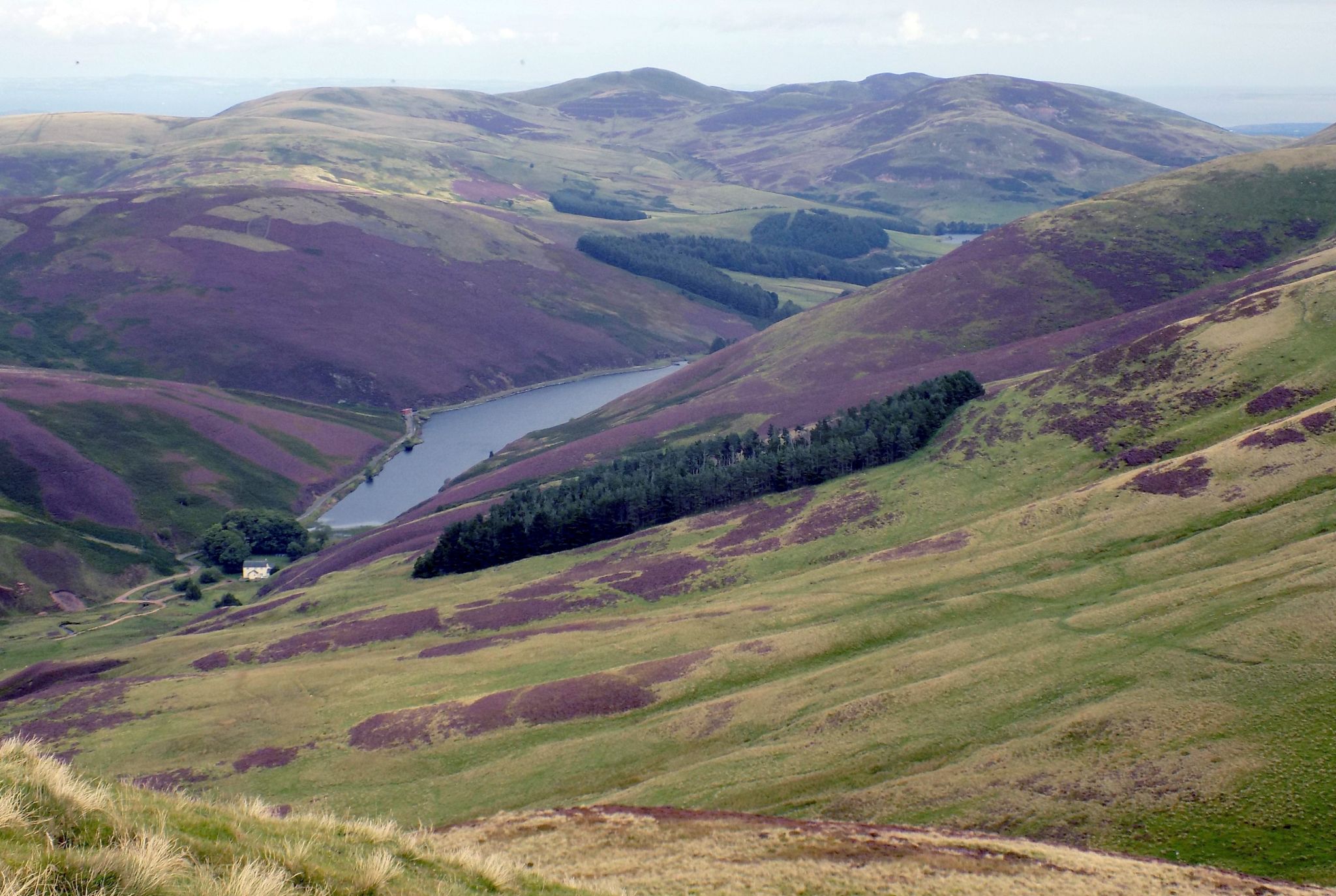
day as we ascended Allermuir Hill. It's always good knowing you have tackled the toughest part of the day and so from Allerrnuir we set off in high spirits towards our next peak across on Capelaw Hill. Although there is no clearly defined footpath on the OS map there is a well-worn path over the hill to keep the mind at ease as you take in your surroundings. This path then followed the fenceline skirting around Bell’s Hill before presenting us with a long climb up the spine of Black Hill. Once we were at the top we were able to appreciate the scenery which surrounds Edinburgh. We found ourselves surrounded by picturesque reservoirs, woods and rivers, making us realise how lucky we are to have all of this right on the doorstep of the capital. We started our descent down Black Hill — some care is required as the ground is loose underfoot and with any amount of rain the route down becomes much trickier. Once down to the valley floor we found ourselves closed in by two steep sides before opening up on to an area surrounding The Howe, a quaint little house at the top of the reservoir. This was a great spot to perch for a packed lunch, and we were glad we had stopped to top up our energy levels as the route started back with a bang, taking us up a steep climb on to the southern ridge of the Pcntlands. With Scald Law looming to our right it was with relief that we turned our backs to the hill and set off up the left-hand path at the crossroads. This path took us up Carnethy Hill and rewarded us with our first views over Midlothian and the moorlands around Penicuik - a strikingly different panorama to that of the rolling hills and reservoirs we had become accustomed to since setting out. From the top of Carnethy we followed the undulating ridge to Turnhouse Hill, appreciating the route for bringing us up Turnhouse from the easier side. A quick descent brought us back down to the valley floor. This is the perfect chance to nip to the toilets at the Flotterstone Information Centre just down the road, or for those wanting a break from the hills the walker-friendly Flotterstone Inn is round the corner. Back on the route we followed the road for a few hundred metres before leaving it again and heading up a footpath back into the hills. Our route took us up past Castlelaw Hill Fort, which is well worth a look around. You will also see the impressive Castlelaw Firing Ranges used for MOD training; a red flag flying signifies that the ranges are in use but you are always well clear of the ranges. New on the home stretch we contoured around Castielaw Hill and headed back north, aiming for the saddle between Allermuir and Capelaw. Back at the crossroads we passed earlier we were thankful at this point that we wouldn’t be heading back up either hill. From here a well-maintained track leads back to the start, downhill all the way.
Route:
Start and finish at the parking area
at Dreghorn Mains ( NT 228680 ). Follow the track to Swanston, leading right at the end and heading up past Swanston Farm and Golf Club.
Continue along the track until
you meet another major track,
taking a left and heading S. Follow the path to the top of
Allermuir and down to the
crossroads
Cross over the path and head
up Copelaw Hill.
Heading up the hills away from the Howe towards the SE you will come to a crossroad in the path.
Take left hand path heading up
Carnethy Hill.
Follow the ridge over Carnelhy
to Turnhouse Hill then follow
the path dowhill in an E
direction.
Cross the bridge and head through
the gate on to a track, turning right.
The track ends at the small fisheries road.
Go through the gate and turn left following the road past a wood to your right.
Take the path on your right after the wood, heading N to a farm at the top of the path.
Follow the signs for Castlelaw and
once in the car park head up to the gate to the N.
Follow the path, keeping Castlelaw
Hill Fort and the firing ranges on
your left and contouring around Castlelaw
Hill.
Follow the path over Faia Knowe
to an intersection of paths and walls.
Take the track to the NW, down the glen with Allermuir Hill to your right and Capelaw Hill to your left.
Follow the track all the way
back to the parking area, keeping
the main woods and the firing ranges
on your left.
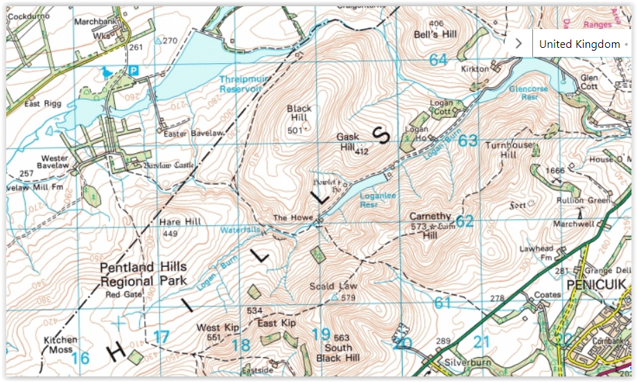
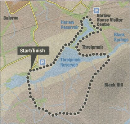
Location: Pentland
Hills Regional Park
Map: OS Landranger 66 (GR167639)
Distance: 6.5 miles ( 10.5 km )
Time: 3 hours 30 minutes
Terrain: tracks and open hillside The
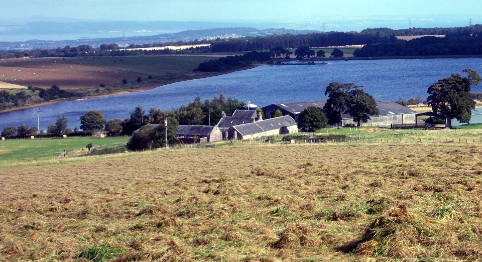
proximity of Edinburgh to the Pentland Hills has resulted in three
major and assorted minor reservoirs within the regional park boundary.
Threipmuir, on the western side of the hills, is the second largest,
and when combined with nearby Harlaw probably comprises the largest
area of water.
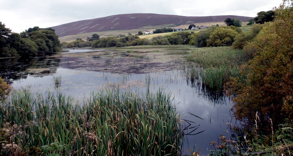
This route combines pleasant walking round the reservoirs with a
rougher hill path traversing the flanks of Black Hill to Green Cleuch,
the enclosed
grassy channel leading to Loganlea and Glencourse at the heart of the
range. A good starting point is the large car park at the western end
of Threipmuir, which is easily accessed from Balerno.
From the far end of the car park, follow the track towards Threipmuir
Reservoir, continuing straight ahead where it swings right to Easter
Bavelaw Farm. A short section of path gains the reservoir edge which
you follow north to the dam and causeway separating Threipmuir and
Harlaw. Keep left at the dam wall and go over the outflow to reach a
road on the west side of Harlaw Reservoir.
The road beside Harlaw leads to a bridge over the reservoir’s outflow
and on to a junction with Harlaw House visitor centre on your left.
Turn right on to a wide path through woodland round the north side of
Harlaw Reservoir and over a footbridge. Continue round the east side to
reach Threipmuir dam, where the main path turns right over the causeway
dividing the reservoirs. Don’t follow this, but take a smaller path
which continues left around Threipmuir. The start can be marshy due to
the proximity of the water, but the going improves once in the woodland.
Either follow the path through the woodland or a lochside path used by
fishermen to where the woodland ends and the paths rejoin. From here the
reservoir path aims for a pumping station in a small stone building on
the flanks of Black Hill beside the
dam over the narrow eastern arm of the reservoir. Cross over the dam to
a stile and ascend the path to the right of the building to a wall.
From here the path levels out and a gentle ascent leads round Black
Hill to a high point overlooking Green Cleugh. The path can be rough
and muddy, but the worst sections are avoidable. Descend steeply beside
the wall to a stile in Green Cleugh, the wide grassy glen between the
hills. Cross over the stile and follow the prepared path west to a gate
and the access road to Bavelaw Castle. Follow the road down through the
fine avenue of beeches and over the bridge. Opposite Red Moss Reserve, a
path on the right signposted Harlaw leads into woodland and is followed
to the first path on the left back to the car park.
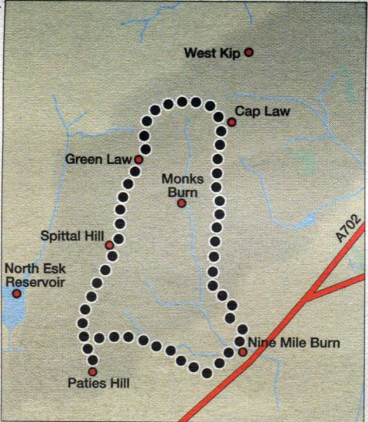
Route
Map for
Monks Burn Circuit
THE MONKS BURN CIRCUIT
Location: the Pentland Hills
Map: OS Landranger 66 ( GR1 T7577 )
Distance: 5 miles / 8km
Time: 2 hours 45 minutes
Terrain: paths and tracks
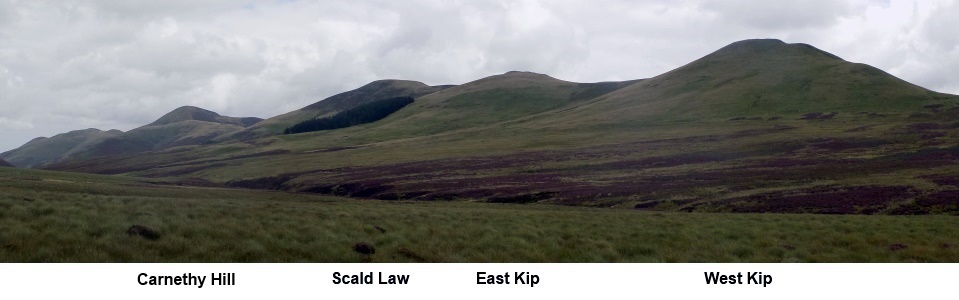
The extension of the main
Pentland Hills ridgeline beyond West Kip is formed by Cap Law, Green
Law and Spittal Hill to terminate at Paties Hill above Carlops.
These are broad grassy hills, and when combined with an approach up
Monks Rig they form a pleasant loop known as the Monks Burn Circuit.
From the parking area at Nine Mile Burn, head north through a gate and
follow the signposted path around the edge of the fields, then cross an
old wall higher up to
gain the open hillside. The Monks Burn lies in the narrow valley below
with the slopes of Green Law and Spittal Hill rising quite steeply
above it.
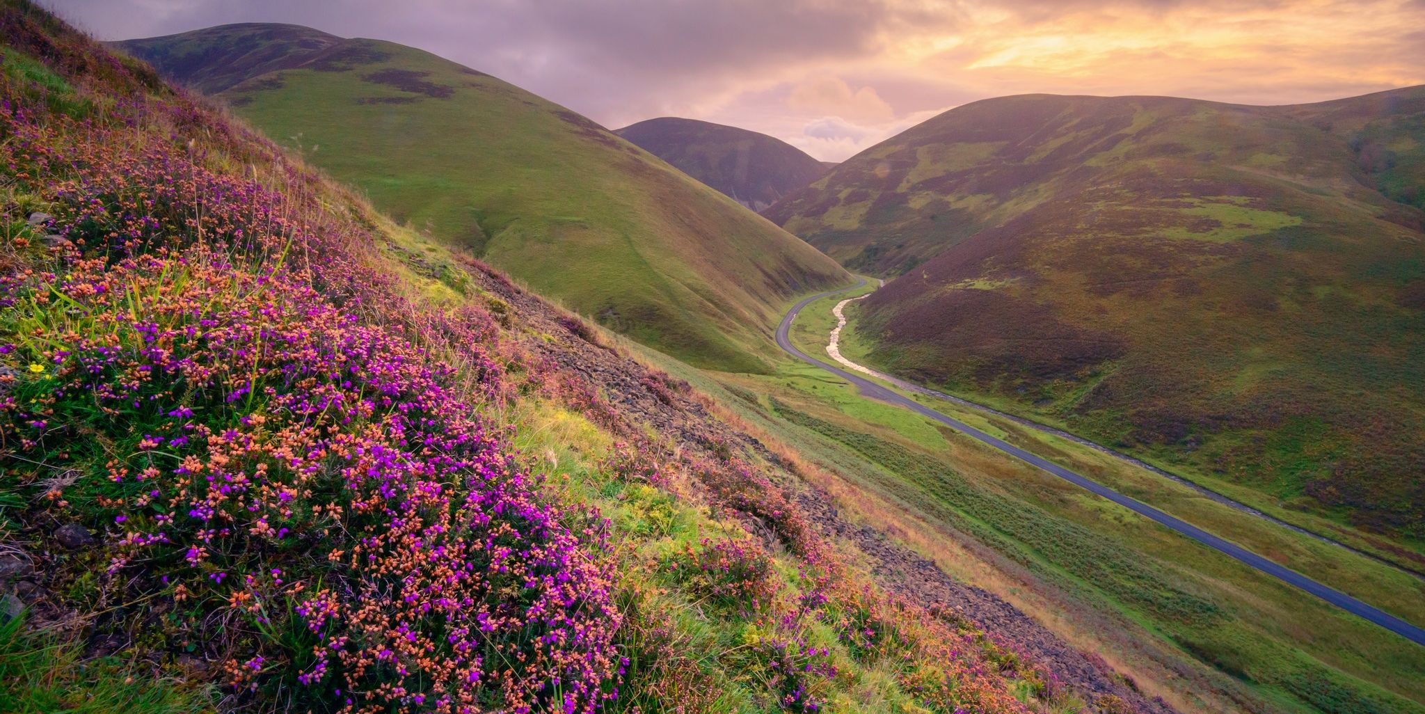
The ascent to these hills, however is a gradual one up the long ridge
of Monks Rig past the Font Stone. This is a hollowed stone thought to
be the remnants of the base for a
medieval cross in which passers-by now leave the odd coin.
At the top of the ridge, just beyond the top of Cap Law ( 490m; 1607ft
), break off left on a grassy track that leads away from the main route
towards West Kip.
This joins another grassy track coming in from the right and curves
around the head of the Monks Burn before climbing to the top of Green
Law ( 525m; 1722ft ).
A short drop gains a broad col between the hills where the track is
followed through a gate then along the right side of a fence to reach
the top of Spittal Hill ( 526m; 1725ft ).
Continue downhill over Greystone Head on the right side of the fence to
reach the col between Spittal Hill and Paties Hill and the track which
runs from Spittal Farm towards
North Esk Reservoir.
It is worth making a small diversion to the top of Paties Hill ( 475m;
1558ft ), which only takes an extra half hour. Cross the cattle grid at
the col and descend the track eastwards
down to, then around, the farm. At the end of the access road turn left
and follow the road back to Nine Mile Burn, crossing over the Monks
Burn to end the circuit.