Munros Tables SMC The Corbetts - SMC

The Scottish Highlands


Beinn Bhuidhe
The High Mountains of Britain & Ireland West Highland Way: Trailblazer


Photographs of an ascent of the Munro Beinn Bhuidhe

above Loch Fyne

 in the Southern Highlands of Scotland

Beinn Bhuidhe in the Southern Highlands of Scotland

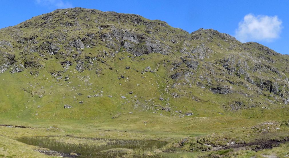
Approach to Beinn Bhuidhe ( 3110ft, 948m )

Beinn Buidhe is an outlier of the Arrochar Alps

 accessed by a 4 mile bike ride

 on the track alongside the River Fyne

 followed by a steep ascent on a path

 with some awkward scrambles

 from the derelict Inverchorachan Cottage.


Approach route to Bheinn Bhuidhe

Approach route to Bheinn Bhuidhe


River Fyne

River Fyne


Approach to Beinn Bhuidhe

 Approach to Beinn Bhuidhe


Approach to Beinn Bhuidhe

 Approach to Beinn Bhuidhe


Inverchorachan Cottage

 Inverchorachan Cottage


Beinn Bhuidhe ( 3110ft, 948m ) on descent from Meall an Fhudair

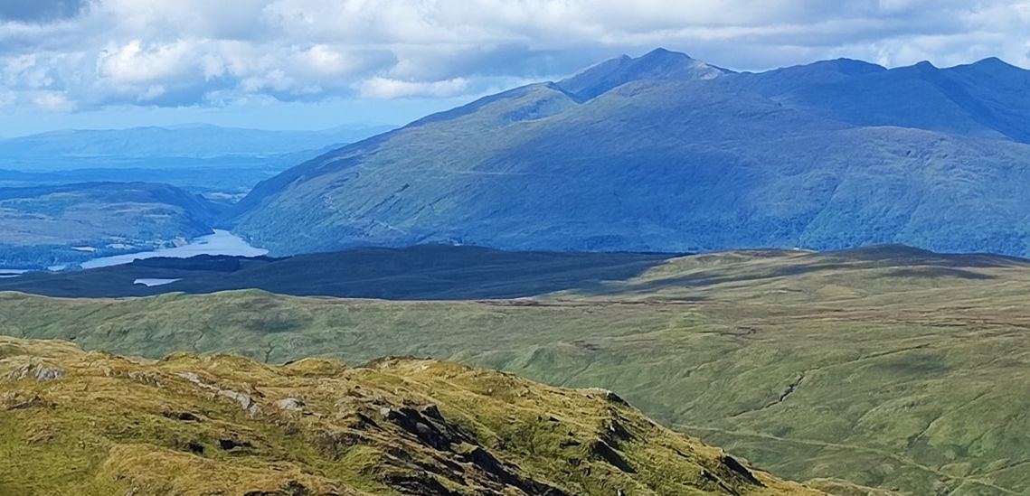
 Ben Lui

on ascent of Beinn Bhuidhe


Ascent route to Bheinn Bhuidhe

Ascent route to Bheinn Bhuidhe


Ascent route to Bheinn Bhuidhe

Ascent route to Bheinn Bhuidhe


Eagle Falls on ascent route to Bheinn Bhuidhe

Eagle Falls

on ascent route

 to Bheinn Bhuidhe


Summit Ridge of Bheinn Bhuidhe

Summit Ridge of Bheinn Bhuidhe


Summit Ridge of Bheinn Bhuidhe

Summit Ridge of Bheinn Bhuidhe


Approach to Summit of Bheinn Bhuidhe

Approach to Summit

 of Bheinn Bhuidhe


Beinn Bhuidhe from An Caisteal

Beinn Bhuidhe from An Caisteal


Ben Lui Group from Beinn Bhuidhe

 Ben Lui Group from Beinn Bhuidhe


Ben Cruachan from Beinn Bhuidhe

 Ben Cruachan

from Beinn Bhuidhe


Ben Cruachan from Beinn Bhuidhe

 Ben Cruachan

from Beinn Bhuidhe


Ben Lui Group from Beinn Bhuidhe

 Beinn Ime in Arrochar Alps

from Beinn Bhuidhe


Beinn Bhuidhe ( 3110ft, 948m ) on descent from Meall an Fhudair

 Ben Lui

on descent of Beinn Bhuidhe


Descent to Inverchorachan Cottage

 Descent to Inverchorachan Cottage


River Fyne

River Fyne


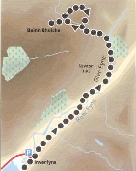
Beinn Bhuidhe - Route map

Beinn Bhuidhe - Route map


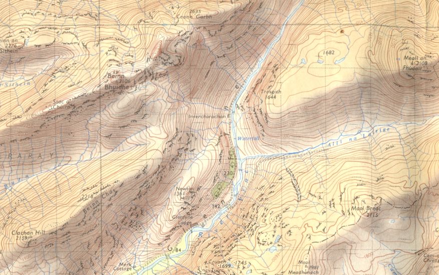
Beinn Bhuidhe - map

Map of Beinn Bhuidhe


Loch Ffyne

Loch Ffyne


BEINN BHUIDHE - ROUTE DESCRIPTION

Location: Glen Fyne
Map: OS Landranger 56 ( GR 204- 187 )
Distance: 18 miles ( 4km )
Time: 5 hours 45 minutes  ( on foot )
Terrain: paths, tracks and road

Beinn Bhuidhe is a peak whose grandness is only appreciated up close. From afar it looks like a sprawling
mass at the head of Loch Fyne, but viewed from its eastern top, it presents a sharp. well-defined peak with steep rocky sides.
The approach is also deceptive - deceptively long. You have to cover four-and-a-half miles of private road and track
before setting foot on the mountain, and here a bicycle is a neat bonus. The inward route is gently uphill
but the outward route requires minimal effort.
Start from the car park just over the bridge on the old road at the head of Loch Fyne ( beware of the height
restriction if you're carrying a bike ). From there, return over the old bridge, turn left onto the private road and
follow it through a farm and the Fyne Ales brewery.
The road crosses back over the river and past Glen Fyne Lodge to a junction where the road turns right
back over the river and up the hillside. Go straight ahead onto a track and through a deer gate followed by a hill and
woodland before the open upper glen and boarded-up house at lnverchorachan.
Go through another deer gate and through a wooden gate on its left from where a path leads up the left side of
a burn in a wooded gorge.
The route is obvious, although there one short but exposed rock step before the gorge opens out to reveal a waterfall. Skirt this on the left and walk on to the upper flanks of the mountain.
Stay beside the burn until the path veers left over marshy ground to a shallow gully leading to the col between Beinn Bhuidhe and its eastern top. From here an open ridge leads to the summit of Beinn Bhuidhe ( 948m, 3,110ft ) whose trig point is no longer standing, with views north and west to Ben Cruachan and Mull.
Return to the col then continue north-east along the ridge to gain a grassy slope leading to a broad summit marked by a few rocks.
The best descent is south-east towards upper Glen Fyne down the grassy and rock steps forming the east ridge until you can drop down right and follow the corrie tip round to meet the ascent route above the waterfall. From here it's all downhill to lnverchorachan and, if you've brought your bike, a speedy return to the car park.


 Beinn Bhuide Gallery Photo Gallery

<< BackSouthern Highlands : Next >>


Scottish Peaks : Scotland Index : Scotland Walks

 Isle of Skye :: Isle of Arran

Knoydart :: Glencoe :: Ben Nevis :: NW Highlands :: Eastern Highlands :: Central Highlands


Worldwide Mountaineering :: Adventure Travel :: Site Index

fb icon  google+ icon  Linkedin icon  twitter


Arrochar Alps - Map Glasgow Popular Hills - Map West Highland Way - Map Loch Lomond North - Tyndrum, Crianlarich, Arrochar - OS Explorer Map Loch Lomond and Inverary OS Landranger Map

Isle of Arran OS Explorer Map Isle of Arran OS Landranger Map Arran - Official Tourist MapIona & Mull MapWestern Scotland & the Western Isles OS Road Map Northern Scotland OS Road MapSouthern Scotland OS Road Map


Walking the Munros - Southern, Central & Western Highlands 

The High Mountains of Britain & Ireland  Munros Tables SMC  The Munros - Scotland's Highest Mountains  Scotland - Lonely Planet  NW Highlands - SMC Guide  Exploring the Far NW of Scotland  Guide to Walks in NW Highlands

Walking in Scotland - Lonely Planet Mountain: Exploring Britain's High Places  National 3 Peaks Walk Scottish Highlands Hillwalking Guide The Scottish Islands Bouldering in Scotland

Central Highlands: Six Long Distance Walks West Highland Way: Official GuideWest Highland Way: Rucksac ReadersWest Highland Way: TrailblazerThe West Highland WayWest Highland Way: Footprint MapWest Highland Way - Map West Highland Way - Map 100 Hillwalks around Glasgow

Pathfinder Guide: Fort William and Glen Coe Walks Rambler's Guide: Ben Nevis and Glen CoeGlencoe Rock & Ice Climbing The Munros: Scottish Mountaineering Club The Munros and Tops The Corbetts - SMC Munros & Corbetts Chart The High Mountains of Britain and Ireland Munro Almanac

The Munros - Scotland's highest mountains Call of the Corbetts Magic of the Munros Hamish's Mountain WalkThe Munros in WinterMy Scotland by Hamish MacInnes

Scottish Mountains - 50 Classic Routes50 More Routes on Scottish Mountains The High Mountains of Britain and Ireland Scotlands 100 Best Walks Scottish Mountains - 100 Best RoutesBig Walks of Great Britain Classic Walks in Britain & Ireland

Scottish Hill & Mountain Names Classic Mountain Scrambles in Scotland Classic Climbs - Central & Southern Highlands Mountaineering in Scotland and Undiscovered Scotland by W.H.MurrayMore Wilderness Walks Wilderness Walks Wilderness Walks 2 - Video Ski Mountaineering in Scotland

Ski Touring in ScotlandScrambles in Lochaber Rock Climbing in Scotland Rock Climbing SkillsThe FACE: Six Great Climbing Adventures Ben Nevis: Rock & Ice ClimbsGreat Snow & Ice Climbs of the British Isles100 Best Routes on Scottish Mountains One Man's Mountains - Tom Patey

A Mountaineer's Tale - W.H.MurrayDougal Haston: Philosophy of RiskThe Glens of Rannoch Southern Highlands - MapNorthern Highlands Central Highlands West Highlands Central Highlands SMCNW Highlands SMC

Scotland - Lonely PlanetScotland's Highlands & Islands - Lonley Planet Scotland's Highlands & Islands - Rough Guide Highlands & Islands of Scotland - Hidden Places Rough Guide ScotlandScottish Highlands & Islands - Rough Guide Rough Guide: Scotland Lonely Planet, Walking in ScotlandLonely Planet - Walking in Britain

50 Walks in the Scottish Highlands & Islands 100 Walks in ScotlandVisit Scotland - Touring Guide Scotland: Where to Stay - Hotels & Guest Houses Scotland: Where to Stay - Bed & Breakfast Hillwalker: The MunrosHillwalker: The Corbetts

Weather for Hillwakers & Climbers Mountain Weather Guide to the Weather Weather: Collins Gem Hillwalking Handbook for Mountain Leaders Hillwalkers Manual Hillwalkers Guide to Mountaineering First Aid on Mountains


Google Analytics


Google Analytics 

extremetracking
 eXTReMe Tracker


extremetracking
Sitelock caingram.com
SiteLock
Sitelock
Sitelock caingram.info
SiteLock
Sitelock