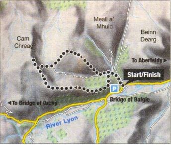
Route Map
for Cam
Chreag
above Glen Lyon
|
|
CAM
CHREAG - ROUTE DESCRIPTION:
Location:
Perthshire
Map: OS Landranger 51 ( Loch Tay and Glen Dochart )
Distance: 9 miles ( 15km )
Time: 5-7 hours
Terrain: Moderate hill walk
The little clachan of Innerwick looks as
though it’s trying to attract walkers. There's a car park with
interpretive signs beside the start of the right of way that runs over
the hills to Loch Rannoch and the little church is well worth a visit
to see the ancient bell of St Adamnan. The bell has been dated to 800AD
and apparently lay in the churchyard of St Brandon’s Chapel in
Glen Lyon for centuries before being rescued. St. Adarnnan travelled
here from Iona, setting up Christian cells on ancient pagan sites of
worship.
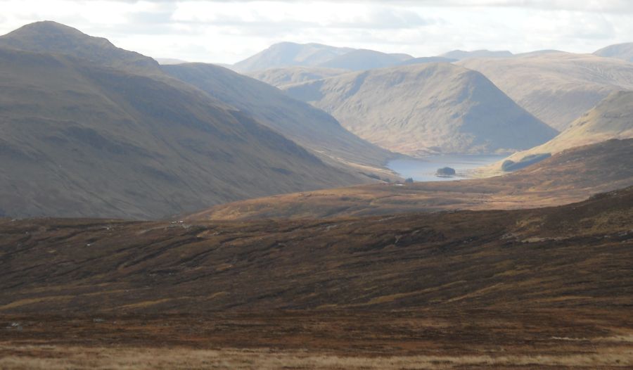
Cam Chreag, a 2828ft / 862m Corbett neighbours the Munro of Meall
Buidhe high above Loch an Daimh - Cam Chreag is a good viewpoint.
A good route is possible by following the hill‘s south-east ridge,
returning to the start via the hill’s lower neighbour of Meall nam
Maigheach ( 741m ),
a pleasant horseshoe-shaped route of about 9 miles ( 15km ) round the
glen of the Allt a'Choire Uidhre.
This glen has a bulldozed track running up its length to a corrugated
iron hut just below Cam Chreag’s eastern face, the guidebook route, but
the first bonus of the horseshoe route becomes apparent on topping out
on
Ben Meggernie, at the end of Cam Chreag's east ridge. This little bump
offers a fabulous view right down the length of Glen Lyon and from here
it's
easy to understand why Tom Weir, and others, described this as
Scotland’s loveliest glen. On one side of the glen the peaks of the Ben
Lawers
range rise high into the sky, the pointed culmination of long, steep
ridges. On the other side, the blunter Carn Mairg hills rise on equally
steep-sided
flanks. The glen itself is well wooded with the River Lyon flowing gently
through green meadows. Rob Roy’s mother was born here, and before that
the
ancient kings of Scotland came here to hunt deer.
To the west from Cam Chreag the big Munroe
stands clear — Stuchd an Lochain and Meall Buidhe, one on either side
of Loch an Daimh and the wild country beyond to the hills of Mamlorn
and Orchy. To the north-west, across Rannoch Moor, Ben Nevis is visible.
There's plenty of wild land here, an empty place tamed only by the West
Highland railway line until the A82 Bridge of Orehy road. The
north-east face of Cam Chreag gives an interesting descent down to the
rounded hump of Meall nam Maigheach and back to the bulldozed track.
Route:
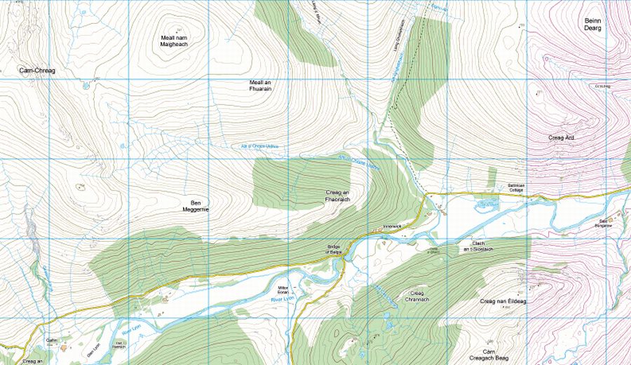
Leave the car park ( GR NN587476 ) on a bulldozed track that runs NW
above the Alli a'Choire Uldhre.
At the end of the forestry plantation leave the track and climb S on to
the ridge of Creag an Fhaoraioh.
Follow this ridge W over Ben Meggernie then NW to the summit ridge of
Cam Chreag and its rocky summit.
To descend, backtrack a little and drop down the steep NE face of Cam
Chreag avoiding the craggier sections of the slope. Aim for the
red—roofed hut in Coire Odhar.
From the hut follow an ergo-cat track over Meall nam Maigheech and
descend by that hill's SE ridge back to Allt a'Choire Uldhre and the
track back to the car park.
Glen
Lyon Photo Gallery 


