West Highland Way: Trailblazer The West Highland Way

 Bearsden & District

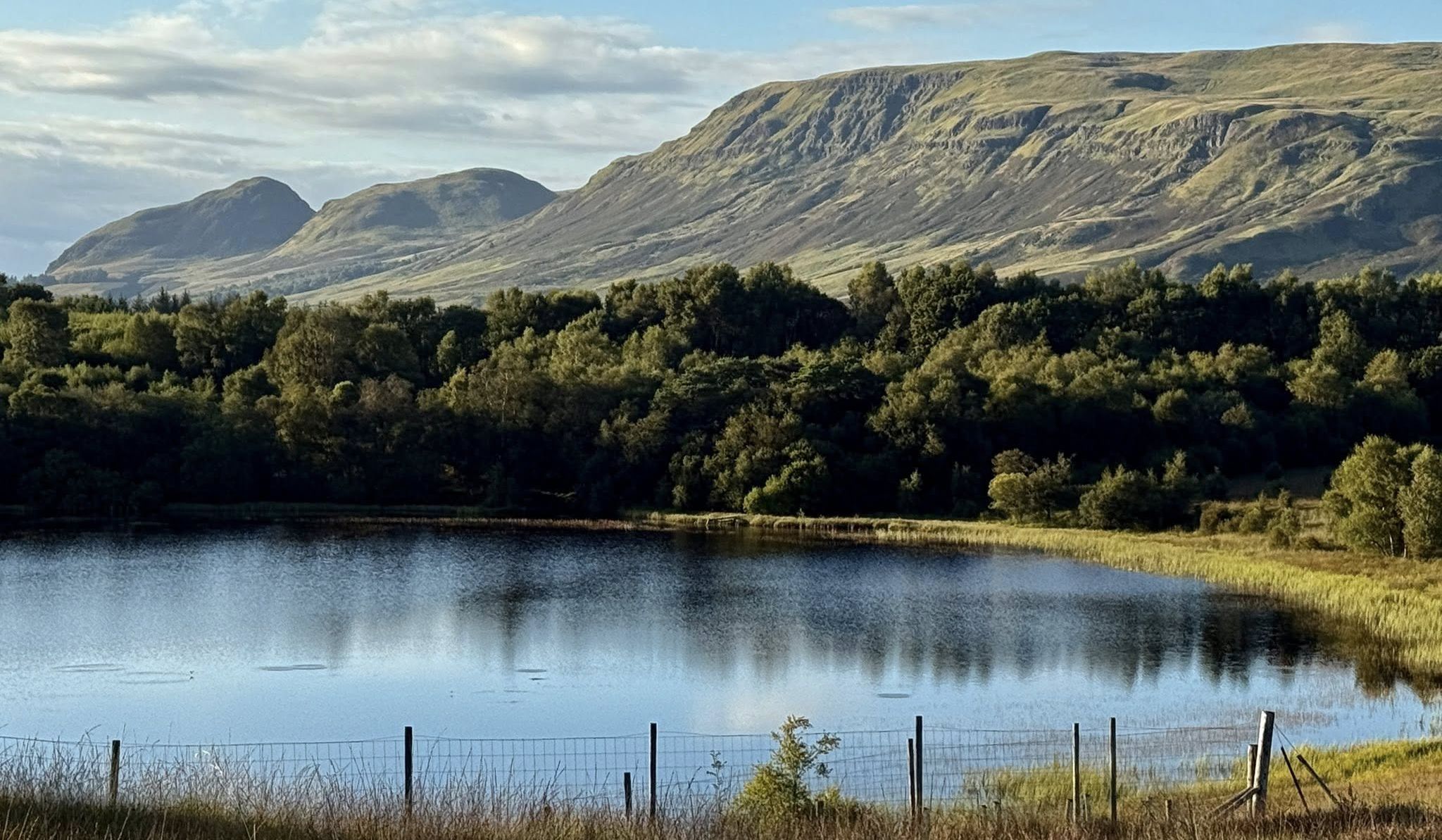
Dumbrock Loch
West Highland Way - Map West Highland Way: Footprint Map


Photographs and map of Dumbrock Muir

and Dumbrock Loch

 near Mugdock Country Park


Campsie Fells above Dumbrock Muir

Campsie Fells above Dumbrock Muir

Dumbrock Muir and Dumbrock Loch

 are to the north of the main etrance

 to Mugdock Country Park


Dumbrock Loch

Dumbrock Loch ( Also known as Abies Loch )
Dumbrock Loch lies to the northeast of Craigend Castle

 and a mile ( 1.5km ) southwest of Strathblane.

 Noted for its bird-life,
it is popular location with walkers and

the Dumbrock Loch Meadows

 has been designated a Site of Special Scientific Interest.
Dumbrock Moor includes a stretch of grassland habitat

that has become rare in Britain.

Mineral-rich bedrock lies close to the surface

 and creates conditions suitable for

flowering species such as harebell, lesser twayblade,

hay rattle, lady’s mantle and cat’s ear.

Most of this kind of habitat has been lost from Scotland as changing

farming practices have converted these grasslands into arable crops.

However Dumbrock Moor has taken a different course.

In years gone by,

the Moor was grazed by sheep and cattle

 and this provided a lawn mowing service

which kept coarse, aggressive grasses in check and ensured that

delicate wild flowers had room to grow

 and places to set seed.

Now, after a prolonged period without grazing,

the number and range of wild flowers has dwindled. 

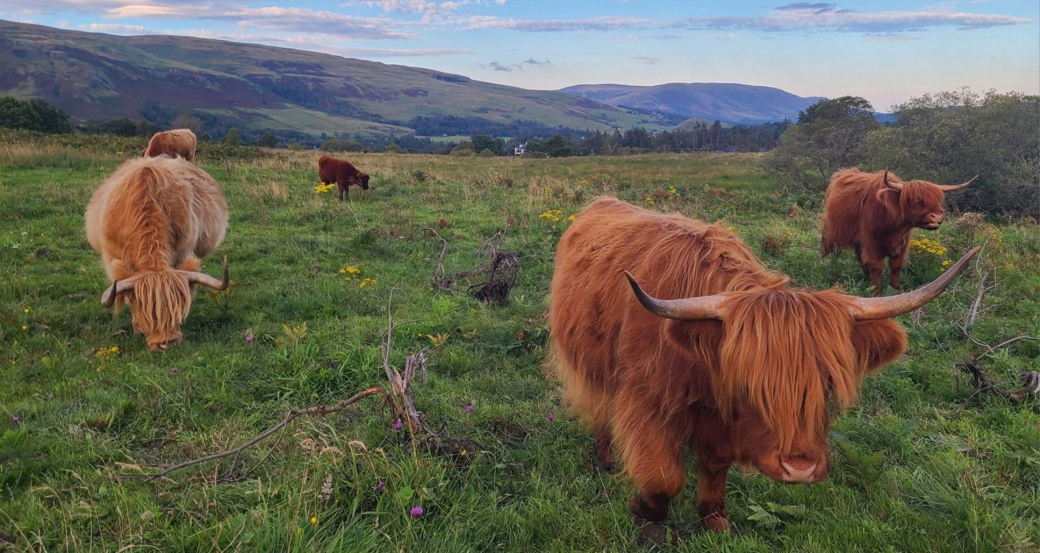
The re-introduction of a low concentration of cows

on the Moor is being considered.

Black grouse breed on the Moor but this iconic Scottish bird

has undergone a drastic population decline in recent years.

The grouse are

vulnerable to disturbance, especially by dogs.


Dumbrock Loch beneath the Campsie Fells

 Campsie Fells from Dumbrock Loch


Campsie Fells

 Campsie Fells


Dumgoyne in the Campsie Fells from Dumbrock Loch

Dumgoyne in the Campsie Fells

from Dumbrock Loch 


Dumgoyne in the Campsie Fells from Dumbrock Muir

Dumgoyne in the Campsie Fells


from Dumbrock Muir


Dumgoyne and Dumfoyne in the Campsie Fells from Dumbrock Muir

Dumgoyne and Dumfoyne

in the Campsie Fells

from Dumbrock Muir


The Campsie Fells from Dumbrock Muir

The Campsie Fells

from Dumbrock Muir


The Campsie Fells from Dumbrock Muir

The Campsie Fells

from Dumbrock Muir


The Campsie Fells from Dumbrock Muir

The Campsie Fells

from Dumbrock Muir


Blanefield beneath the Campsie Fells from Dumbrock Muir

Blanefield beneath the Campsie Fells

from Dumbrock Muir


The Campsie Fells from Dumbrock Muir

The Campsie Fells

from Dumbrock Muir


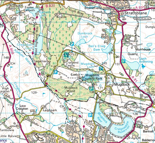
Location Map for Dumbrock Loch

Location Map for Dumbrock Loch


DUMBROCK MUIR WALK - ROUTE DESCRIPTION:


This walk is a circular walk which crosses over Dumbrock Moor from Mugdock Country Park.
lt can be as short as 2.5 miles or up to 4miles if extended beyond the Moor.
The walk leaves the Visitors Centre carpark, crosses the main road and passes through the gate opposite to enter Dumbrock Moor.
It follows the grass track to pass the power pylon on the right and then through another gate. Afler crossing the burn it takes the uphill path on the left, then passes between the silverbirch trees before reaching the hill top and the panoramic view of Strathblane and Blanefield.
The walk continues on the downhill path before crossing marshy grass and over a burn.
It passes through a kissing gate and down the side of the wood before crossing the burn via stones. On turning right it continues along a grass path for a short distance before exiting the Moor through the gate on the left onto a vehicle track and opposite the Gowk Stane.
Turning right along the vehicle track, the walk passes the Gary Wright's memorial seat. Gary was a Royal Marine Commando killed in action in Afghanistan.
The walk then passes by two gates for the sub-station and re-enters the Moor through the next kissing gate.
On the right a vehicle track crosses over a burn. At the top of the hill it passes through another kissing gate onto open moor on the right and houses on the left. The longer walk leaves the Moor through the next gate on the left and heads along Moor Road. At the t-junction turn right onto the minor road and uphill past Deil's Craig Dam and Valhalla farm before turning right at the crossroads.
Afler a short distance you get to Mugdock’s East carpark. If not restricted by the lambing season, the walk can re-enter the Moor on the right through the kissing gate shortly after the Valhalla Farmhouse. Take the faint path across the field to pass through two gates to the right of the white house, then cross the road and re-enter the East Car Park. The walk continues through here onto Peitches Moor which is a delightful
open country and then into Pheasants Wood and back to the start.
The shorter walk returns over Dumbrock Moor along the vehicle track beyond the left turn gate to Moor Road. After the next bend before the fenced tree it leaves the track on the right onto the moor to pass over a medium-sized stone and rowan tree on the right. Go diagonally upwards along a track and faint path to pass on the left a large stone at the bottom of a rowan tree and then a larger silver birch.
Then take a faint path on the right and head towards a wooden fence at a gap in a stone wall. This can be a difficult section to find.
After going through the gate and over a burn the track becomes easier to follow. At the gate for the Dumbrock Loch, exit the loch path at the next gate which joins up with the path back to the Visitor Centre Car Park.


Dumbrock Loch Gallery Photo Gallery :: Dumgoyne & Campsie Fells Photo Gallery 

<< BackBearsden Walks Index : Next >>


Scotland Index :: Scottish Peaks :: Scotland Walks

Glencoe | Ben Nevis | Knoydart | Isle of Skye | Isle of Arran

The Eastern Highlands | The Central Highlands | The Southern Highlands | The NW Highlands


Adventure Travel : Worldwide Mountaineering : Site Index

fb icon  google+ icon  Linkedin icon  twitter


Guide Books & Maps - Scotland:-


West Highland Way: Footprint MapWest Highland Way - Map West Highland Way - Map Western Scotland & the Western Isles OS Road Map Northern Scotland OS Road MapSouthern Scotland OS Road MapGlasgow Popular Hills - Map


Ochils and Campsie Fells

Glasgow Visitor Guide - Colin Baxter Itchy Insider's Guide to Glasgow Glasgow Footprint Pocket Guide Glasgow Insight Pocket Guide Glasgow Guide Pub Companion Glasgow Scotland's Highlands & Islands - Rough Guide Scotland - Rough Guide

Glasgow Insight Pocket GuideCollins Street Map of GlasgowGlasgow: Then & NowThey belonged to Glasgow Phillips Street Atlas of Glasgow & West Central Scotland Glasgow: The Photographic Atlas100 Hillwalks around Glasgow 50 Walks in Glasgow & SW Scotland

Visit Scotland - Touring Guide Scotland: Where to Stay - Hotels & Guest Houses Scotland: Where to Stay - Bed & Breakfast Rough Guide ScotlandScottish Highlands & Islands - Rough Guide Scotland - Lonely PlanetScotland's Highlands & Islands - Lonley Planet Great Glasgow StoriesGlasgow & Surroundings - Insight Guide

West Highland Way: Official GuideWest Highland Way: Rucksac ReadersWest Highland Way: TrailblazerThe West Highland WayWest Highland Way: Footprint MapWest Highland Way - Map West Highland Way - Map West Highland Way Wet Highland Way - Official Guide

Munro Almanac The High Mountains of Britain and Ireland The Munros: Scottish Mountaineering Club The Isle of Skye The Isle of Arran Wilderness Walks Ski Mountaineering in Scotland

More Wilderness Walks 50 Best Routes on Skye and Raasay Skye - W.A.PoucherMagic of the Munros Mountaineering in Scotland and Undiscovered Scotland by W.H.MurrayA Long Walk on the Isle of Skye

Classic Climbs - Central & Southern Highlands The Isle of Arran Lonely Planet, Walking in ScotlandPathfinder Guide: Skye and NW Highlands WalksPathfinder Guide: Fort William and Glen Coe Walks Rambler's Guide: Ben Nevis and Glen Coe50 Best Routes on Skye and Raasay - Chris Townsend


Google Analytics


Google Analytics

extremetracking
 eXTReMe Tracker


extremetracking
Sitelock caingram.com
SiteLock
Sitelock
Sitelock caingram.info
SiteLock
Sitelock