  |
City of GlasgowRouken Glen Park
|
|
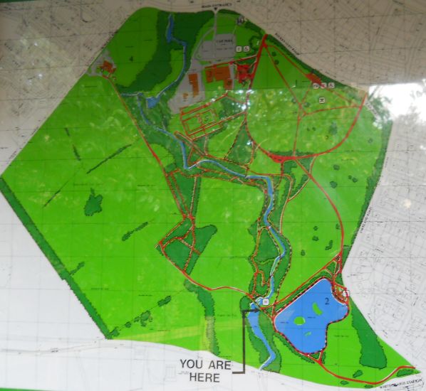 Map
of Rouken Glen Park
( Note: Click here or on map for large format copy ) Rouken Glen Park is a 58 hectare ( 143 acre ) historic park. It is located next to Thornliebank, Giffnock and Newton Mearns some 10km ( 6 miles ) to the south of the city centre of Glasgow. Rouken Glen Park contains one of the most important geological sites in Scotland. It is protected as a Site of Special Interest ( SSSI ) The park contains a range of facilities including:
|
|
Gardens in
Rouken Glen Park
|
|
Boating
Pond in Rouken
Glen Park
|
Boat
House in Rouken Glen Park
|
Boating
Pond in Rouken
Glen Park
|
Waterfall
in Rouken Glen Park
|
Waterfall
in Rouken Glen Park
|
Woodland
Walk
beside stream in Rouken Glen Park |
Deaconsbank
Golf Course at Rouken Glen Park
|
Crocus
in Rouken Glen Park
|
Gateway
in Rouken Glen Park
|
Signboard
in Rouken Glen Park
|
Garden
Centre at Rouken Glen Park
|
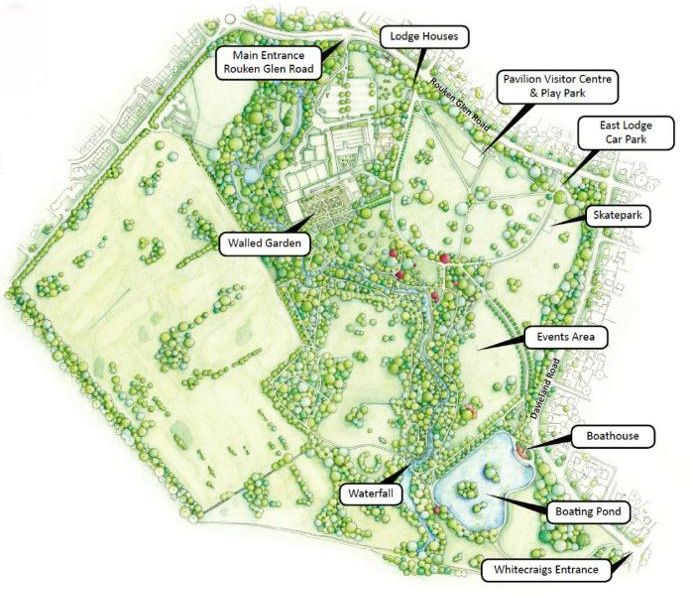 Map of Rouken
Glen Park
|
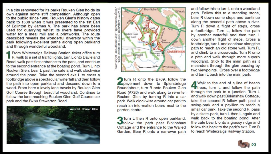 Rouken Glen Walk
|
Glencoe | Ben Nevis | Knoydart | Isle of Skye | Isle of Arran | The West Highland Way
The Eastern Highlands | The Central Highlands | The Southern Highlands | The NW Highlands
