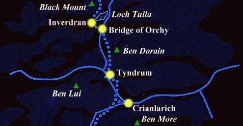
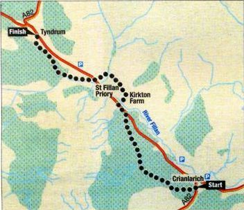
West Highland Way: Crianlarich to
Tyndrum - Route Description:
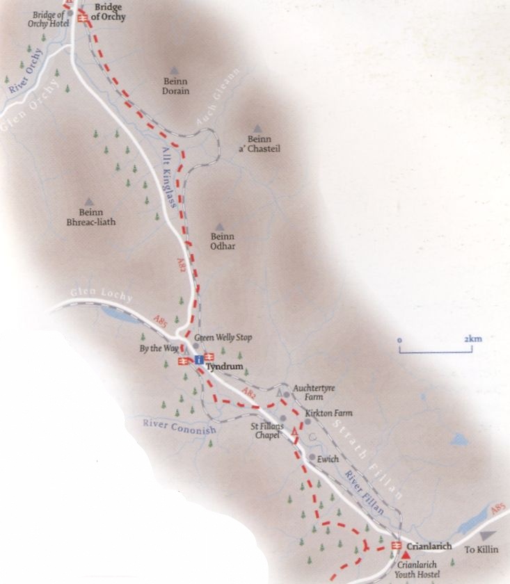
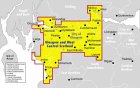
Locatlon:Stirling Map:OS Landranger 50 Distance:7miles { 11km } Time: 4hours Grade: moderate low
level walk on good paths Between
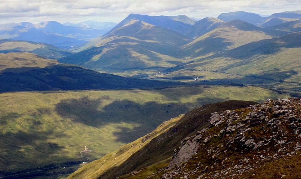
Crianlarich and Tyndrum sit the two most southerly of Scotland’s ancient pinewoods:
remnants of the Caledonian
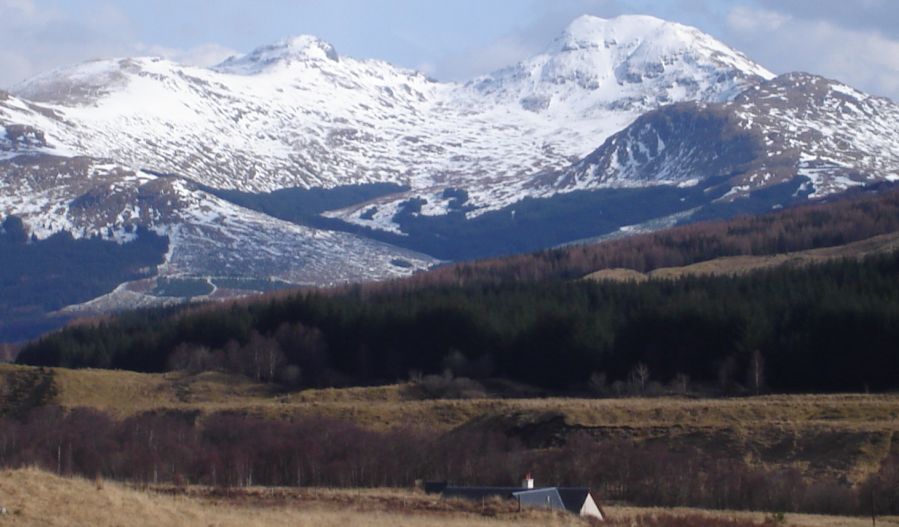
forests that have grown naturally since the last ice age. The pinewoods
at Glen Falloch and Coille
Coire Chuilc support Scots pine trees more than 200 years old. Starting from Crianlarich station or
the car park opposite the
Crianlarich Hotel, head south up the A82 and turn right after the station at a
Forestry Commission sign to the West Highland
Way (WHW}.
The path climbs through a
thicket of rowan trees draped
in mosses and bearded lichen. then into a larch plantation. Once out of the trees at
the top of Glen Bogle the path joins the WHW. To
see Glen Falloch pinewood.
turn left through the wooden gate and take the old military road west.
Approaching the Keilator farm
buildings the wood can be seen across the A82 below Beinn a’ Chroin and An
Caisteall. The scattered
mature pines stand on Dun Falloch and down what was known as “the hidden
glen". A large forest
persisted here until the 19th century when thousands of trees were felled leaving the
100 or so we see today.
Return to the head of Glen
Bogle. turning left after the
gate along the WHW. Continue, going down to the railway. across the A82 and over the River
Fillan to Kirkton Farm. Pass the ruins of St
Fillan’s Chapel, keeping with
the WHW past Auchtertyre Farm and campsite.
Re-cross the A82 and follow the path beside the River Cononish to a three-arch stone
bridge. The WHW continues over
the old main road but to see the Coille Coire Chuilc pinewood go left
through a gate and over the
bridge.
After the bridge, take the
track on the right towards a
plantation. alongside the railway. Cross the railway by a stone bridge and continue
uphill on the east bank of Allt Gleann
Auchreoch. The old pine trees
come into full View with Ben Lui behind. It is hard to avoid a feeling of being in a
primeval landscape, although the truth is that
human influence has greatly
shaped the area. Much of the forest
of pine and oak that once covered the surrounding moorland was felled to
fuel iron foundries and to
provide props for lead and gold mines.
The most notable feature today is the lack of young trees due to livestock grazing.
A conservation area has been
established with fencing deep in the wood to help protect the new growth.
Carry on along the track for
another kilometre to get
close to some magnificent old pine trees with great views of the wood and mountains, then
return to the bridge over the river and turn
left to join the WHW towards
Tyndrum.
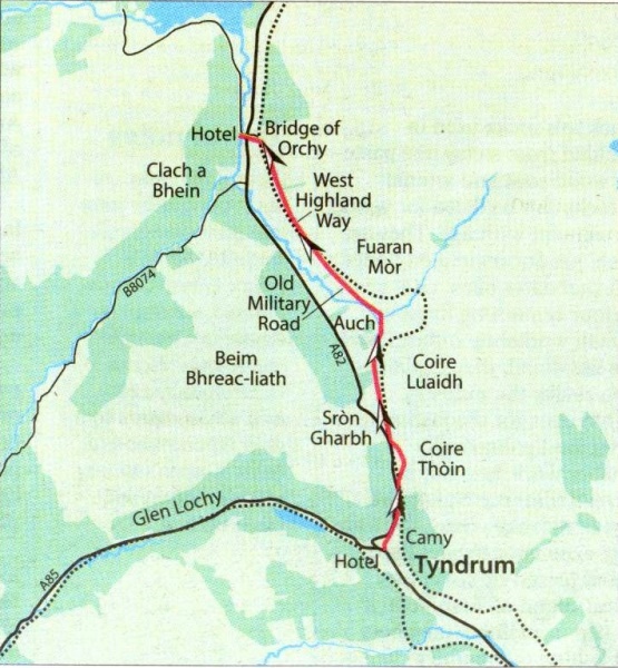
West Highland Way: Tyndrum to Bridge
of Orchy - Route Description:
Location:
Glen Orchy & Loch Etive
Map: OS Landranger 50
Distance: 7 miles: 11km
Time: 3-4 hours
Terrain: Moderate trail walk Much of the West Highland Way has good
transport links and lends itself well to day walks and this section is
no exception. It is also one of the finest sections of the Way
and a grand walk in its own right.
For much of the route you follow the line of the Military Road
engineered by Major William Caulfeild between 1750 and 1752 as part of
the road building programme intended to make
it easier for British government forces to move between barracks and
thus help to subdue any uprisings. These roads were commissioned
following a survey by General Wade
after the London government had been given a severe fright by the
advance of Bonnie Prince Charlie's Jacobite army as far south as Derby
in the winter of 1745-46.
Caulfeild's road remains impressively sound, with moderate gradients
and a good firm surface, allowing you to enjoy the surrounding landscape
to the full.
The only exception is a fairly short section where the Military Road is
blocked and you have to go uphill, along and then down on a rough,
stony path.
Leaving Tyndrum, note the amusing wooden sculptures carved from local
wood and then pass the newish Tyndrum cemetery.
The track continues steadily uphill past a water treatment works and
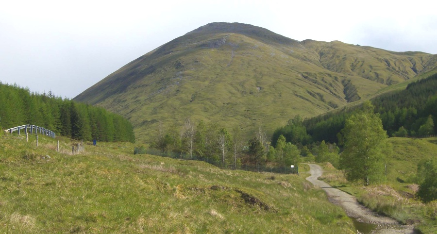
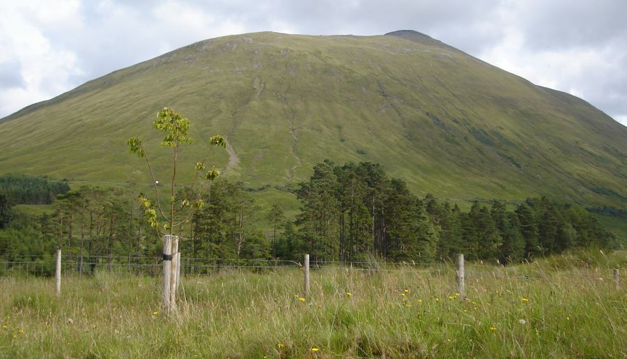
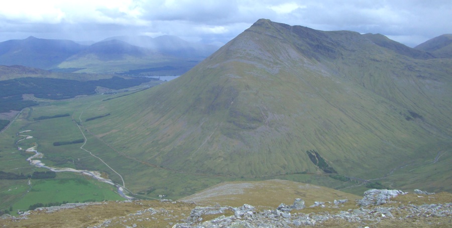
then breaks out into the open. To the right Beinn Odhar ( appropriately
"dun-coloured hill” ) rises steeply.
Your route is shared by the A82 road and the West Highland Railway.
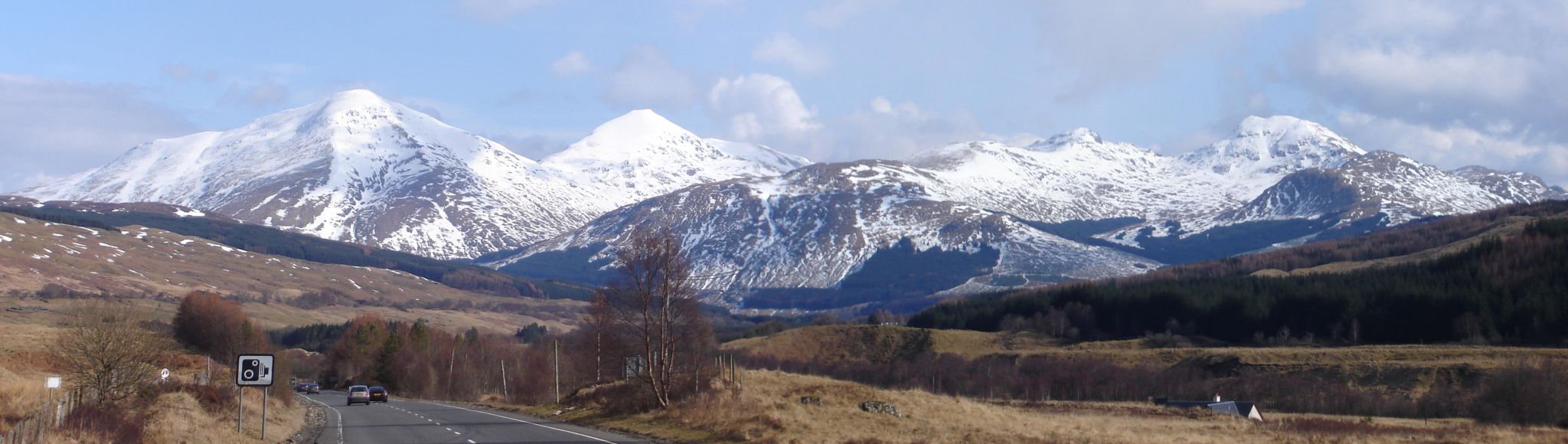
Before long the centrepiece of the walk comes more prominently into
view ahead of you - the imposing bulk of Beinn Dorain, celebrated in
verse by the Gaelic poet Duncan
Ban Macintyre, who was born at lnverveigh in 1724. A translation does
not do Macintyre’s sonorous verse full justice but hillwalkers will
identify
with him when he speaks of being “... away to climb rough country, and
late would I be coming home; the clean rain and the air on the peaks of
the
high mountains helped me to grow, and gave me robustness and vitality”.
Beinn Dorain ( probably “hill of streams" ) looks like a conical peak
from here but what you see is actually the end of its summit ridge,
which rises to 1076 metres.
With this glorious scene ahead of you. and the Blackmount Hills
appearing to its left, you can stride easily down past the farm at Auch
and cross the Allt Chonoglais by a lovely old bridge.
To the right, the railway takes a huge swing round the glen to maintain
its height with several viaducts - a fine piece of civil engineering.
From here to Bridge of Orchy the going is easy but you should note that
there is no shelter of any kind and given that the area has a high
average
rainfall figure of more than 2000mm, good waterproofs are a necessity.
As you approach Bridge of Orchy, you can see on the right the corrie
between Beinn Dorain and its neighbouring Munro, Beinn an Dothaidh (
1004m ); this is the usual
line of approach for those climbing the two hills and also provides a
way through to Glen Lyon in the east.
The Way runs down past the station to the Bridge of Orchy Hotel which
has a "Walkers Welcome" sign on its doors and offers accommodation
and refreshment in comfortable surroundings before your journey back by
bus or train.
Route:
Follow West Highland Way signs from beside Brodie‘s Stores in Tyndrum
uphill on road then track.
Go through gate and follow track.
In about 2.5km go uphill on rough stony path as signed.
Traverse hillside for about 400m then drop steeply down to pass under
railway and rejoin track.
Follow track past Auch Farm and onto Bridge of Orchy.
Descending past the station to the Bridge of Orchy Hotel.