  |
Bearsden & DistrictArdinning Loch |
  |
Ardinning
Loch Wildlife Reserve
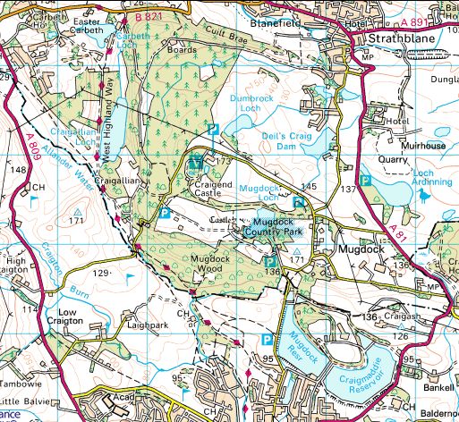
Located two miles north of Milngavie with access from a layby on the A81 There is a 1.5km nature trail and also a longer route of 3.5km over the moors - both marked with posts. Loch Ardinning is a Dam. Built in 1796 to serve Mills in the Blane Valley. |
Ardinning
Loch
|
Ardinning
Loch
|
Dumgoyne and Campsie
Fells
from Ardinning Loch Wildlife Reserve |
Muirhouse
Farm beneath Campsie
Fells
|
 Muirhouse
Farm beneath Campsie
Fells
|
 Muirhouse
Farm beneath Campsie
Fells
|
Fin Glen and Crow Road in the Campsie
Fells
|
Cairn
in Ardinning Loch Wildlife
Reserve
and the Campsie Fells Part of the nearby rock formation used to be called Cat Craig, derived from the ancient British and Gaelic words meaning ‘battle rock’. The earliest known historical reference to the area concerns the Battle of Ardunnion about AD570 when Gwallawg and his brother kings of Cumbria fought and defeated Hussa the son of the king of Bernicia. A fierce battle was fought between Cat Craig and the Blane Water. |
 Battle signpost in Ardinning Loch Wildlife
Reserve
The earliest known historical reference to the area concerns the Battle of Ardunnion about AD570 when Gwallawg and his brother kings of Cumbria fought and defeated Hussa the son of the king of Bernicia. A fierce battle was fought between Cat Craig and the Blane Water. |
 Ardinning
Loch and Campsie Fells
|
Ardinning
Loch
|
Ardinning
Loch
|
Ardinning
Loch
|
Ardinning
Loch
|
 Location
Map for Ardinning Loch
|
 :: Dumgoyne
& Campsie Fells
Glencoe | Ben Nevis | Knoydart | Isle of Skye | Isle of Arran
The Eastern Highlands | The Central Highlands | The Southern Highlands | The NW Highlands