Munros Tables SMC Glen Coe & Glen Etive - OS Explorer Map

The Scottish Highlands


GLENCOE
The High Mountains of Britain & Ireland Rambler's Guide: Ben Nevis and Glen Coe

Photographs of a traverse of the Corbett Beinn a Chrulaiste

in Glencoe above the West Highland Way.

A fine viewpoint for the surrounding Munros:-

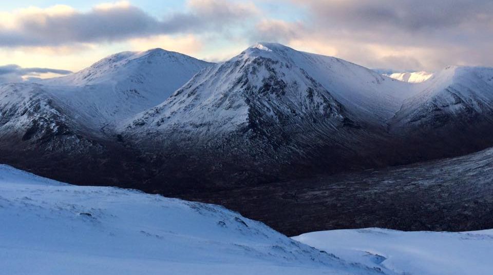
Meall a BurraidhBuachaille Etive Mor,

Buachaille Etive Beag,  Bidean nam Bian


Beinn a'Chrulaiste and White Corries chairlift on Meall a' Burraidh

Beinn a'Chrulaiste

from
White Corries chairlift

 on Meall a' Bhuiridh


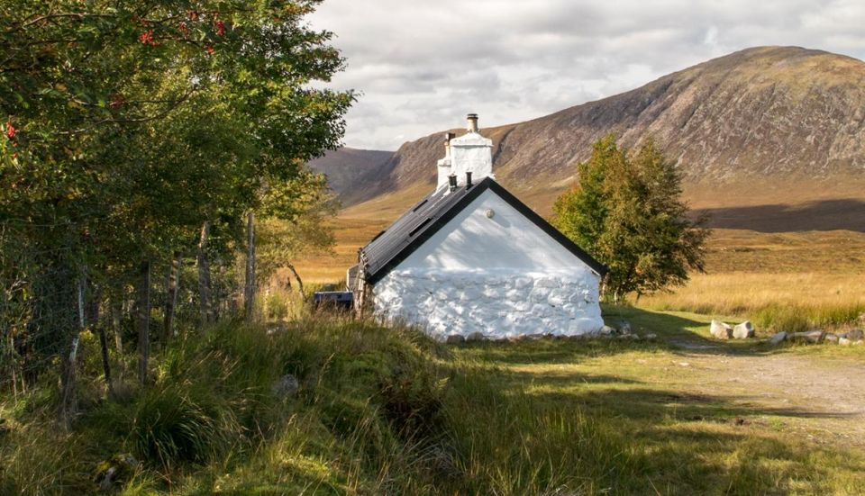
Beinn a'Chrulaiste beyond Black Rock Cottage

Beinn a'Chrulaiste

 beyond
Black Rock Cottage


Beinn a'Chrulaiste from Meall a' Bhuiridh

Beinn a'Chrulaiste

 
from Meall a' Bhuiridh


Beinn a Chrulaiste from Buachaille Etive Mor


Beinn a Chrulaiste from Buachaille Etive Beag


Beinn a'Chrulaiste

Beinn a'Chrulaiste


West Ridge of Stob Beinn a Chrulaiste

West Ridge of Stob Beinn a Chrulaiste

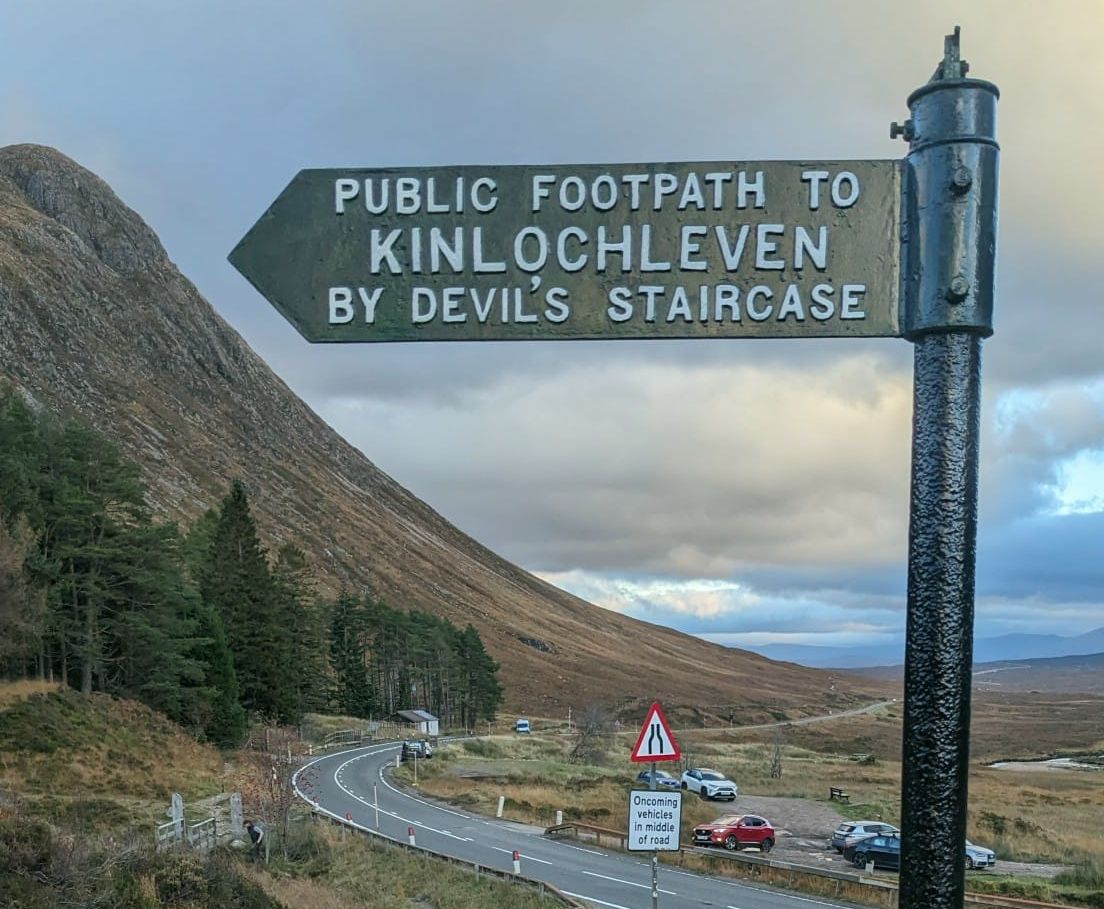
The ascent starts along the path

 of the West Highland Way

to the 
Devil's Staircase

 before heading up the west ridge

 of Stob Beinn a Chrulaiste.


West Ridge of Stob Beinn a Chrulaiste

West Ridge of Stob Beinn a Chrulaiste


Buchaille Etive Beag ( The Little Shepherd ) in Glencoe in the Highlands of Scotland

Buachaille Etive Beag ( 3345m )

 at start of ascent


Buchaille Etive Mor in Glencoe in the Highlands of Scotland


Buchaille Etive Mor in Glencoe in the Highlands of Scotland


Beinn a Chrulaiste and Buchaille Etive Mor in Glencoe in the Highlands of Scotland

Beinn a Chrulaiste

and
Buachaille Etive Mor 


The West Highland Way on the Devil's Staircase

The West Highland Way on the Devil's Staircase

The name was given by the soldiers
who were part of the road building program
 of General Wade.

 The carrying of building materials
up this stretch of the road was not popular!
The name was perpetuated when some of the workers
 building the Blackwater Dam
chose to travel to the nearest pub
 at the Kingshouse Inn
after their wages had been paid
- the journey to the Kingshouse Hotel
proved more difficult than expected
and the return journey even worse on unsteady legs
- on a cold winter’s night,
the devil often ”claimed his own“.

h


Bidean nam Bian, Stob Coire nan Lochan and Gearr Aonach of the Three Sisters of Glencoe

h


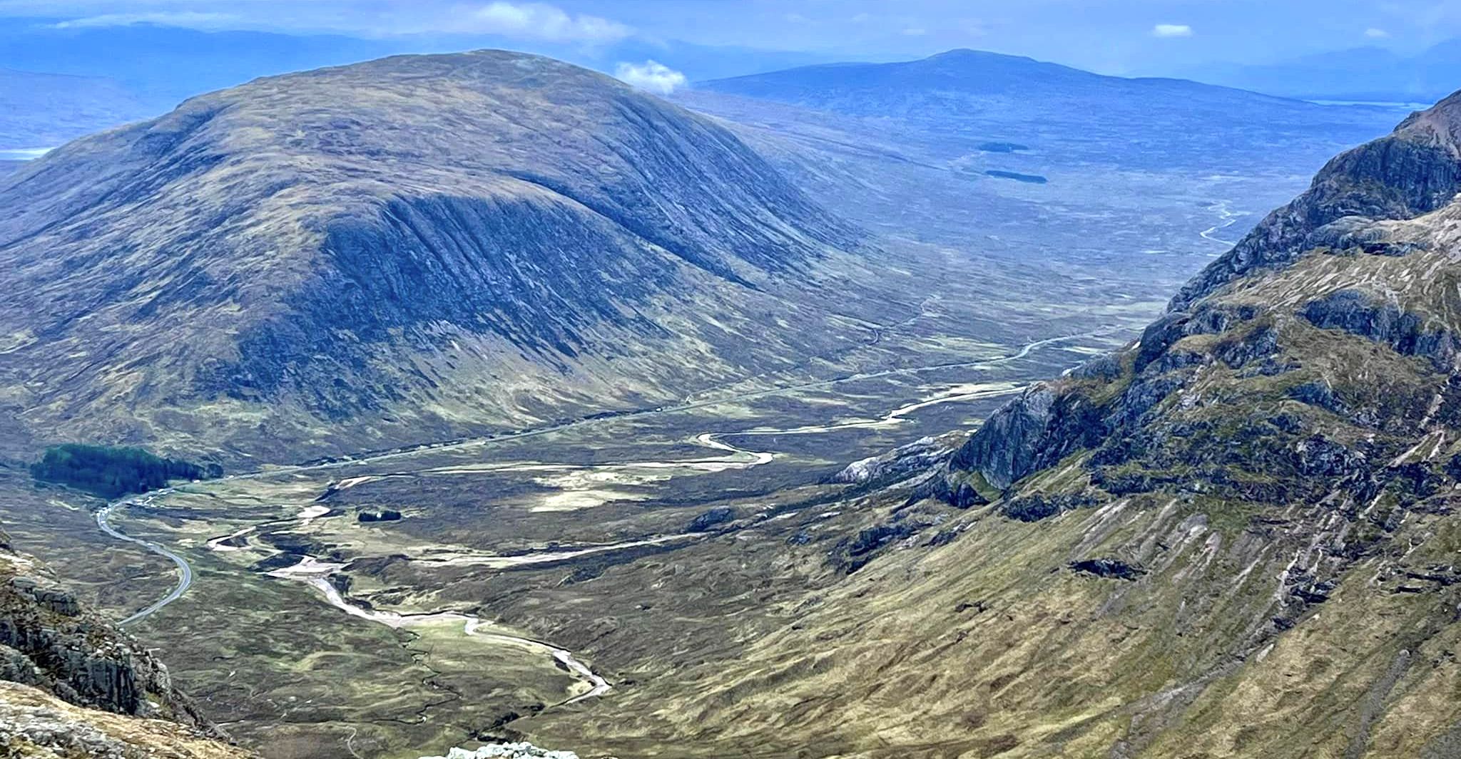
Glencoe from Beinn a Chrulaiste

Glen Coe from Beinn a Chrulaiste

Buachaille Etive Beag

and the Three Sisters on the left

and the
Aonach Eagach Ridge on the right


Glencoe from summit of Beinn a Chrulaiste

Glen Coe

from summit of Beinn a Chrulaiste

h


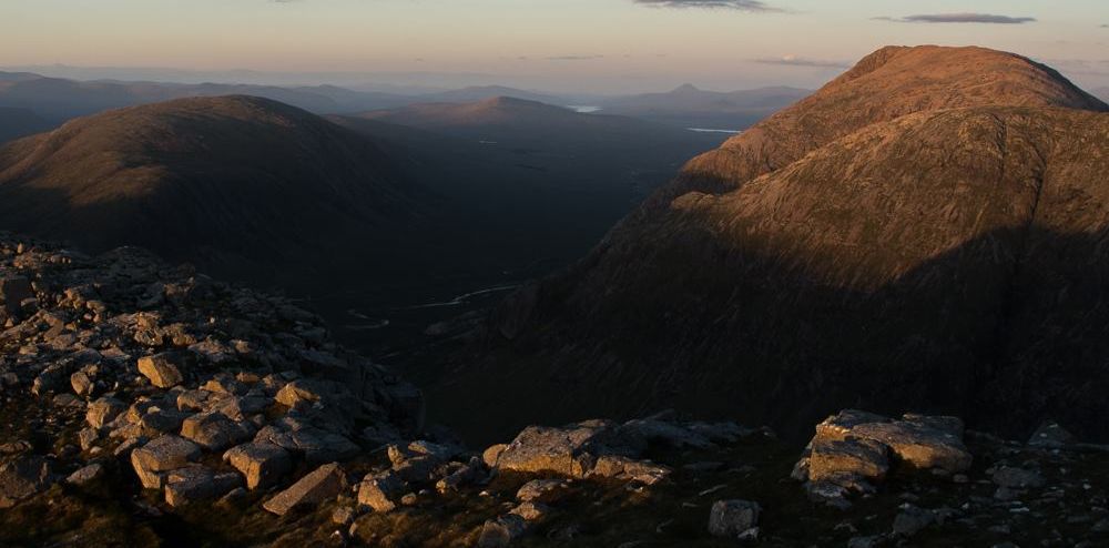
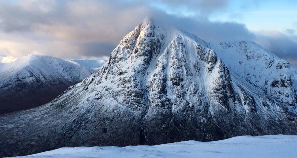
Buachaille Etive Mor from the summit of Beinn a Chrulaiste in Glencoe in the Highlands of Scotland

Buachaille Etive Mor

from the summit of Beinn a Chrulaiste


Buachaille Etive Mor


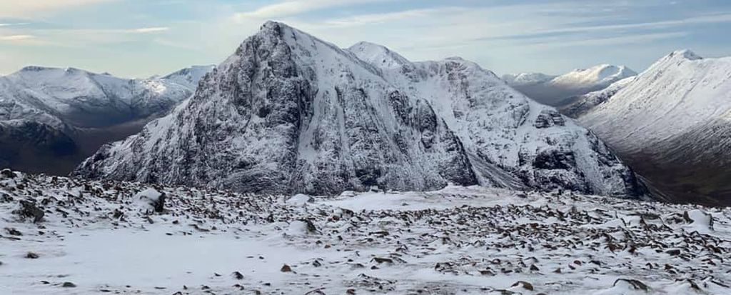
Buachaille Etive Mor from the summit of Beinn a Chrulaiste in Glencoe in the Highlands of Scotland

Buachaille Etive Mor

from the summit of Beinn a Chrulaiste


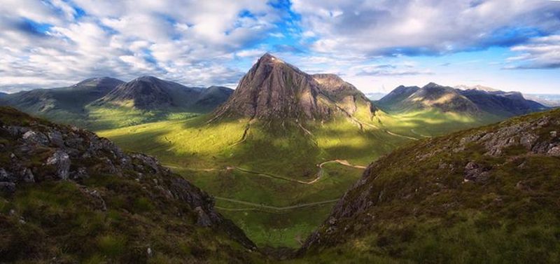
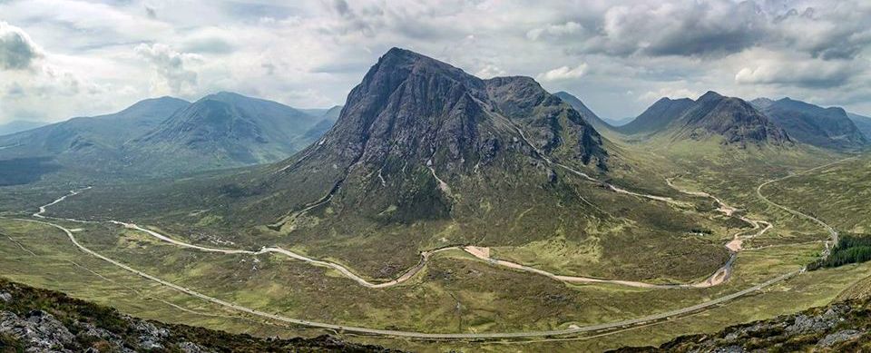
Buachaille Etive Mor from Beinn a Chrulaiste in Glencoe in the Highlands of Scotland

Buachaille Etive Mor

from Beinn a Chrulaiste


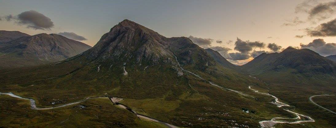
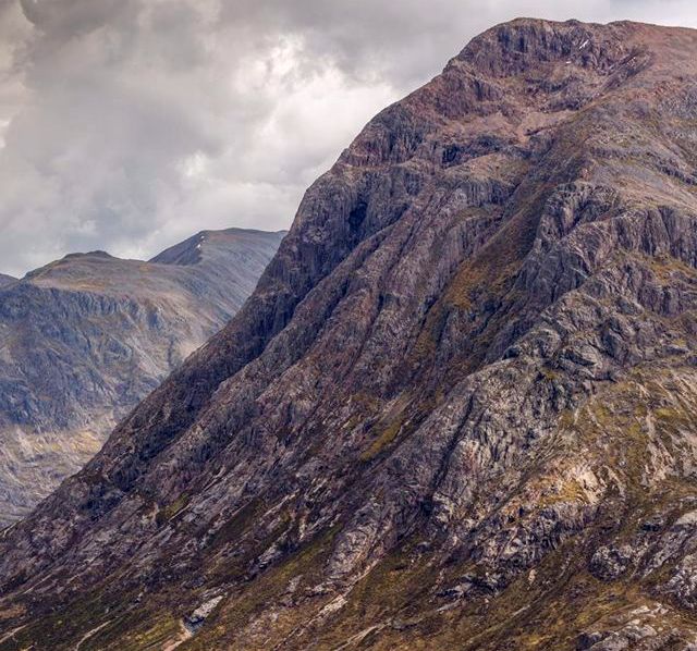
Buchaille Etive Mor in Glencoe in the Highlands of Scotland


Buchaille Etive Mor in Glencoe in the Highlands of Scotland


Buchaille Etive Beag in Glencoe in the Highlands of Scotland


Buachaille Etive Mor from Beinn a Chrulaiste in Glencoe in the Highlands of Scotland

Buachaille Etive Mor

from Beinn a Chrulaiste


Buachaille Etive Mor from Beinn a Chrulaiste in Glencoe in the Highlands of Scotland

Buachaille Etive Mor

from Beinn a Chrulaiste


Buachaille Etive Mor from Beinn a Chrulaiste in Glencoe in the Highlands of Scotland

Buachaille Etive Mor

from Beinn a Chrulaiste


Buachaille Etive Mor from Beinn a Chrulaiste in Glencoe in the Highlands of Scotland

Buachaille Etive Mor

from Beinn a Chrulaiste


Buachaille Etive Mor from Beinn a Chrulaiste in Glencoe in the Highlands of Scotland

Meall a Burraidh, Creise,

 
Buachaille Etive Mor


from Beinn a Chrulaiste


Meall a Burraidh and Creise from the summit of Beinn a Chrulaiste in Glencoe in the Highlands of Scotland

Meall a Burraidh and Creise

from the summit of Beinn a Chrulaiste


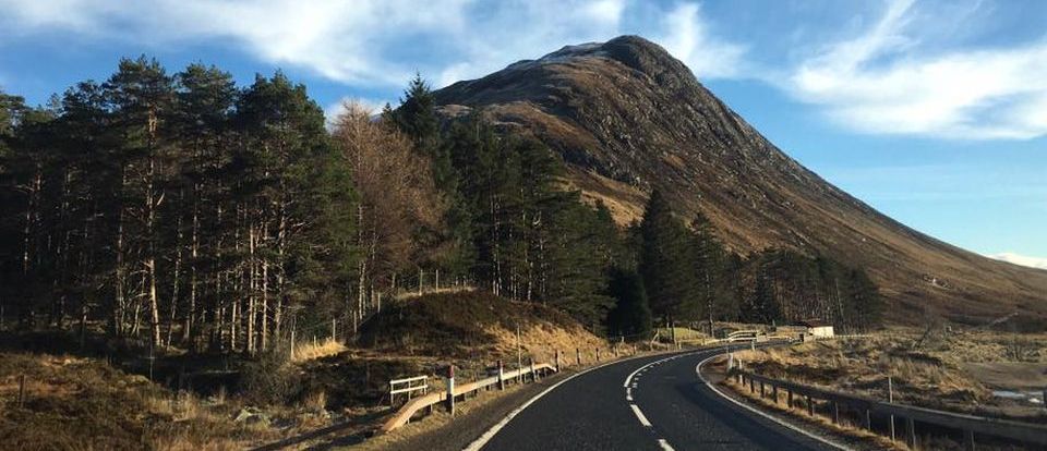
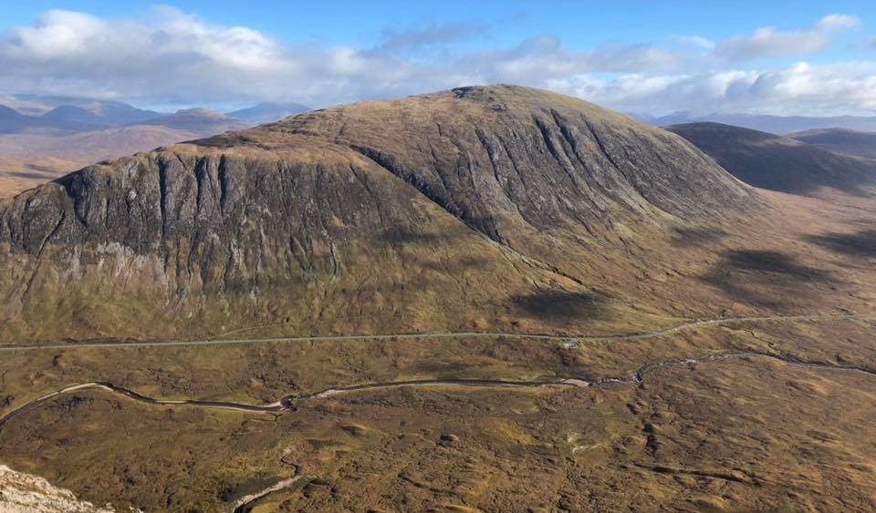
Beinn a Chrulaiste in Glencoe in the Highlands of Scotland

Beinn a Chrulaiste

from 
Buachaille Etive Mor


Beinn a Chrulaiste in Glencoe in the Highlands of Scotland

Beinn a Chrulaiste

from 
Buachaille Etive Mor


Beinn a Chrulaiste in Glencoe in the Highlands of Scotland

Beinn a Chrulaiste


Beinn a Chrulaiste in Glencoe in the Highlands of Scotland

Beinn a Chrulaiste


Meall a Burraidh and Creise from the summit of Beinn a Chrulaiste in Glencoe in the Highlands of Scotland

Meall a Burraidh and Creise

from the summit of Beinn a Chrulaiste


Buachaille Etive Mor from the summit of Beinn a Chrulaiste in Glencoe in the Highlands of Scotland

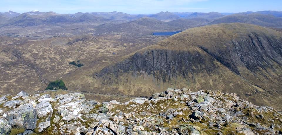
Blackwater Reservoir

and 
The Mamores

from the summit of Beinn a Chrulaiste


Creise above Kings House Hotel


Beinn a Chrulaiste above Kings House Hotel

Beinn a Chrulaiste

above 
Kings House Hotel


Kings House Inn in Glencoe in the Highlands of Scotland

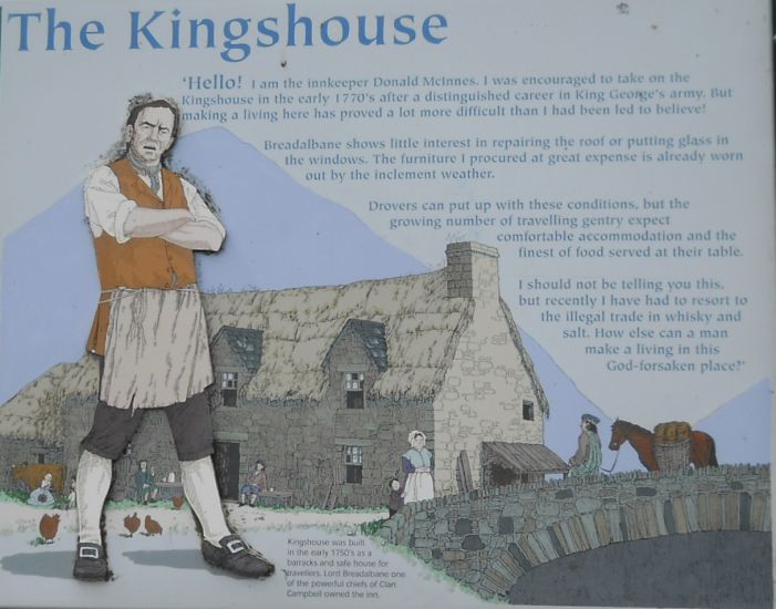
The Kingshouse in Glen Coe

The Kingshouse was built in the early 1750’s
 as a barracks and safe house for travellers.
 Lord Breadalbane one of the powerful chiefs
 of Clan Campbell owned the inn.

The Kingshouse: ‘Hello’ I am the innkeeper Donald McInnes.
 I was encouraged to ta
ke on the Kingshouse in the early 1770’s
after a distinguished career in King George’s army.
But making a living here has proved a lot more difficult
 than I had been led to believe!

Breadalbane shows little interest in repairing the roof
 or putting glass in the windows.
 The furniture I procured at great expense
 is already worn out by the inclement weather.

Drovers can put up with these conditions,
but the growing number of travelling gentry
 expect comfortable accomodation
 and the finest of food at their table.

I should not be telling you this,
 but recently I have had to resort
 to the illegal trade in whisky and salt.
 How else can a man make his living
 in this God-forsaken place.


 ( Note: Click here or on above for large format copy )


Beinn a Chrulaiste

Beinn a Chrulaiste


Beinn a Chrulaiste from Buachaille Etive Mor

Beinn a Chrulaiste

from
Buachaille Etive Mor 


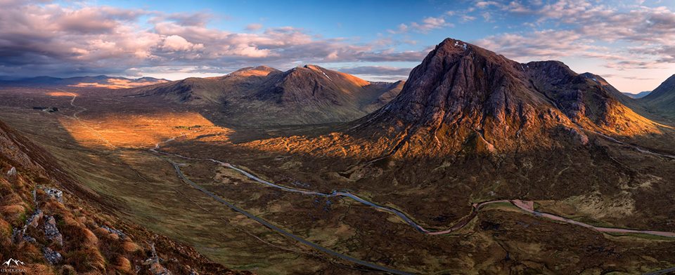
Buachaille Etive Mor and Beinn a Chrulaiste

Buachaille Etive Mor

and
Beinn a Chrulaiste


Black Rock Cottage, Buachaille Etive Mor and Beinn a Chrulaiste


Black Rock Cottage and Beinn a Chrulaiste

Black Rock Cottage

and Beinn a Chrulaiste


Beinn a Chrulaiste

Beinn a Chrulaiste


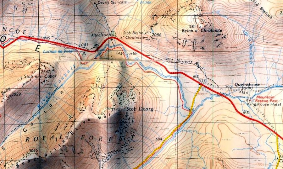
Map of Beinn a Chrulaiste in Glencoe

Map of Beinn a Chrulaiste

 in Glencoe

h


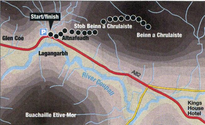
Route Map of Beinn a Chrulaiste in Glencoe

Map of Beinn a Chrulaiste

 in Glencoe

h


BEINN a'CHRULAISTE - ROUTE DESCRIPTION:

Location: Glen Coe
Map: OS Landranger41 ( GR220563 )
Distance: 6 1/2 km ( 4 miles )
Time: 3 hours
Terrain: Hill path

Beinn a’ Chrulaiste is the great rounded lump of a hill which sits across the road from Buachaille Etive Mor and, while it is not an eye-catching mountain like its neighbour, it does afford fabulous views of that iconic peak and the rest of the Glen Coe massif. Many people opt for the ascent from the King’s House Hotel but the approach from further West at Altnafeadh is perhaps the finer.
Start from the large layby on the A82 at Altnafeadh where the
West Highland Way footpath climbs over to Kinlochleven via the Devil’s Staircase. From the eastern end of the layby a path leads on to the West Highland Way which is followed alongside the road over two wooden bridges to the end of a small forestry plantation. Climb up the side of this plantation to pass beneath the power lines and head for a gate in the fence which can be seen up to the right. Go through this gate then immediately step over the fence beside it and climb the hillside past some wooden posts to pick up a rough hill path which ascends the edge of the slope overlooking the road.
Height is gained rapidly and fabulous views begin to open out with
Buachaille Etive Mor on the other side of the road continually drawing the eye.
The steepness soon eases and the path swings away from the edge to pass over the minor bump of Stob Beinn a’ Chrulaiste where the view extends north to the peaks of the Mamores and Ben Nevis.
Continue in the direction of these peaks for a short way to bypass a boggy area and some peat hags then swing around and follow the rough path east up grassy slopes to the rocky summit of Beinn a’ Chrulaiste ( 857m; 2811ft ).
It is worth walking around the flat summit area to savour the views before probably settling on a perch looking across to the magnificent
Buachaille Etive Mor. Although the route back retraces that of the ascent, Glen Coe and its attendant peaks are now spread at one’s feet, making this perhaps a more fitting way to leave the mountain.


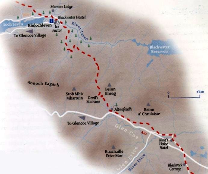
Map of the West Highland Way from Kingshouse to Kinlochleven

Map of the West Highland Way from Kingshouse to Kinlochleven 

h


DEVIL'S STAIRCASE & STOB MHIC MHARTUIN - ROUTE DESCRIPTION:
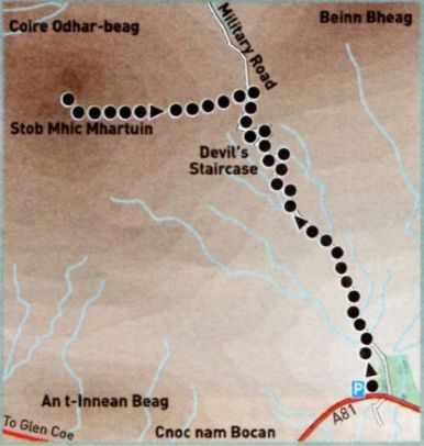

Location: Glen Coe
Map: OS Landranger 41 [GR 216 574]
Distance: 5km [3 miles]
Time: 1hr 30 minutes
Terrain: Good paths

Sometimes the shortest of walks can reveal stupendous views and this route to the summit of Stob Mhic Mhartuin on the north side of GlenCoe is a perfect example. Surrounded by some of the most dramatic mountains in Scotland, Stub Mhic Mhartuin is just a bump, but its ascent allows that great Glen Coe sentinel, Buachaille Etive Mor, to be viewed from a different perspective than the usual shortbread-tin vista from the east -with the conical tower of Stob Dearg rising above the River Coupal.
The route starts from the layby on the north side of the A82 at Altnafeadh. At weekends this can be particularly busy and there is overflow parking on the south side of the road. It's in the vicinity of the track that leads down to the foot-bridge that takes you over the River Coupal to Laggangarbh cottage. From the east side of the car park, follow the path signposted West Highland Wayalongside the burn. It follows the line of the old military road that was constructed in around 1750, much of it on the route of the old drove road used to herd cattle from the Highlands to the lowland markets. This section of the military road was built under the command of Major Caulfield, successor to General Wade. It ascends to the Devil's Staircase, the zigzags carrying the road up the steep gradient below the col between Stob Mhic Mhartuin and Beinn Bheag.
As you ascend. the massive Blackwater Reservoir starts to come into view to the north-east. Built between 1905 and 1909 with dynamite and pick axe, and at the cost of many lives, the reservoir served the now closed aluminium smelter in Kinlochleven.
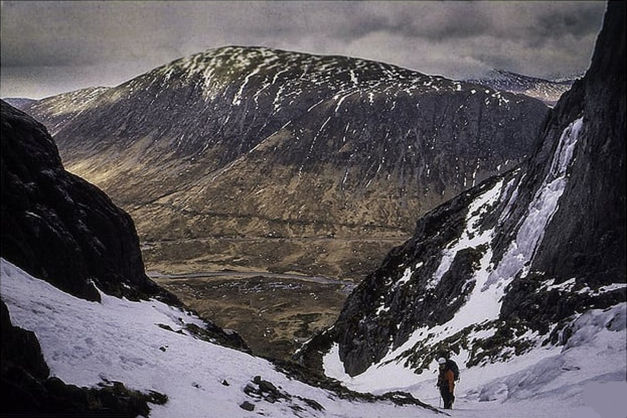
However, it is the other side of the glen that dominates the view, in the shape of the vast, dark depths of Buachaille Etive Mor’s north-facing Coire an Tulaich, with the tiny white cottage of Laggangarbh below. If this feels a little claustrophobic — and even these eastern and more open reaches of
Glen Coe have that effect on some people — then arriving at the col below Stob Mhic Mhartuin is positively agoraphobic.
Suddenly, the landscape opens up with a sweeping view down to the wooded glen of the River Leven and across to a backdrop of the Mamores and the whaleback plateau of Ben Nevis beyond. The north side of the Leven, almost directly ahead, was the site of a prisoner-of-war camp during the First World War. lt must have been a dismal location in winter.
From the cairn at the col a smaller footpath leads left up the broad ridge to the top of Stob Mhic Mhartuin and further fine views down the length of Glen Coe, flanked by the peaks of the Aonach Eagach ridge to the north and the rocky spurs and summits of the
Three Sisters, Stob Coire nan Lochan and Bidean nam Bian to the south.
From the summit return to the col and descend the Devil’s Staircase back to the road.


Route description and map for the Devil's Staircase above Glencoe from the WestHighland Way

Route Map for the Devil's Staircase

h

Beinn a Chrulaiste Gallery Thumbnail Gallery :: Glencoe Photo Gallery Photo Gallery

<< Back : West Highland Way : Next >>


Scotland Index :: Scottish Peaks Index

Ben Nevis | Knoydart | Isle of Skye | Isle of Arran | The West Highland Way

The Eastern Highlands | The Central Highlands | The Southern Highlands | The NW Highlands


Adventure Travel : Worldwide Mountaineering : Site Index

fb icon  google+ icon Linkedin icon  twitter


Travel & Guide Books & Maps:-


Loch Etive & Glen Orchy - OS Explorer Map Glen Coe & Glen Etive - OS Explorer Map Rannoch Moor & Ben Alder - OS Explorer Map

Glencoe Superwalker MapWestern Scotland & the Western Isles OS Road Map Northern Scotland OS Road Map Southern Scotland OS Road Map


Ben Nevis OS Explorer Map


Ben Nevis & Glencoe - 100 Walks in Lochaber  Ben Nevis & Glencoe

The High Mountains of Britain & Ireland  Munros Tables SMC  The Munros - Scotland's Highest Mountains  Scotland - Lonely Planet  NW Highlands - SMC Guide  Exploring the Far NW of Scotland  Guide to Walks in NW Highlands

Walking in Scotland - Lonely Planet Mountain: Exploring Britain's High Places  National 3 Peaks Walk Scottish Highlands Hillwalking Guide The Scottish Islands Bouldering in Scotland

Pathfinder Guide: Fort William and Glen Coe Walks Rambler's Guide: Ben Nevis and Glen CoeGlencoe Rock & Ice Climbing The Munros: Scottish Mountaineering Club The Munros and Tops The Corbetts - SMC Munros & Corbetts Chart The High Mountains of Britain and Ireland Munro Almanac

Central Highlands: Six Long Distance Walks West Highland Way: Official GuideWest Highland Way: Rucksac Readers West Highland Way: TrailblazerThe West Highland WayWest Highland Way: Footprint MapWest Highland Way - Map West Highland Way - Map 100 Hillwalks around Glasgow

Scottish Highlands Hillwalking Guide The Munros - Scotland's highest mountains Call of the Corbetts Magic of the Munros Hamish's Mountain WalkThe Munros in Winter My Scotland by Hamish MacInnes

Scottish Mountains - 50 Classic Routes50 More Routes on Scottish Mountains The High Mountains of Britain and Ireland Scotlands 100 Best Walks Scottish Mountains - 100 Best RoutesBig Walks of Great Britain Classic Walks in Britain & Ireland

Scottish Hill & Mountain Names Classic Mountain Scrambles in Scotland Classic Climbs - Central & Southern Highlands Mountaineering in Scotland and Undiscovered Scotland by W.H.MurrayMore Wilderness Walks Wilderness Walks Wilderness Walks 2 - Video Ski Mountaineering in Scotland

Ski Touring in ScotlandScrambles in Lochaber Rock Climbing in Scotland Rock Climbing SkillsThe FACE: Six Great Climbing Adventures Ben Nevis: Rock & Ice ClimbsGreat Snow & Ice Climbs of the British Isles100 Best Routes on Scottish Mountains One Man's Mountains - Tom Patey

A Mountaineer's Tale - W.H.Murray Dougal Haston: Philosophy of RiskThe Glens of Rannoch Southern Highlands - MapNorthern Highlands Central Highlands West Highlands Central Highlands SMCNW Highlands SMC

Scotland - Lonely PlanetScotland's Highlands & Islands - Lonley Planet Scotland's Highlands & Islands - Rough Guide Highlands & Islands of Scotland - Hidden Places Rough Guide Scotland Scottish Highlands & Islands - Rough Guide Rough Guide: Scotland Lonely Planet, Walking in ScotlandLonely Planet - Walking in Britain

50 Walks in the Scottish Highlands & Islands 100 Walks in ScotlandVisit Scotland - Touring Guide Scotland: Where to Stay - Hotels & Guest Houses Scotland: Where to Stay - Bed & Breakfast Hillwalker: The MunrosHillwalker: The Corbetts

Weather for Hillwakers & Climbers Mountain Weather Guide to the Weather Weather: Collins Gem Hillwalking Handbook for Mountain Leaders Hillwalkers Manual Hillwalkers Guide to Mountaineering First Aid on Mountains


Google Analytics


Google Analytics

extremetracking
 eXTReMe Tracker


extremetracking
Sitelock caingram.com
SiteLock
Sitelock
Sitelock caingram.info
SiteLock
Sitelock