Munros Tables SMC Ski Mountaineering in Scotland

 The Scottish Highlands


Ben Challum Circuit
The High Mountains of Britain & Ireland Southern Highlands - Map

A circular traverse of Ben Challum

including the two Corbetts

 - Beinn Chaorach and Cam Chreag

 and an ascent of the NW ridge of 
Ben Challum

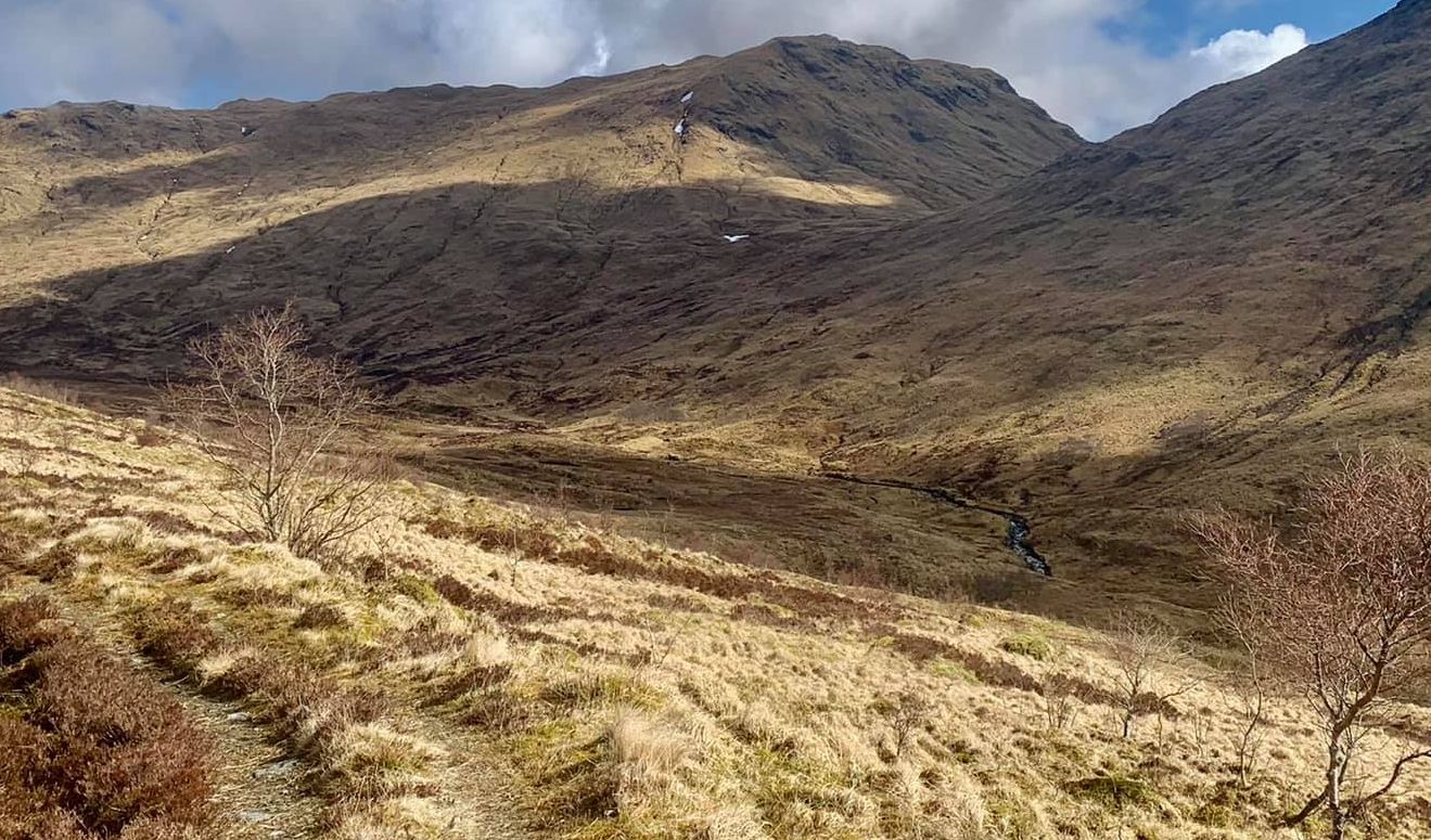
Beinn Chaorach at start of ascent from Auchtertyre

Beinn Chaorach ( 2685ft, 818m - a Corbett )

 at start of ascent from Auchtertyre

Cam Chreag at start of ascent from Auchtertyre

Cam Chreag ( 2900ft, 884m - a Corbett )

at start of ascent from Auchtertyre


Cam Chreag

Cam Chreag ( 2900ft, 884m - a Corbett )


Ben Lui on ascent of Beinn Chaorach

Ben Lui on ascent of Beinn Chaorach

Ben Dorain from trig point on summit of Beinn Chaorach

Ben Dorain

from trig point on

summit of Beinn Chaorach


XJ6

Beinn Chuirn ( 2887ft, 880m - a Corbett )

in the Ben Lui Group

from Beinn Chaorach


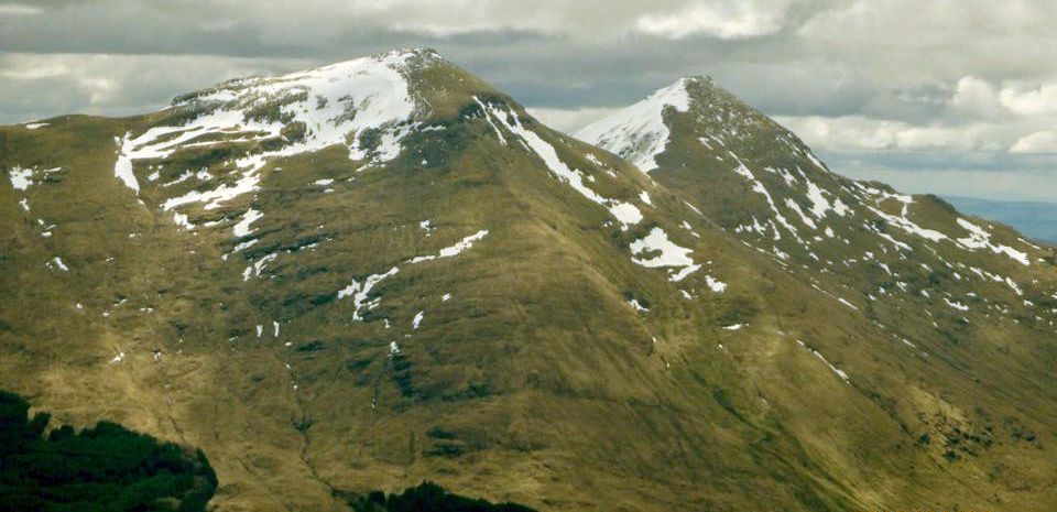
Ben Dorain and Beinn a' Chaistal ( 2907ft, 886m - a Corbett ) from Beinn Chaorach

Ben Dorain

and 
Beinn a Chaisteil ( 2907ft, 886m - a Corbett )

 
from Beinn Chaorach


Ben Challum from Beinn Chaorach

Ben Challum from Beinn Chaorach


Beinn a Chuirn ( 3020ft ) and Beinn Mhanoch ( 3125ft ) from Beinn Chaorach

Beinn nam Fuaran ( 2645ft, 806m - a Corbett )

from
Beinn Chaorach


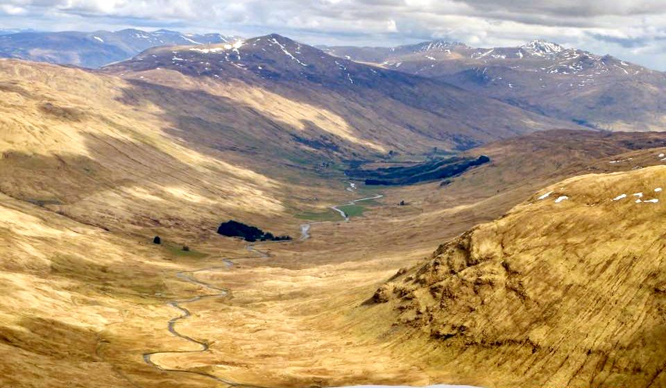
Auch Gleann

West Highland Way 

crossing Auch Gleann

 beneath Ben Dorain


Ben Nevis from Cam Chreag

Beinn an Dothaidh and Ben Nevis

from
Cam Chreag


Beinn Mhanach ( 3125ft ) above Loch Lyon from Cam Chreag

Beinn Mhanach ( 3125ft )

above
Loch Lyon from Cam Chreag 


Beinn Mhanach ( 3125ft ) above Loch Lyon from Cam Chreag

Beinn Mhanach ( 3125ft ) 

from
Ben Challum 


Ben Lui from Summit of Cam Chreag

Ben Oss, Beinn Dubhchraig,

 
Ben Lui and Beinn Chuirn

from summit of 
Cam Chreag ( 2900ft, 884m )


North Face of Ben Challum from Cam Chreag

North Face of Ben Challum

from 
Cam Chreag


Meall Glas from Cam Chreag

Meall Glas from Cam Chreag


Meall Glas from Carn Chreag

Cruach Ardrain ( 3428ft, 1046m )

 
from Ben Challum


Ben More and Stob Binnein from Ben Challum


Ben More and Stob Binnein from Ben Challum


Ben Challum from Beinn Dubhchraig

Cam Chreag and Ben Challum

on descent from Beinn Dubhchraig


Ben Challum from Beinn Dubhchraig


Auchtertyre at start / finish of Ben Challum Circuit

Auchtertyre

at start / finish of Ben Challum Circuit 


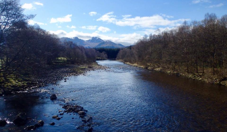
Stob Garbh and Cruach Ardrain from River Fillan

Stob Garbh and Cruach Ardrain

from
River Fillan 


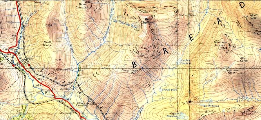
Map for Ben Challum

Map for Ben Challum


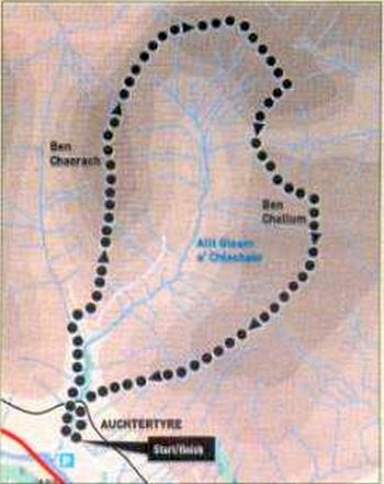
Route Map for Ben Challum

Route Map for Ben Challum

( Note: Click here or on map for large format copy )


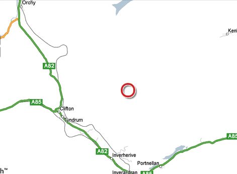
Location Map for Ben Challum

Location Map for Ben Challum


Ben Challum - Ascent Route Map

Ben Challum

- Ascent Route


BEN CHALLUM CIRCUIT - ROUTE DESCRIPTION:

Location: Tyndrum. Stirlingshire
Map: OS Landranger 50 [GR 386 322]
Distance: 12.5 miles ( 20km )
Time: 6 hours
Terrain: paths and open hillside

Ben Challum has an unjustified reputation as a rather dull hill, largely due to the standard route of ascent up the broad southern flanks.
True, these slopes are not very interesting and have more than their fair share of fences, boggy bits and indistinct paths, but things do get better as height is gained and the second and steeper half of the ascent is excellent.
The following route will spice it up by adding an entree in the form of two Corbetts - Beinn Chaorach and Cam Chreag - and leaving the boggy hits to the end, when anything gentle, downhill and spongy underfoot is to be welcomed.
Leave the A82 south-east of Tyndrum and park just below Auchtertyre farm. Follow the access road towards the farm
and chalets, tuming left on to a track before the bridge over the river. Pass under the railway and follow the track up the glen onto the southern ridge of the first Corbett - Beinn Chaorach. This broad grassy ridge leads gently to the summit, marked by a cylindrical trig point and spectacular views north. Head down the north ridge, with even better views, to the col below Cam Chreag, then ascend north and east across slightly rockier terrain to the summit, which is marked bya small cairn. Turn east and follow the airy ridge, aiming straight for Ben Challum's north lace. Following the ridge to its very end gives a fine view of this big craggy face, before turning west to the blunt west ridge. Here an old fence is followed steeply down to the Bealach Ghlas Leathaid below Ben Challum.
The north-west ridge looks imposingly steep and craggy, but the stabby crag is easily avoided on its east side, via a diversion on to the north face. Regain the ridge and follow it to the large summit cairn. From here, a short section of ridge leads to the South Top. Descend stony slopes following an old fence line which brings you to a three—way meeting of fences and a stile. A choice of descents can be made from here.
Crossover to a higher path and remain on the high ground until you can descend grassy slopes south-west to gain a track which passes below the eastern end oi the railway viaduct and leads hack down toAuchtertyre.
Alternatively, remain on the path beside the fence and follow it down to cross the railway above Kirkton Farm and take the
West Highland Way back to Auchtertyre.

Ben Challum Gallery Photo Gallery :: West Highland Way Photo Gallery

<< BackSouthern Highlands : Next >>


Scotland Index :: Scottish Peaks :: Scotland Walks

Isle of Skye :: Isle of Arran

Knoydart :: Glencoe :: Ben Nevis :: NW Highlands :: Eastern Highlands :: Central Highlands


Worldwide Mountaineering :: Adventure Travel :: Site Index

fb icon  google+ icon  Linkedin icon  twitter


Books & Maps - Scotland:-


Arrochar Alps - Map Glasgow Popular Hills - Map West Highland Way - Map Loch Lomond North - Tyndrum, Crianlarich, Arrochar - OS Explorer Map Loch Lomond and Inverary OS Landranger Map

Isle of Arran OS Explorer Map Isle of Arran OS Landranger Map Arran - Official Tourist MapIona & Mull MapWestern Scotland & the Western Isles OS Road Map Northern Scotland OS Road MapSouthern Scotland OS Road Map


Loch Lomond & Trossachs - 25 Walks  Loch Lomond & Trossachs NP - Vol 1 - West  Loch Lomond & Trossachs NP - Vol 2 - East  Walking Loch Lomond and the Trossachs

The High Mountains of Britain & Ireland  Munros Tables SMC  The Munros - Scotland's Highest Mountains  Scotland - Lonely Planet  NW Highlands - SMC Guide  Exploring the Far NW of Scotland  Guide to Walks in NW Highlands

Walking in Scotland - Lonely Planet Mountain: Exploring Britain's High Places  National 3 Peaks Walk Scottish Highlands Hillwalking Guide The Scottish Islands Bouldering in Scotland

Central Highlands: Six Long Distance Walks West Highland Way: Official GuideWest Highland Way: Rucksac ReadersWest Highland Way: TrailblazerThe West Highland WayWest Highland Way: Footprint MapWest Highland Way - Map West Highland Way - Map 100 Hillwalks around Glasgow

Pathfinder Guide: Fort William and Glen Coe Walks Rambler's Guide: Ben Nevis and Glen CoeGlencoe Rock & Ice Climbing The Munros: Scottish Mountaineering Club The Munros and Tops The Corbetts - SMC Munros & Corbetts Chart The High Mountains of Britain and Ireland Munro Almanac

The Munros - Scotland's highest mountains Call of the Corbetts Magic of the Munros Hamish's Mountain WalkThe Munros in WinterMy Scotland by Hamish MacInnes

Scottish Mountains - 50 Classic Routes50 More Routes on Scottish Mountains The High Mountains of Britain and Ireland Scotlands 100 Best Walks Scottish Mountains - 100 Best RoutesBig Walks of Great Britain Classic Walks in Britain & Ireland

Scottish Hill & Mountain Names Classic Mountain Scrambles in Scotland Classic Climbs - Central & Southern Highlands Mountaineering in Scotland and Undiscovered Scotland by W.H.MurrayMore Wilderness Walks Wilderness Walks Wilderness Walks 2 - Video Ski Mountaineering in Scotland

Ski Touring in ScotlandScrambles in Lochaber Rock Climbing in Scotland Rock Climbing SkillsThe FACE: Six Great Climbing Adventures Ben Nevis: Rock & Ice ClimbsGreat Snow & Ice Climbs of the British Isles100 Best Routes on Scottish Mountains One Man's Mountains - Tom Patey

A Mountaineer's Tale - W.H.MurrayDougal Haston: Philosophy of RiskThe Glens of Rannoch Southern Highlands - MapNorthern Highlands Central Highlands West Highlands Central Highlands SMCNW Highlands SMC

Scotland - Lonely PlanetScotland's Highlands & Islands - Lonley Planet Scotland's Highlands & Islands - Rough Guide Highlands & Islands of Scotland - Hidden Places Rough Guide ScotlandScottish Highlands & Islands - Rough Guide Rough Guide: Scotland Lonely Planet, Walking in ScotlandLonely Planet - Walking in Britain

50 Walks in the Scottish Highlands & Islands 100 Walks in ScotlandVisit Scotland - Touring Guide Scotland: Where to Stay - Hotels & Guest Houses Scotland: Where to Stay - Bed & Breakfast Hillwalker: The MunrosHillwalker: The Corbetts

Weather for Hillwakers & Climbers Mountain Weather Guide to the Weather Weather: Collins Gem Hillwalking Handbook for Mountain Leaders Hillwalkers Manual Hillwalkers Guide to Mountaineering First Aid on Mountains


Loch Lomond


Loch Lomond

Google Analytics


Google Analytics

extremetracking

 eXTReMe Tracker


extremetracking

Sitelock caingram.com
SiteLock
Sitelock
Sitelock caingram.info
SiteLock
Sitelock