  |
The Scottish Highlands Meall Tairneachan
& Farragon Hill |
  |
Photographs of an ascent of the two Corbetts Meall Tairneachan and Farragon Hill
in
the Southern
Highlands of Scotland.
Views of Schiehallion
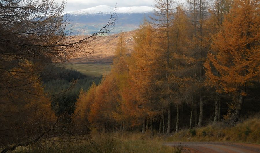 Beinn a' Chuallaich
on ascent to Meall Tairneachan |
|
|
Meall
Tairneachan ( " hill of thunder " ) |
|
|
Schiehallion
from the trig point on the summit of Meall Tairneachan ( 2582ft, 787m ). |
|
Farragon
Hill
( St. Feargain's Hill ) |
Farragon
Hill
|
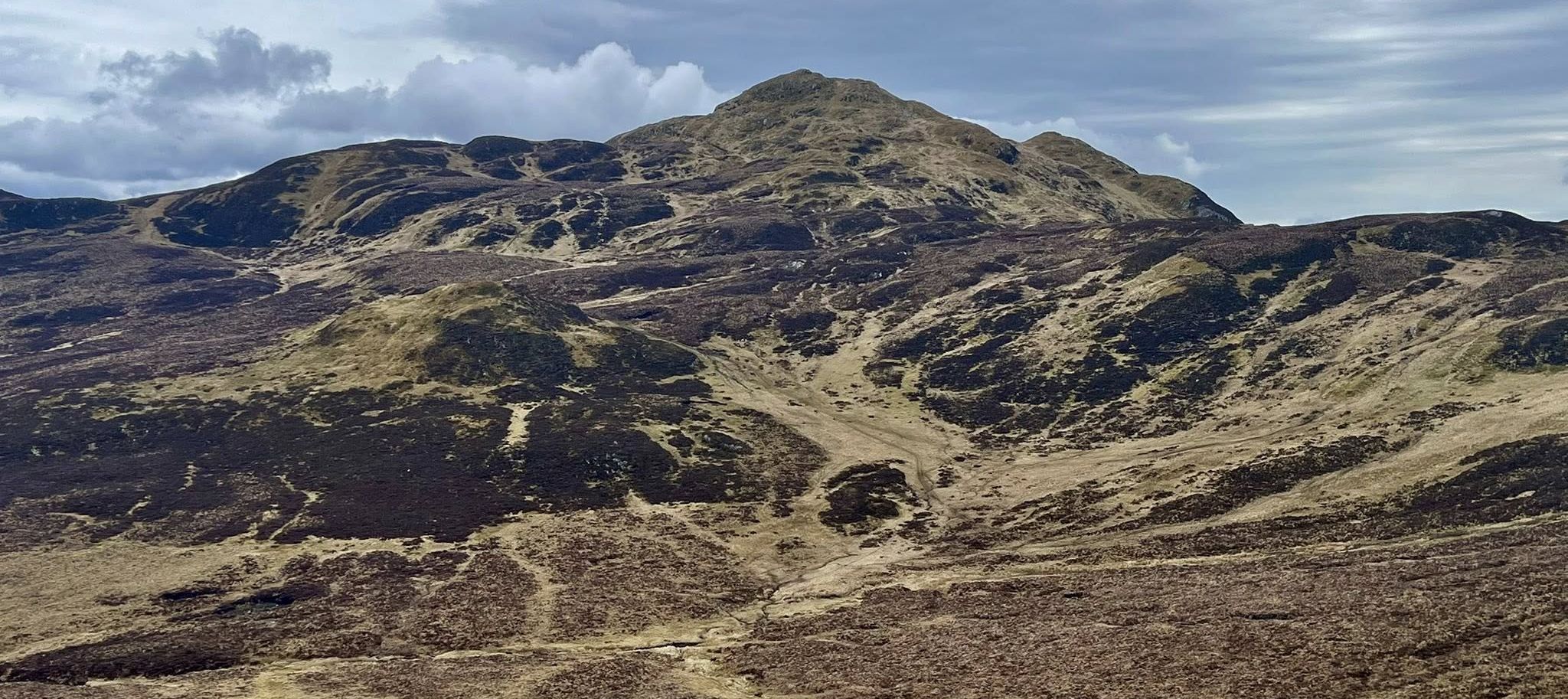 Farragon
Hill
|
Loch
Derculich
from Farragon Hill |
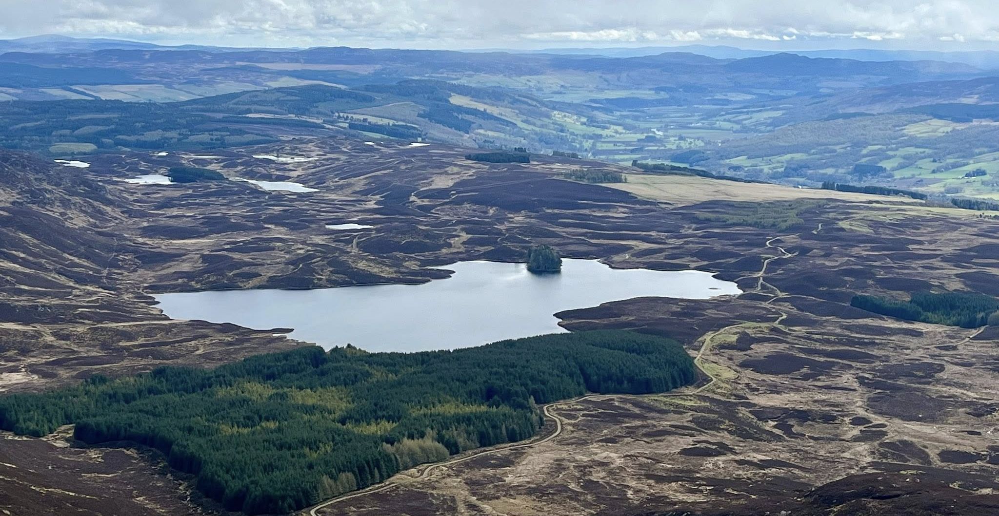 Loch
Derculich
from Farragon Hill |
Schiehallion
from the summit of Farragon Hill ( 2569ft, 783m ) |
View
to the North
from Farragon Hill |
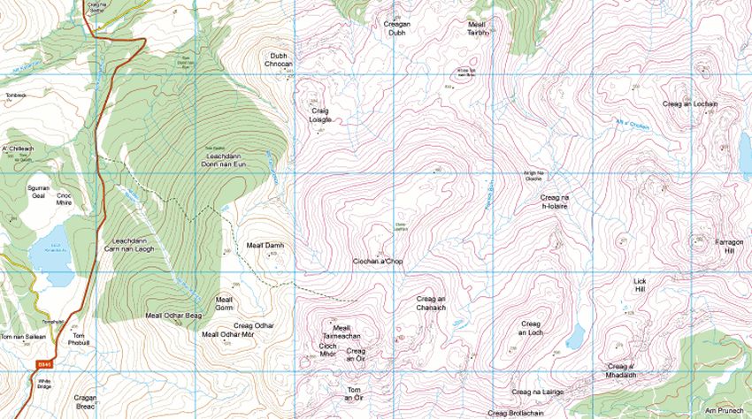 Map of Meall Tairneachan and Farragon Hill |
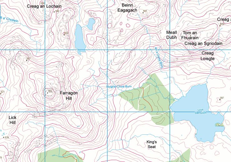 Map of
Farragon Hill
|
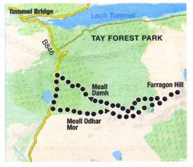 Route
Map of
Farragon Hill
|
Meall Tairneachan and Farragon Hill - Route Description:
Location: Perthshire
Map: OS Landranger 52
Distance: 10miles / 16km
Time: 4-6 hours
Terrain: Moderate hill walk, ascent of 2100ft / 650m
As you drive north on the A9 towards Pitlochry, you can see the ragged skyline of the Farragons, a little-visited hill area which lies in the shadow of
Perthshire's finest peak, Schiehallion. The Farragons’ broad, knobbly ridge runs from Meall Tairneachan in the west to Farragon Hill itself, making up the highest
points of a huge forested area between Loch Tummel and Strath Tay.
A walk linking the two hills, both of them Corbetts, makes a good winter day.
Park car at Tomphubil, just south of Loch Kinardoehy, and follow the edge of a forestry plantation due east towards Meall Tairncachan.
This gives the advantage of starting off at over 300m, and although the initial slopes are steep and heathery you gain height quickly on a faint path
which follows a drystone wall.
The summit of Meall Tairneachan is reached within an
hour, with views to the north and east towards the Dalnaspidal hills and the blue Cairngorms.
To the west are Schiehallion and the Glen Lyon hills.
Just below Meall Tairneacharl a great man-made corrie houses a labyrinth of baryte mines, together
with their buildings, fences, bulldozed roads and signs but by carefully keeping as far south as possible
it is possible to avoid the worst of the workings and maintained at least a sense of unspoiled landscape.
Taking this line is a high-level route between the two Corbetts which unfortunately
fights the grain of the land and several steep-sided tops and ridges formed natural barriers which had
to be crossed before reaching the broad Lairig Laoigh. an ancient through-route between Strath Tay and Loch Tummel.
From the Lairig, complete with its own reed-fringed loch. it was a boggy tramp to the steep west facing slopes of Farragon Hill.
It was a steep climb to the summit, but an interesting one, following grassy ramps between rocky outcrops.
Return along the bulldozed track used for the extraction of ‘baryte minerals from the mines and follow the track down the hillside
through the pine scented forest and back to the road.
 :: Schiehallion
Gallery