Glasgow Visitor Guide - Colin Baxter Glasgow Insight Pocket Guide

 Burgh of Bearsden

Garscube Estate
Old Bearsden Glasgow - A Portrait

 Photographs of a circular walk around Garscube Estate

and Dawsholm Park in Bearsden 


North Lodge at entrance to Garscube Estate from Maryhill Road at Killermont in Bearsden

North Lodge

 at entrance to Garscube Estate
 from Maryhill Road at Killermont

Garscube was a large 19th-century estate

 extending over the River Kelvin

 into the City of Glasgow


Driveway in Garscube Estate from North Lodge on Maryhill Road

Driveway

 in Garscube Estate

 from North Lodge


Trees in Garscube Estate in Bearsden

Trees in Garscube Estate

Garscube Estate was purchased

by the University of Glasgow in 1947.

The estate holds the Veterinary School,

Small Animal Hospital, Wolfson Halls of Residence,

Wolfson Cancer Research Centre,

West of Scotland Science Park

and sports complex.


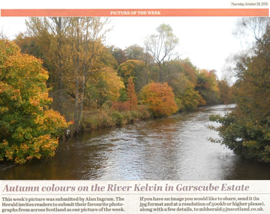
Kelvin River in Garscube Estate in Bearsden

 Kelvin River in Garscube Estate


Kelvin River in Garscube Estate


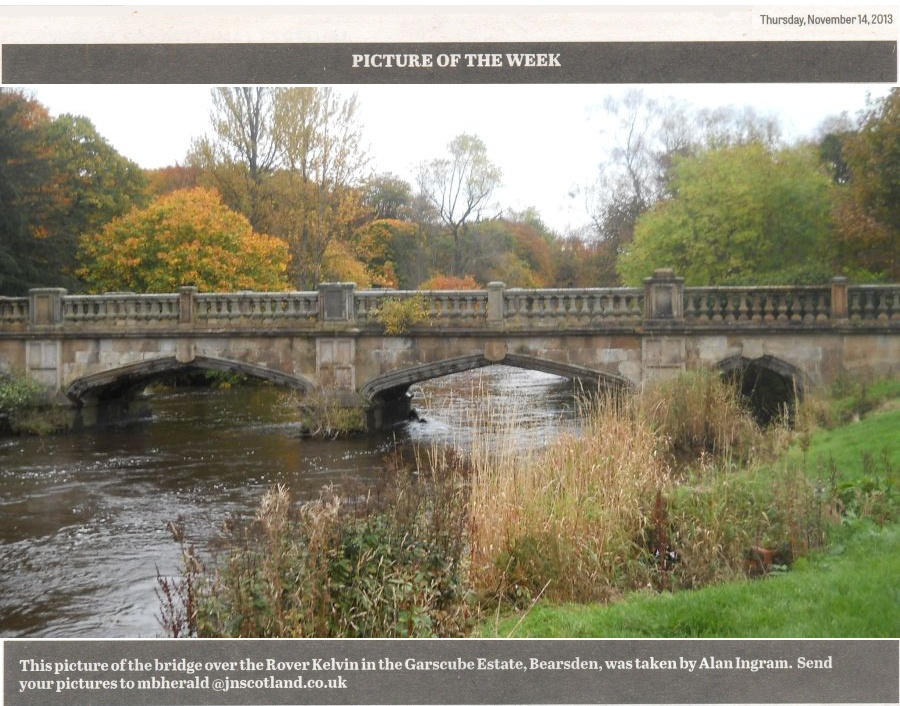
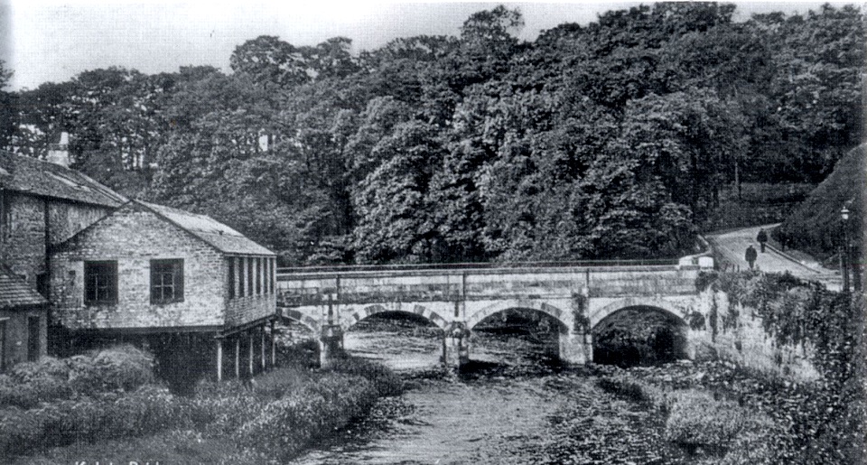
Bridge over Kelvin River in Garscube Estate

Bridge over Kelvin River in Garscube Estate

This is an estate bridge
connecting the site of the former Garscube House
 ( now demolished ) with Maryhill Road.

 The bridge has four flat Tudor-arched spans,
 and a level carriageway.

Note the elaboration of the piers,
arch stones and parapet.

 The square-section balusters are typical
 of the late 16th and 17th centuries.

 The architectural treatment of this bridge
reflects the popularity of the Tudor and Jacobean styles
 for the design of country houses
 and associated buildings
until the Scottish Baronial came into vogue
 in the late1840s.


Bridge over Kelvin River in Garscube Estate

Bridge over Kelvin River

 in Garscube Estate


Bridge over Kelvin River in Garscube Estate

Bridge over Kelvin River

in Garscube Estate


Bridge over Kelvin River on Maryhill Road at Killermont from Garscube Estate

Bridge over Kelvin River

on Maryhill Road at Killermont

from Garscube Estate


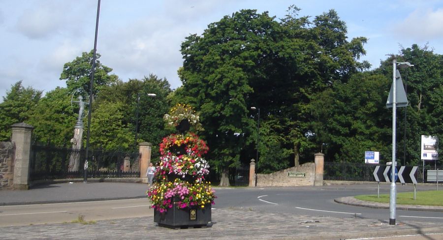
Entrance to Garscube Estate from Maryhill Road

Entrance to Garscube Estate

 from Maryhill Road at Killermont


Monument at Venture Building in Kelvin Campus Science Park in Garscube Estate

Monument at Venture Building

in Kelvin Campus Science Park

 in Garscube Estate


Reception Building for Science Park in Garscube Estate

Reception Building

for Science Park in Garscube Estate


Signpost in Garscube Estate

Signpost at Garscube Estate


Signpost at entrance to Dawsholm Park

Signpost at entrance

 to Dawsholm Park


Bridge over Kelvin River at entrance to Dawsholm Park from Kelvin Walkway

Bridge over Kelvin River

at entrance to Dawsholm Park

from Kelvin Walkway


Kelvin River in Dawsholm Park

Kelvin River in Dawsholm Park


Bridge over Kelvin River in Garscube Estate

Bridge over Kelvin River

at entrance to Dawsholm Park

from Kelvin Walkway


Dawsholm Mill on River Kelvin

Former Dawsholm Mill

on River Kelvin


Pond in Dawsholm Park


Gate House at entrance to Garscube Estate from Switchback Road

Gate House

 at entrance to Garscube Estate

 from Switchback Road


Wolfson Cancer Research Centre Building in Garscube Estate

Wolfson Cancer Research Centre

 in Garscube Estate


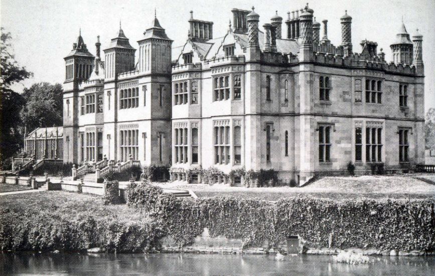
Former Garscube House

Photograph of the former Garscube House
 around 1870

Built in 1827
it was demolished in 1954

Garscube Estate was acquired
by the Colquhouns of Luss in 1558.

The western part of the estate
was in the county of Dunbartonshire
and the eastern part within the City of Glasgow,
 the boundary being the River Kelvin.  

Glasgow Buildings


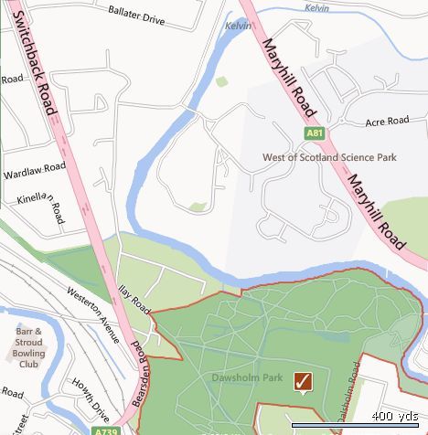
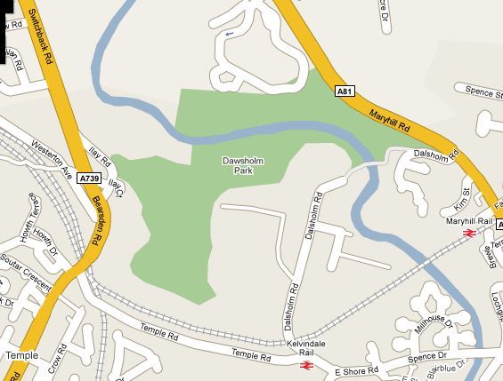
Map of Garscube Estate and Dawsholm Park

Map of Garscube Estate

and Dawsholm Park


Map of Dawsholm Park


GARSCUBE ESTATE  CIRCULAR WALK DESCRIPTION:


This walk is a circular walk of about five miles which should take no more than three hours on the outskirts of Glasgow.
It follows the canal and River Kelvin to and from the impressive Maryhill Aqueduct. Start at the turn off for Acre Road Roundabout in Maryhill Road and enter the West of Scotland Science Park. Then turn right to the Garscube Sports Complex Car Park.
From the car park turn left and go past the rugby pitch. The walk crosses the attractive stone footbridge over the River Kelvin and turns left onto the driveway to pass by the School of Veterinary Medicine. lt then exits the Estate through the gates onto the junction of llay Avenue and Bearsden Road and continues downhill to the traffic lights, crosses the main road into the bottom half of llayAvenue and enters Old Farm Road to cross under the railway lines. At the Forth and Clyde Canal the walk crosses the canal at the footbridge on the left and turns left onto the canal
towpath. It passes the busy Lock 27 bar/restaurant and takes the underpass at Kelvindale before reaching the Maryhill Aqueduct, This is one of the finest aqueducts ever built, with view over the stone bridge of the River Kelvin immediately below and the high flats of Maryhill in the distance. At the end of the bridge and before the Maryhill Locks, the walk turns right off the canal and descends a winding path to turn right and join the Kelvin Cycle Way. It passes under the massive stonebridge carrying the canal and after passing under several other substantial
bridges and open grassland the walk leaves the riverside opposite a footbridge and climbs uphill through a gate onto Dalsholm Road.
Turn left and continue ahead to cross Maryhill Road at the traffic lights and follow the Kelvin Way and enter Maryhill Park. The walk turns right at the first path junction and after climbing a set of steps passes the unused bowling greens and tennis courts.
Further on to the right however, the walk passes round the popular children's play area and with the adjacent open grass fields provides a very pleasant part of the park. Exit the park at Caldercuilt Road, and turn left.
The walk can be shortened by turning left again at the side of the park onto the footpath to Acre Road. The longer walk takes a pleasant loop round beside the Kelvin by continuing ahead on the Kelvin Way to pass by the Disabled Riding Centre and John Paul Academy. It goes through a kissing gate and at the end of the path turns left onto the Kelvin riverside path. At the tall gate into the Riding Centre, the walk takes the narrow path on the
right between trees, shrubbery and an open field to rejoin and turn right onto the shortened walk footpath to Acre Road.
At Maryhill Road, cross over the roundabout to re-enter the West of Scotland Science Park at the Kelvin Campus and return to the Sports Complex car park.


Allander - Kelvin Walkway Gallery Photo Gallery :: Bearsden Gallery Photo Gallery :: Garscube Gallery Thumbnail Gallery

<< Back : Bearsden Walks Index : Next >>


Glasgow Index :: Scotland Index :: Scottish Peaks

Glencoe | Ben Nevis | Knoydart | Isle of Skye | Isle of Arran | The West Highland Way

The Eastern Highlands | The Central Highlands | The Southern Highlands | The NW Highlands


Adventure Travel : Worldwide Mountaineering : Site Index

fb icon  google+ icon Linkedin icon  twitter


Guide Books & Maps - Scotland:-


Western Scotland & the Western Isles OS Road Map Northern Scotland OS Road MapSouthern Scotland OS Road MapGlasgow Popular Hills - Map UK Trails


Old Bearsden Glasgow - A Portrait  Glasgow from the Air  Glasgow - No Mean City  Lost Glasgow  Glasgow - The Real Gorbals Story  

Glasgow Visitor Guide - Colin Baxter Itchy Insider's Guide to Glasgow Glasgow Footprint Pocket Guide Glasgow Insight Pocket Guide Glasgow Guide Pub Companion Glasgow Scotland's Highlands & Islands - Rough Guide Scotland - Rough Guide

Glasgow Insight Pocket GuideCollins Street Map of GlasgowGlasgow: Then & NowThey belonged to Glasgow Phillips Street Atlas of Glasgow & West Central Scotland Glasgow: The Photographic Atlas100 Hillwalks around Glasgow 50 Walks in Glasgow & SW Scotland

Visit Scotland - Touring Guide Scotland: Where to Stay - Hotels & Guest Houses Scotland: Where to Stay - Bed & Breakfast Rough Guide ScotlandScottish Highlands & Islands - Rough Guide Scotland - Lonely PlanetScotland's Highlands & Islands - Lonley Planet Great Glasgow StoriesGlasgow & Surroundings - Insight Guide

West Highland Way: Official GuideWest Highland Way: Rucksac ReadersWest Highland Way: TrailblazerThe West Highland WayWest Highland Way: Footprint MapWest Highland Way - Map West Highland Way - Map West Highland Way Wet Highland Way - Official Guide

Munro Almanac The High Mountains of Britain and Ireland The Munros: Scottish Mountaineering Club The Isle of Skye The Isle of Arran Wilderness Walks Ski Mountaineering in Scotland

More Wilderness Walks 50 Best Routes on Skye and Raasay Skye - W.A.PoucherMagic of the Munros Mountaineering in Scotland and Undiscovered Scotland by W.H.MurrayA Long Walk on the Isle of Skye

Classic Climbs - Central & Southern Highlands The Isle of Arran Lonely Planet, Walking in ScotlandPathfinder Guide: Skye and NW Highlands WalksPathfinder Guide: Fort William and Glen Coe Walks Rambler's Guide: Ben Nevis and Glen Coe50 Best Routes on Skye and Raasay - Chris Townsend


Google Analytics


Google Analytics

extremetracking
 eXTReMe Tracker


extremetracking
Sitelock caingram.com
SiteLock
Sitelock
Sitelock caingram.info
SiteLock
Sitelock