The Antonine Wall Antonine Wall - Map

Antonine Wall


 Croy Hill to Tollpark
Edge of Empire - Scotland's Roman Frontier Lonely Planet, Walking in Scotland

Photographs of the route of the Antonine Wall

from Croy Hill to Tollpark at Cumbernauld


Campsie Fells / Kilsyth Hills from Croy

Campsie Fells / Kilsyth Hills

from Croy


Kilsyth and Auchinstarry Basin on Forth & Clyde Canal from Croy Hill

Kilsyth and Auchinstarry Basin

on Forth & Clyde Canal

from Croy Hill


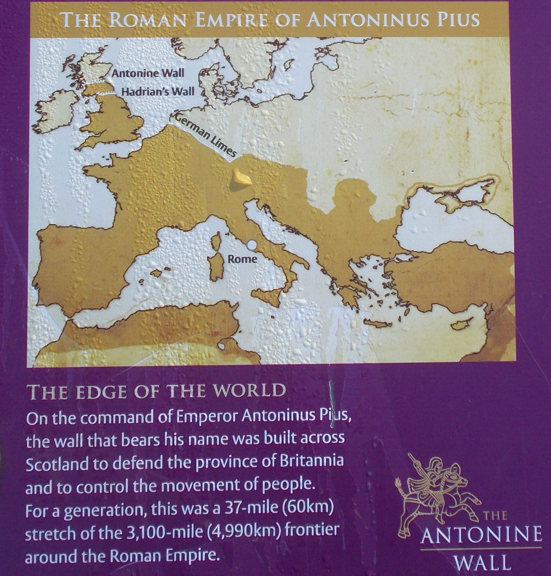
Antonine Wall information board on Croy Hill

Antonine Wall information board

on Croy Hill


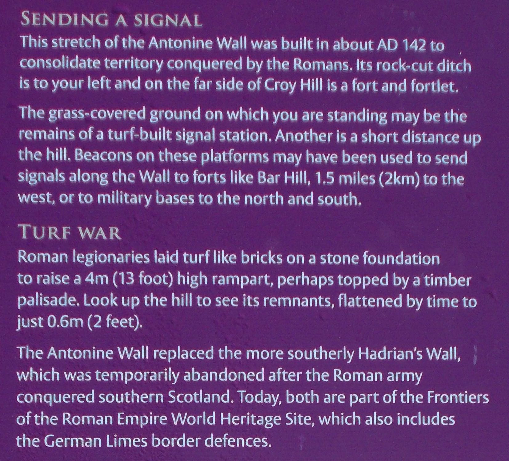
Antonine Wall information board on Croy Hill

Antonine Wall information board

on Croy Hill


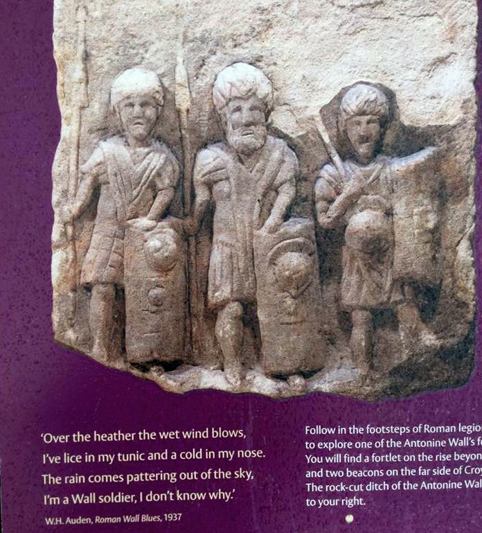
Antonine Wall information board on Croy Hill

Antonine Wall information board

on Croy Hill


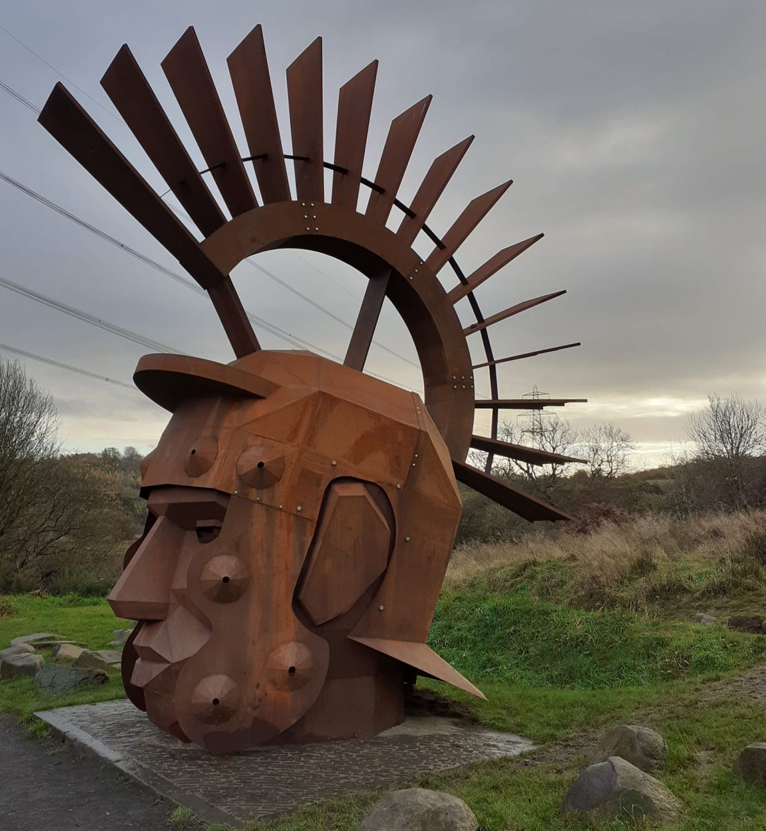
Silvanus on Antonine Wall at Croy Hill

The seven-metre Roman head sculpture,
named Silvanus  - Roman god of the woods,
at the Nethercroy site
 of the Antonine Wall near Kilsyth


Silvanus on Antonine Wall at Croy Hill

Silvanus  - Roman god of the woods


Silvanus on Antonine Wall at Croy Hill

Silvanus  - Roman god of the woods


Campsie Fells / Kilsyth Hills from Croy Hill

Campsie Fells / Kilsyth Hills

from Croy Hill


Campsie Fells / Kilsyth Hills

Campsie Fells / Kilsyth Hills


Route of the Antonine Wall over Croy Hill

Route of the Antonine Wall

over Croy Hill


Forth & Clyde Canal from Auchinstarry to Castlecary

Forth & Clyde Canal

from Auchinstarry to Castlecary


Kilsyth Hills and Forth & Clyde Canal from route of the Antonine Wall

Kilsyth Hills and Forth & Clyde Canal

from route of the Antonine Wall 


Ditch and ramparts of the Antonine Wall

Dullatar Ditch and ramparts

of the Antonine Wall


Kilsyth Hills and Forth & Clyde Canal from route of the Antonine Wall

Kilsyth Hills and Forth & Clyde Canal

from site of Westerwood Fort

on the Antonine Wall


Ochil Hills from route of the Antonine Wall

Ochil Hills

from route of the Antonine Wall


Avenue of trees along route of the Antonine Wall at Tollpark

Avenue of trees along route

of the Antonine Wall

at Tollpark


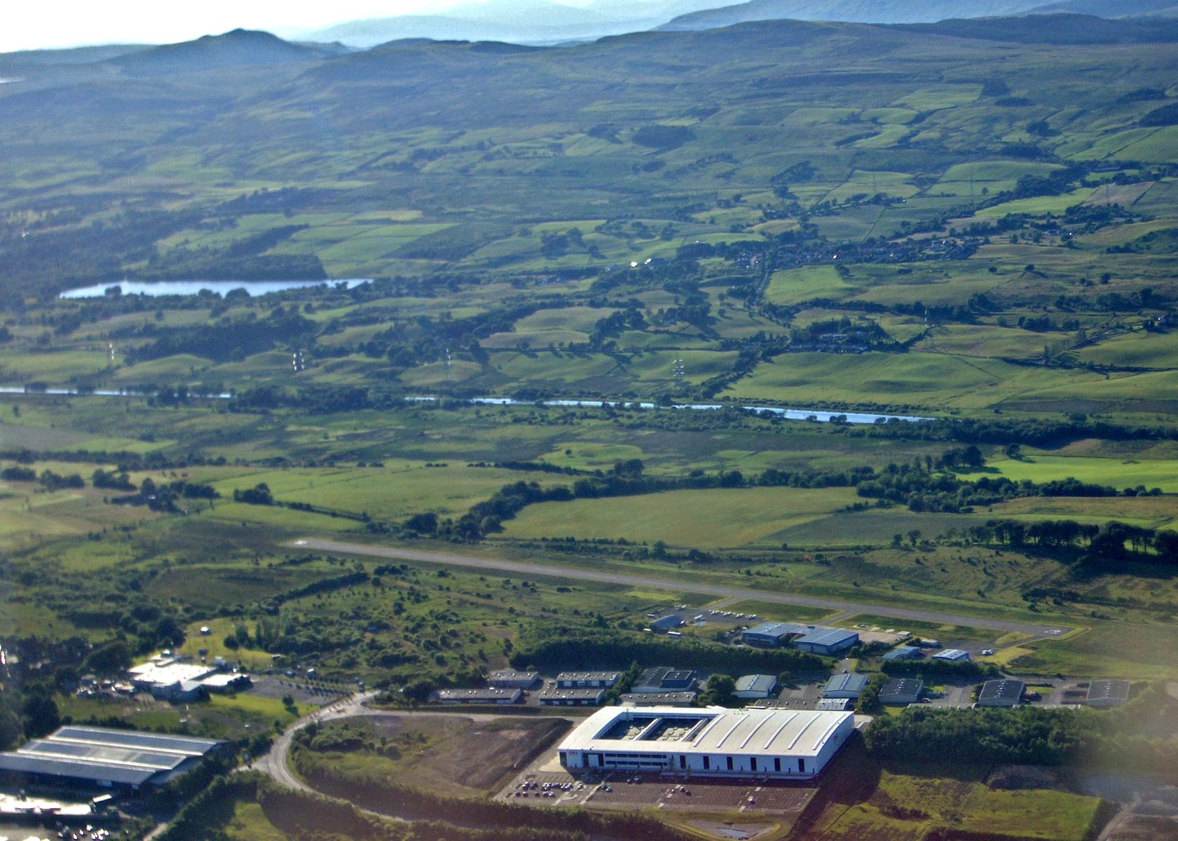
Cumbernauld Airport from route of the Antonine Wall at Tollpark

Airport at Cumbernauld 

from route of the Antonine Wall

at Tollpark


Aerial view of airport at Cumbernauld, Forth & Clyde Canal and route of the Antonine Wall

Aerial view of airport at Cumbernauld,

Forth & Clyde Canal

and route of the Antonine Wall


Avenue of trees along route of the Antonine Wall at Tollpark

Avenue of trees

along route of the Antonine Wall

at Tollpark


Antonine Wall information board at Tollpark

Antonine Wall information board

at Tollpark

at Cumbernauld


Antonine Wall information board at Tollpark

Antonine Wall information board

at Tollpark

at Cumbernauld


Gorse in bloom at Tollpark

Gorse in bloom

at Tollpark

at Cumbernauld


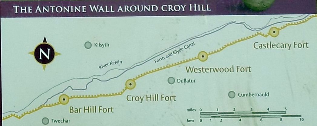
Map of Antonine Wall around Croy Hill

Map of the Antonine Wall

around Croy Hill


Map of Antonine Wall from Croy Hill to Tollpark at Cumbernauld

Map of the Antonine Wall

from Croy Hill to Tollpark

at Cumbernauld


Map of Antonine Wall from Croy Hill to Tollpark at Cumbernauld

Map of the Antonine Wall

from Croy Hill to Tollpark

at Cumbernauld


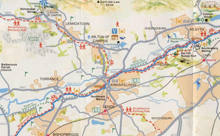
Location Map of Roman Fort on Barr Hill at Kilsyth

Location Map of Roman Fort

 on Barr Hill
 at Kilsyth


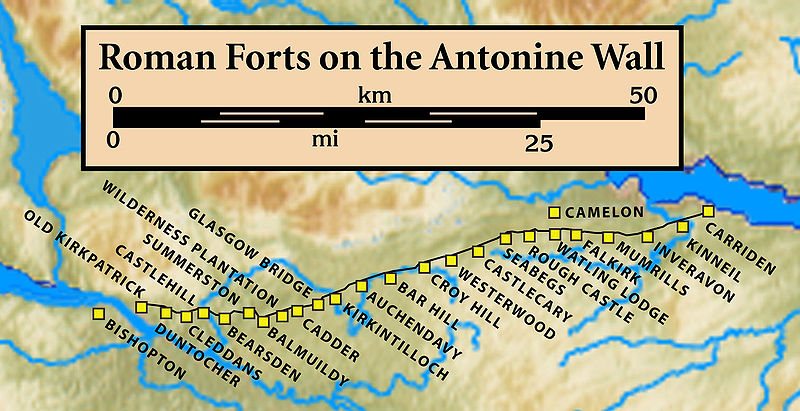
Map of Roman Forts on the Antonine Wall

Map of Roman Forts

on the Antonine Wall


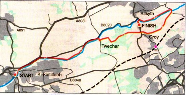
Route Map - Kirkintilloch to Kilsyth

Route Map

- Kirkintilloch to  Kilsyth


ANTONINE WALL - KIRKINTILLOCH to KILSYTH - ROUTE DESCRIPTION:


Location: Central Belt
Map: OS Landranger 64
Distance: 8 miles ( 13km )
Time: 4-5 hours
Terrain: Canal towpath and hill paths

Give your legs a much-needed stretch on this straightforward walk, which uses a section of the John Muir Way ( ]MW ) and combines canal paths with a section of the Romans’ more northerly coast-to-coast barricade ( the other being of course Hadrian’s Wall ). The Antonine Wall was an earth barrier so less of it remains; consequently it's less dramatic than its more illustrious counterpart but it is still worth seeking out. The start and finish points are eight miles apart so to avoid being stranded due to seasonal disruption to bus timetables it's probably best that you arrange for someone to collect you from the end of the walk, at Auchinstarry Marina.
From Kirkintilloch you head east along the towpath of the Forth and Clyde Canal for 5km to Twechar.
This is very easy walking and has a surprisingly rural feel given the generally urban nature of the surrounding areas. The canal is lined with trees and bushes and holds a fair amount of waterbirds including some graceful swans.
The canal, which was largely built by the itinerant labourers called navies, is left at Twechar, over an old swing bridge, and the route heads uphill before turning off to reach Bar Hill, one of the best sections of the Antonine Wall. The wall was built between 142 and 154AD on the orders of the Emperor Antoninus Pius and is about 63km long, with 16 forts. The wall was abandoned only eight years after being finished. The elevated nature of the wall, which generally aimed to keep to the higher ground, provides good views of the Campsie Fells to the north and the sprawl of
Glasgow to the south-west. The route drops from Bar Hill on a track to cross the B802 then swerves around a bit ~ keep a careful eye on the waymarks here, particularly at a point where you go straight ahead on a track and not the more obvious right turn — and then goes through a gate to climb on to Croy Hill. There was a Roman fort here and you pass beneath part of the high banks of the fortification.
The final stretch of the walk is back along the canal path — not part of the JMW — to the marina at Auchinstarry where there is also a sensory garden trail, a welcoming bar and restaurant called the Boathouse and just across the road the well-known climbing crags in the old quarry. Alternatively, call your personal taxi and head home so you can crack on with replacing all those calories you've just burned.

Route:
Start at Kirkinlilloch ( GR: NS656739 ).
Follow the canal towpath east for 5km.
Cross the bridge at Twechar and walk uphill.
In 400m go L on a track, still uphill.
After the track curves R go L on path and follow John Muir Way signs over Bar Hlll.
Leave the woods and follow a track down to the road.
Cross and follow signs to pick up a track then a narrower path leading on to Croy Hill.
Follow clear grass path over the hill, dip L and walk through a small valley.
Continue with grass path.
Under power lines go L on a track.
Follow JMW signs down to the canal.
Cross and TL on the towpath back to Auchinstarry.
Cross the bridge for the marina ( GR: NS722767 ).
Return by bus via Kilsylh, or arrange to be collected.


  Croy - Tollpark Gallery Thumbnail Gallery :: Antonine Wall Gallery Thumbnail Gallery :: Forth & Clyde Canal Gallery Photo Gallery

<< BackAntonine Wall Index : Next >>


References:


Scotland Index :: Scotland Walks

Glencoe | Ben Nevis | Knoydart | Isle of Skye | Isle of Arran | The West Highland Way

The Eastern Highlands | The Central Highlands | The Southern Highlands | The NW Highlands


Adventure Travel : Worldwide Mountaineering : Site Index

fb icon  google+ icon Linkedin icon  twitter


Guide Books & Maps - Scotland:-


Western Scotland & the Western Isles OS Road Map Northern Scotland OS Road MapSouthern Scotland OS Road MapGlasgow Popular Hills - Map


Edge of Empire - Scotland's Roman Frontier  The Antonine Wall  Antonine Wall - Map

Glasgow Visitor Guide - Colin Baxter Itchy Insider's Guide to Glasgow Glasgow Footprint Pocket Guide Glasgow Insight Pocket Guide Glasgow Guide Pub Companion Glasgow Scotland's Highlands & Islands - Rough Guide Scotland - Rough Guide

Glasgow Insight Pocket GuideCollins Street Map of GlasgowGlasgow: Then & NowThey belonged to Glasgow Phillips Street Atlas of Glasgow & West Central Scotland Glasgow: The Photographic Atlas100 Hillwalks around Glasgow 50 Walks in Glasgow & SW Scotland

Visit Scotland - Touring Guide Scotland: Where to Stay - Hotels & Guest Houses Scotland: Where to Stay - Bed & Breakfast Rough Guide ScotlandScottish Highlands & Islands - Rough Guide Scotland - Lonely PlanetScotland's Highlands & Islands - Lonley Planet Great Glasgow StoriesGlasgow & Surroundings - Insight Guide

West Highland Way: Official GuideWest Highland Way: Rucksac ReadersWest Highland Way: TrailblazerThe West Highland WayWest Highland Way: Footprint MapWest Highland Way - Map West Highland Way - Map West Highland Way Wet Highland Way - Official Guide

Munro Almanac The High Mountains of Britain and Ireland The Munros: Scottish Mountaineering Club The Isle of Skye The Isle of Arran Wilderness Walks Ski Mountaineering in Scotland

More Wilderness Walks 50 Best Routes on Skye and Raasay Skye - W.A.PoucherMagic of the Munros Mountaineering in Scotland and Undiscovered Scotland by W.H.MurrayA Long Walk on the Isle of Skye

Classic Climbs - Central & Southern Highlands The Isle of Arran Lonely Planet, Walking in ScotlandPathfinder Guide: Skye and NW Highlands WalksPathfinder Guide: Fort William and Glen Coe Walks Rambler's Guide: Ben Nevis and Glen Coe50 Best Routes on Skye and Raasay - Chris Townsend


extremetracking
 eXTReMe Tracker


extremetracking
Sitelock caingram.com
SiteLock
Sitelock
Sitelock caingram.info
SiteLock
Sitelock