West Highland Way: Trailblazer Ochils and Campsie Fells

 The Trossachs

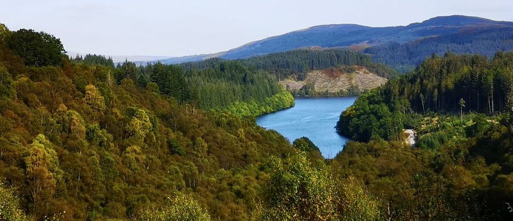
 Loch Drunkie
West Highland Way - Map West Highland Way: Footprint Map
 

Photographs of a three lochs ( Reoidhte, Drunkie, Achray )

 and forest walk

at Aberfoyle

in the Trossachs Region of Scotland

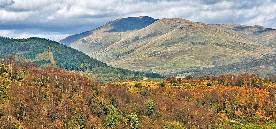
Ben Ledi

Ben Ledi

from viewpoint at start of walk


Loch Reoidhte

Loch Reoidhte


Loch Reoidhte

Loch Reoidhte


Loch Drunkie

Loch Drunkie

( gaelic Loch Drongaidh )


Ben Lomond from Loch Ard Forest

Ben Ledi from Loch Drunkie


Loch Drunkie from Pine Ridge trail

Loch Drunkie

 from Pine Ridge trail


Trail through pine forest

Trail through pine forest


Head of Loch Drunkie

Head of Loch Drunkie


Dam at head of Loch Drunkie

Dam at head of Loch Drunkie


Return trail alongside Loch Drunkie

Return trail alongside Loch Drunkie


Loch Drunkie

Loch Drunkie


Loch Drunkie

Loch Drunkie


Loch Drunkie

Loch Drunkie


Loch Drunkie

Loch Drunkie

 ( gaelic Loch Drongaidh )


Loch Drunkie

Loch Drunkie


Ben Venue from Loch Achray trail

Ben Venue

from Loch Achray trail


Ben Aan from Loch Achray

Ben Aan

from Loch Achray


Stream from Loch Achray trail

Stream from Loch Achray trail


Ben Aan from Duke's Pass Road

Ben Aan

from
Duke's Pass Road


Ben Venue above Duke's Pass in the Trossachs

Ben Venue

above
Duke's Pass Road

 in the Trossachs


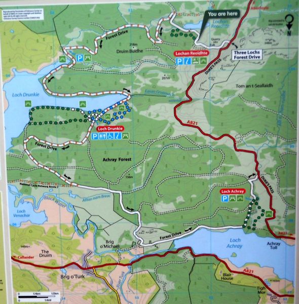
Map of Three Loch Forest Drive

Map of Three Loch Forest Drive

( Note:- Click here or on above for large format copy )


Map of Route to Loch Drunkie from Brig O'Turk

Map of Route to Loch Drunkie

 from Brig O'Turk


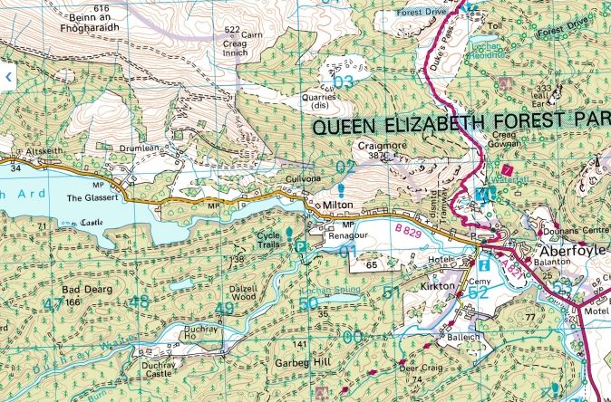
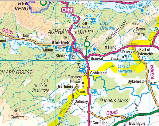
Map of Aberfoyle and surroundings

Map of Aberfoyle and surroundings


Map of Aberfoyle and the Menteith Hills

Map of Aberfoyle

and the Menteith Hills


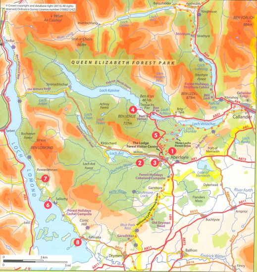
Map of Loch Lomond and Trossachs area

Map of Loch Lomond and Trossachs area

( Note:- Click here or on above for large format copy )


Loch Drunkie Walk - Route Description:

This circular walk is about 2.5 miles in distance and along Loch Drunkie. There is a moderate climb to the loch.
Loch Drunkie lies on the A821 from Aberfoyle to Loch Achray and Loch Vennacher, it's known as the Duke's Pass road and is much favoured by touring buses taking tourists through the Trossachs.
Once you cross the crest of the pass look out for a sign to the Three Lochs Drive on your right.
This is a Forestry Commission single car width track that meanders for eight miles through the Commissions plantations and alongside Lochan Reoidhte which is near the beginning of the walk alongside Loch Drunkie. This is a circular drive along the south shore of Loch Achray.
There is a small carpark at the south end of Loch Drunkie but don't park here except for the view. Continue to the much larger car park which has picnic tables and permanent toilets. Here we began two short walks each of about one and a quarter miles.
Starting with the easier one first. It is marked by green banded posts. lt starts just beyond the toilet block and goes along the western shore of Loch Drunkie. Incidentally, the loch was not named after a local drunkard but is a corruption of the Gaelic Loch Drongaidh which means the loch between the ridges. Afler a quarter of a mile a wooden open sided and roofed building spans the path. From the ceiling about 8 ropes descend. Give them a good tug and you'll discover that they are attached to bells - an open-air belfry.
This is just one of seven constructions in wood that the Forestry Commission has installed along the path. One is a boat balanced on its stern facing the Loch with a seat inside where you can shelter from the elements. Bless the Forestry Commission for not only providing well-surfaced paths but also installing delightful surprises along the way. In a further quarter of a mile the path turns to the left uphill. A green-banded waymark post indicates it - don’t continue along the lochside. The broad waymarked track leads over a small hill and down to the car park.
If you wish to walk further, cross the main vehicle track and pick up a path marked by blue-banded posts right opposite the can-park.
This path zig-mags up the steep slope but it is no too strenuous a climb. At the top you can stand on a rock and from there obtain a fine view along Loch Drunkie. When you start to descend you have the choice of taking a straighter but steeper option on the left, or of going straight ahead and following a path that is longer but less steep to reach the main drive.
At the end of the walk you can eat your picnic at one of the several tables beside the car park from where you can look over the Loch.


        Loch Drunkie Gallery Photo Gallery :: Loch Ard Gallery Photo Gallery :: Aberfoyle & Menteith Hills Gallery Photo Gallery

<< Back : Bearsden Walks Index : Next >>


Scotland Index :: Scottish Peaks :: Scotland Walks

Glencoe | Ben Nevis | Knoydart | Isle of Skye | Isle of Arran

The Eastern Highlands | The Central Highlands | The Southern Highlands | The NW Highlands


Adventure Travel : Worldwide Mountaineering : Site Index

fb icon  google+ icon Linkedin icon  twitter


Guide Books & Maps - Scotland:-


West Highland Way: Footprint MapWest Highland Way - Map West Highland Way - Map Western Scotland & the Western Isles OS Road Map Northern Scotland OS Road MapSouthern Scotland OS Road MapGlasgow Popular Hills - Map


Ochils and Campsie Fells

Glasgow Visitor Guide - Colin Baxter Itchy Insider's Guide to Glasgow Glasgow Footprint Pocket Guide Glasgow Insight Pocket Guide Glasgow Guide Pub Companion Glasgow Scotland's Highlands & Islands - Rough Guide Scotland - Rough Guide

Glasgow Insight Pocket GuideCollins Street Map of GlasgowGlasgow: Then & NowThey belonged to Glasgow Phillips Street Atlas of Glasgow & West Central Scotland Glasgow: The Photographic Atlas100 Hillwalks around Glasgow 50 Walks in Glasgow & SW Scotland

Visit Scotland - Touring Guide Scotland: Where to Stay - Hotels & Guest Houses Scotland: Where to Stay - Bed & Breakfast Rough Guide ScotlandScottish Highlands & Islands - Rough Guide Scotland - Lonely PlanetScotland's Highlands & Islands - Lonley Planet Great Glasgow StoriesGlasgow & Surroundings - Insight Guide

West Highland Way: Official GuideWest Highland Way: Rucksac ReadersWest Highland Way: TrailblazerThe West Highland WayWest Highland Way: Footprint MapWest Highland Way - Map West Highland Way - Map West Highland Way Wet Highland Way - Official Guide

Munro Almanac The High Mountains of Britain and Ireland The Munros: Scottish Mountaineering Club The Isle of Skye The Isle of Arran Wilderness Walks Ski Mountaineering in Scotland

More Wilderness Walks 50 Best Routes on Skye and Raasay Skye - W.A.PoucherMagic of the Munros Mountaineering in Scotland and Undiscovered Scotland by W.H.MurrayA Long Walk on the Isle of Skye

Classic Climbs - Central & Southern Highlands The Isle of Arran Lonely Planet, Walking in ScotlandPathfinder Guide: Skye and NW Highlands WalksPathfinder Guide: Fort William and Glen Coe Walks Rambler's Guide: Ben Nevis and Glen Coe50 Best Routes on Skye and Raasay - Chris Townsend


Google Analytics


Google Analytics

extremetracking
 eXTReMe Tracker


extremetracking
Sitelock caingram.com
SiteLock
Sitelock
Sitelock caingram.info
SiteLock
Sitelock