
 |
WalkingScotlandCoast to CoastJOHN MUIR WAY
|
  |
This famed coast-to-coast walking and cycling path spans central Scotland,
linking Helensburgh on the Firth of Clyde with John Muir’s birthplace of Dunbar on the Firth of Forth.
One of Scotland’s Great Trails, the route encapsulates the deep love that Muir, the writer, explorer and a
conservationist who founded the US National Park system, had for the great outdoors.
Tackle it in one 134 mile ( 216 km ) odyssey - or split it up into shorter sections
as you take in beaches and coastline, castles, lochs, hills, woodlands, old railway lines, canal
towpaths, Roman forts, the Antonine Wall and nature-packed habitats.
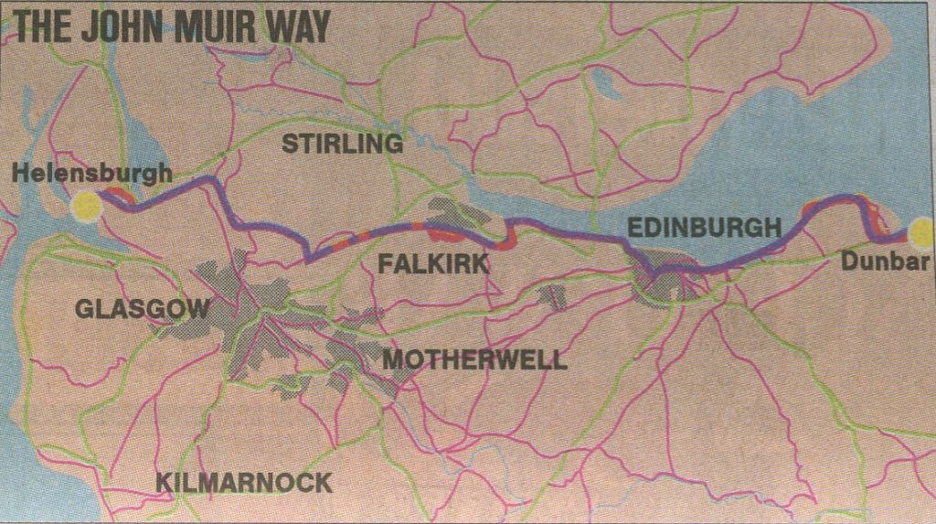 Map of John Muir Way |
THE JOHN MUIR WAY: THE ROUTE:
1. Helensburgh to Balloch:
Esplanade at Helensburgh
on the north shore
of the Firth of Clyde
at the entrance to the Gare Loch.
Helensburgh is a popular destination
for day trips from Glasgow.
- Balloch to Helensburgh - the "Three Lochs Trail " from Balloch on Loch Lomond to Craigendoran at Helensburgh on the Firth of Clyde
- Ben Bowie - Ascent of Ben Bowie from Craigendoran near Helensburgh
2. Balloch to Strathblane
Balloch Castle
in Balloch Country Park
- Ishneith Waterfall - a short distance off the route from Balloch to Burncrooks Reservoir
- Burncrooks Reservoir - there is a circular path round the reservoir
The Whangie and Auchineden Hill
across Burncrooks Reservoir
The Loch at Carbeth
3. Strathblane to Kilsyth
- Strathkelvin Railway Path from Strathblane to Lennoxtown
Highland Cow beneath Dunglass
Confluence of the Glazert Water
and the River Kelvin
from the Thomas Muir Trail
/ Strathkelvin Railway Path
at Kirkintilloch
4. Kilsyth to Falkirk
- Forth and Clyde Canal from Kilsyth to Castlecary
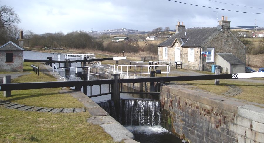
Wyndford Locks 20 at Castlecary
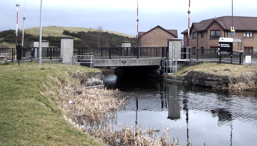
Lifting Bridge
over the Forth & Clyde Canal
at Bonnybridge
5. Falkirk to Linlithgow
- Union Canal from Falkirk to Linlithgow
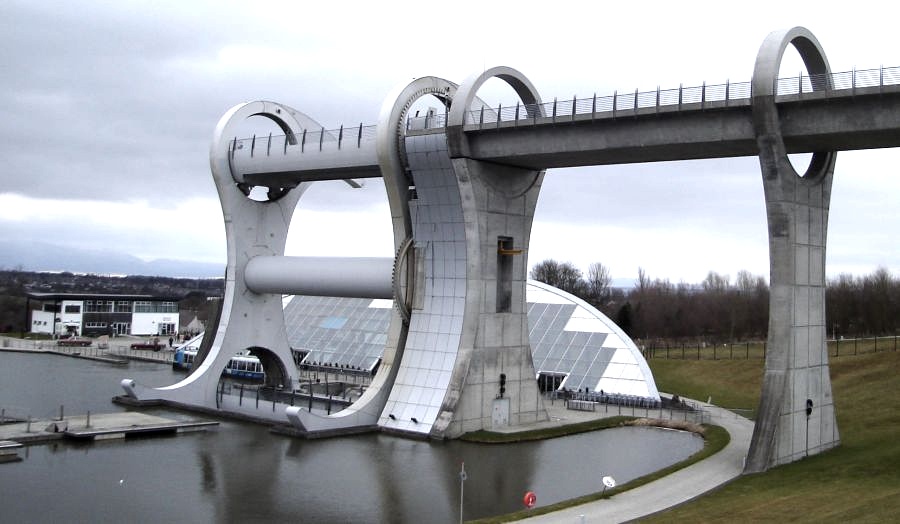
The Falkirk Wheel - rotating boat lift
connecting the Forth and Clyde Canal
and the Union Canal
6. Linlithgow to South Queensferry
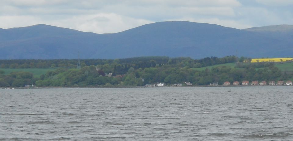
across the Firth of Forth
from Bo'ness
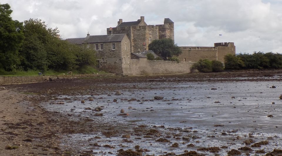
- Blackness Castle along the Firth of Forth to South Queensferry
Forth Railway Bridge at Queensferry
The Forth Railway Bridge is a cantilever type bridge
over the Firth of Forth in the east of Scotland.
It is an internationally recognised Scottish landmark.
It is located to the east of the Forth Road Bridge
and 14Km ( 9 miles ) west of central Edinburgh.
7. South Queensferry to Edinburgh
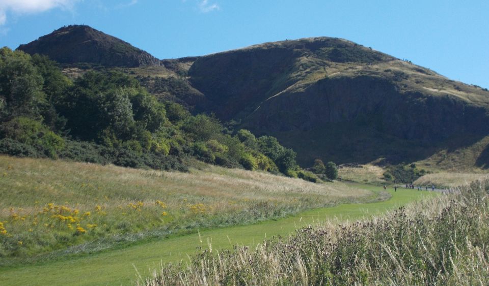
Arthur's Seat
in Holyrood Park
in Edinburgh
8. Edinburgh to Prestonpans
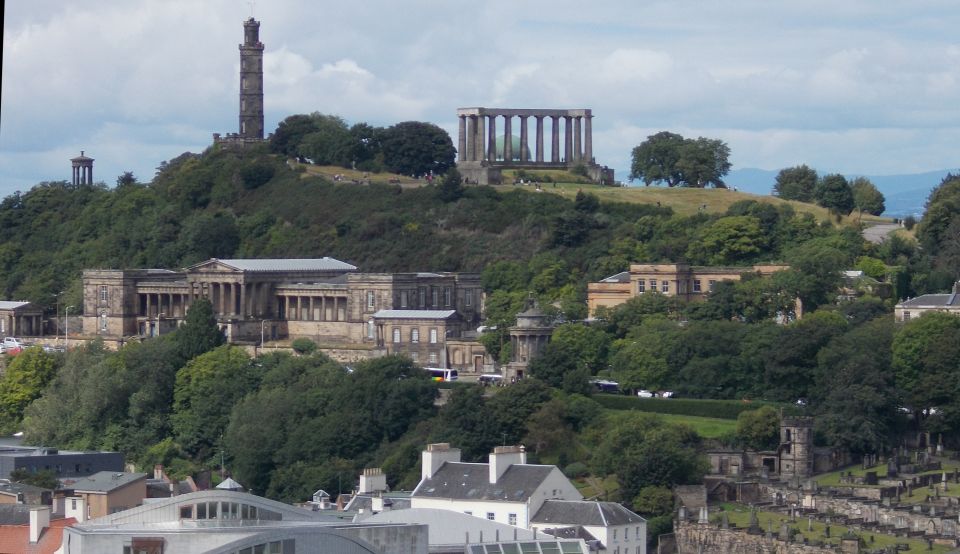
The Old Royal High School,
Nelson Monument
and the National Monument
on Calton Hill in Edinburgh
from Salisbury Crags
9. Prestonpans to North Berwick
10. North Berwick to Dunbar
THE JOHN MUIR WAY:
A picturesque coast-to-coast walking route named after Scotland’s greatest conservationist has earned its place among the country’ s top trails.
The 134 mile John Muir Way, which runs from Helensburgh, in Argyll and Bute, to Dunbar in East Lothian, has been given Great Trail Status to
join other world-famous paths that have previously been honoured with the prestigious award.
The path is the 28th long distance route to be given the accolade by Scottish Natural Heritage, alongside trails such as the West Highland Way and Southern Upland Way.
Muir is regarded as the founder of nature conservation and is also known as the “father of national parks” after spearheading the creation of Yosemite in the US as a protected parkland.
Since the Scottish route’s launch in April 2014, which marked the centenary year of the Dunbar-born conservationists death, it has fulfilled the key criteria
to earn the highly sought after status, SNH said.
The route echoes Muir’s own personal journey growing up in Dunbar before heading to the west coast, where he set sail for life in America.
The route takes in castles, historic towns and villages, and stunning coastal scenery, as well as Scotland’s first national park, Loch Lomond and The Trossachs National Park.
It has attracted both walkers and cyclists from as far afield as the US, Canada, Germany, Sweden and the Netherlands.
Keith Geddes, chairman of the Central Scotland Green Network Trust, said: “By raising awareness of Muir’s legacy we hope to inspire youngsters, and Scots
in general, to join the fight against climate change and help preserve our planet.
“There is a growing understanding in Scotland of Muir’s significance throughout the world and the award of ‘Scotland’s Great Trail’ will help to further raise awareness of
both Muir and the route.
“The John Muir Way has proved to be popular with locals going out for a short walk, for those long distance walkers who complete the route on consecutive days or
over several visits and to hundreds of visitors from abroad, particularly from Muir’s adopted homeland wanting to learn more about his life in Dunbar.”
Ian Ross, SNH chairman, said: “The coast-to-coast route is the second longest of our great trails and, spanning central Scotland, it is easily accessible for millions of
people living here.” He said he hoped it would encourage many more visitors.
THE JOHN MUIR WAY - ROUTE DESCRIPTION:
Let's be honest, John Muir would probably have hated the John Muir Way. The long-distance walking trail set up in his honour is surely
too flat for a man happiest on a hill, who once declared: “The mountains are calling and I must go”.
While Covid-19 may prevent us from hopping across the Atlantic to enjoy the national parks he set up, Muir’s legacy here is a nonetheless
spectacular trail that handily ripples across central Scotland, accessible to many even in lockdown, that more than justifies its
official recognition as one of Scotland’s Great Trails.
Curiously Muir is not even an assured household name to some in his homeland.
Americans find this baffling because across the Atlantic this seminal figure, who hails from Dunbar on the craggy East Lothian
coast, is revered as the founder and inspiration behind the US national park network.
After a childhood spent beguiled by nature, rambling around the sturdy sandstone cliffs and starched white beaches
that surround Dunbar, Muir emigrated from the pier at Helensburgh to Wisconsin in 1849 at the tender age of 10.
It is fitting, then, that the 134 mile / 2l5km trail that opened in 2014 runs between Dunbar and Helensburgh, kicking off at the museum
dedicated to him that is now in the house he was born in right in the heart of Dunbar, then culminating on the waterfront in
Helensburgh where he left Scotland, never to return.
The chances are, if you live in central Scotland, at some point you have walked on a section of the John Muir Way.
My neighbour is anecdotal evidence. He steadfastly denied ever having walked on any of the trail; a position that quickly
became untenable when I pointed out the John Muir Way marker on a lamppost outside our houses.
I still suspect he thinks I may just have planted it there in advance.
The waymarked John Muir Way is that sort of trail, a route most of us have unconsciously walked stretches of in a way
different to other long distance walks. You seldom, for example, mindlessly complete mountainous legs of the West Highland
Way by accident.
The John Muir Way connects the Clyde with the Forth, the Atlantic with the North Sea, skirting just to the north of Glasgow, scooping down
and around the southern shores of Loch Lomond, past the Falkirk Wheel and right through Edinburgh.
It is central Scotland in a walking route.
Over the years as a travel writer I’ve walked most of it and can attest to the John Muir Way deserving to be listed alongside
its more illustrious long-distance cousins as one of Scotland’s official Great Trails.
It is, for example, more varied and less of a slog than the tough Southern Upland Way and less frustrating than the Speyside Way,
where land ownership issues often have you enviously eyeing up the river from afar.
I’ve managed to walk almost all of the John Muir,Way. Not in one go - that would take around 10-12 days - but in bite-sized chunks.
And unusually for a long-distance walk, that was the idea when it was dreamt up.
As much as its founders hoped people would go “bagging” the whole length, they also wanted to connect communities and
just get people out there enjoying the great outdoors, continuing the work of Muir, who both extolled the joys of nature and the
benefits of getting closer to it.
Reinforcing this sectional nature, I’ve taken Covid as an opportunity to tick off my penultimate section.
Being a grounded travel writer, I’ve realised - like many of us - in a way I may never have otherwise, the wealth of what I have around me.
Setting off on just two feet from my front door I swept from the Hopetoun Estate, where West Lothian becomes Edinburgh,
right into the heart of the city, on a 15 mile stretch. I was meant to be in Gran Canaria; but, as travel corridors closed, my fitness
and sanity retaining options narrowed as they have for us all.
This chunk of the ]ohn Muir Way proved a microcosm for the whole trail, packed with epic scenery, landmarks and history
and plenty of surprsises. The John Muir Way is like a pedestrian submarine. You pop up in places you don’t expect and connect
other places you didn’t realise were so close.
Yes, I’m well acquainted with the Forth Bridges and the charms of the Union Canal, but I must have driven past Davidson's Mains Park
a thousand times on the A90 and never realised it was there. I had never scaled the wooded heights of Corstorphine Hill
in the footsteps of David Balfour in Stevenson’s Kidnapped or realised how good a job they’ve done revamping Saughton Park.
It was in the green oasis of Saughton Park that I met Chris Davidson who runs the bright and breezy Garden Bistro.
It could scarcely be more symbolic of Covid-19. Opened in the chaos of last year, the teamhave switched between helping
relieved customers wine and dine post-lockdown I, before reining things in to outdoor dining only as restrictions grew,
then as during my Lockdown II visit on to takeaway-only. I tucked into a delicious steak beef burger as Davidson enthused
about the john Muir Way: “It’s a great way for people to enjoy a wander through the city, to explore corners they might
otherwise not find. We get loads of people who stumble upon us, people who without Covid might not even bother walking in their own city.
This is a trend that Scott Goddard, owner of South Queensferry’s Little Parlour, echoes. “Before Covid our customers were
most often people coming out to take a few photos of the Forth bridges and enjoy an ice cream,” he says. “Now they come in all
shapes and sizes, often walking east or west on the ]ohn Muir Way, which actually runs right by us on the High Street."
When regulations finally lift and you can venture further afield - or if you are lucky to live there - my favourite stretch
of the way is between Helensburgh and Strathblane. You soon head north away from the Clyde with views of Glasgow’s
lifeblood river opening up behind you, before you tackle thick, life-affirming forest.
Gouk Hill at 277m rewards your efforts with views back towards the Firth of Clyde and onwards to Loch Lomond.
One of the joys of long distance walking in more normal times is tucking into a hearty meal and savouring a glass of wine
at the end of the day. This brings me to the ultimate post-walk treat.
Cameron House sits close to the way and when it reopens this year again becomes handy for hiking in serious style.
One of the advantages of the John Muir Way travelling through less remote areas is that it overflows with hotels, hostels, B&Bs and restaurants.
There is even a bag service if you want to have your luggage shipped to the next overnight stop.
The second part of my favourite stretch of the John Muir Way sweeps from the shores of Loch Lomond across some properly
wild country to Strathblane at the foot of the Campsie Fells. Like all the sections of the way, it offers a variety of terrain,
with sections of tarmac broken up by single-track gravel paths and forest trails.
For a section you share the route with the West Highland Way. The John Muir Way interacts with other walking routes along its length like this.
The rest of 2021 is, of course, uncertain in myriad ways for us all. One of my post-lockdown goals, after the stay local rule
lifts on April 26, is to finally complete the John Muir Way by yomping the 15 miles from North Berwick to Dunbar.
There the museum at Muir’s birthplace awaits. The mountains called and the young Muir went.
I’m a huge fan of the Munros and American national parks too, but l’ve a sneaking suspicion that if Muir were locked
down in East Lothian today he would take quiet satisfaction that the route named in his honour is fulfilling his pivotal aim in
life: “I care to live only to entice people to look at Nature’s loveliness."
Robin McKelvie, Glasgow Herald, 10/4/2021
Ben Nevis | Glencoe | Knoydart | Isle of Skye | Isle of Arran | The West Highland Way
The Eastern Highlands | The Central Highlands | The Southern Highlands | The NW Highlands