Munros Tables SMC Ben Lawyers & Glen Lyon OS Map

 The Scottish Highlands


Ben Lawers
The High Mountains of Britain & Ireland Southern Highlands - Map

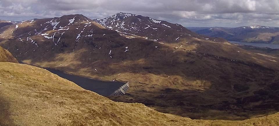
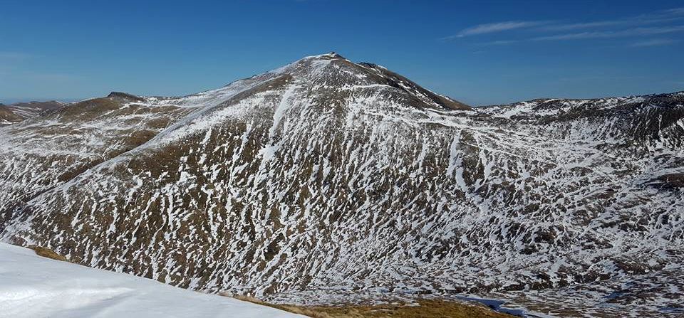
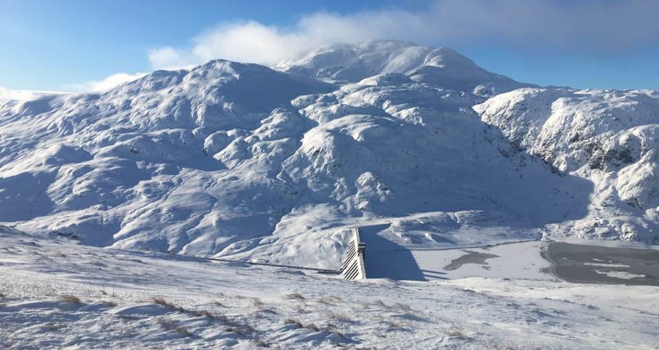
 Photographs of a springtime ascent of Ben Lawers

above Killin and Loch Tay

in the Southern Highlands of Scotland


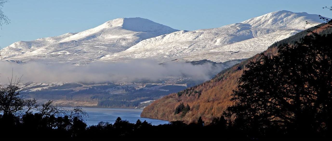
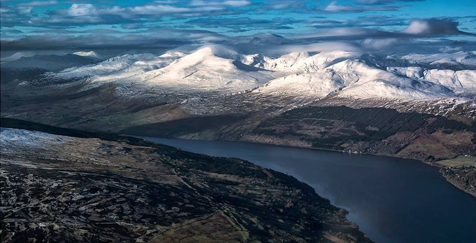
Ben Lawyers on approach to Killin

Ben Lawers ( 3983ft, 1214m ) on approach to Killin

Ben Lawers is one of the highest mountains

in the Southern Highlands of Scotland.


 It lies on the northern side of Loch Tay

and is the highest point of a long ridge

 that includes seven Munros.


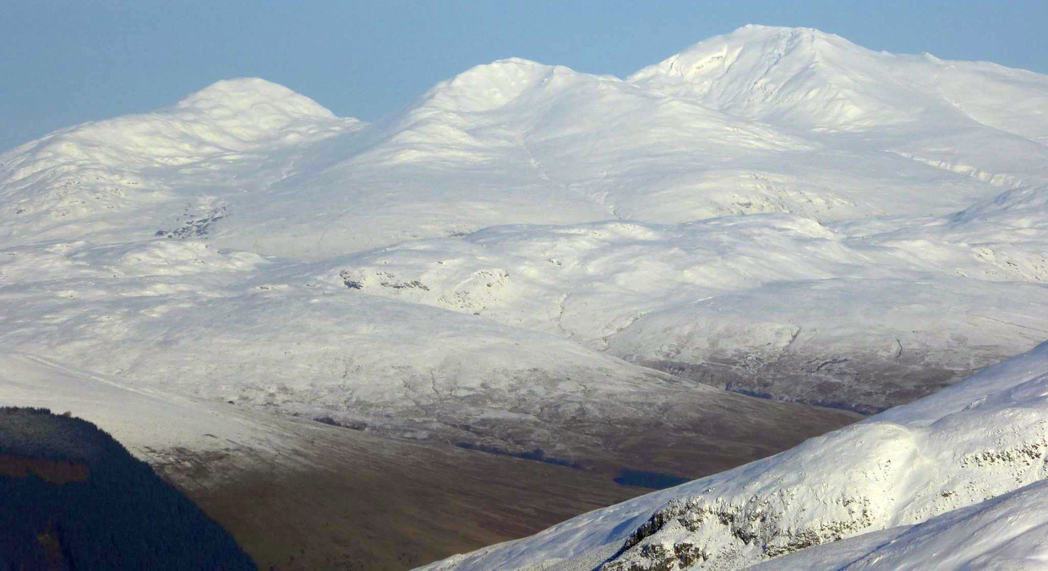
Meall na Fearna, Ben Vorlich, Stuc a'Chroin and Beinn Each above Loch Tay


Meall nan Tarmachan on ascent of Ben Lawyers

Meall nan Tarmachan

on ascent of Ben Lawers


Meall Corranach and Beinn Ghlas from Meall nan Tarmachan

Meall Corranach and Beinn Ghlas

 from Meall nan Tarmachan


Ben Lawyers

Ben Lawers


Ben Lawyers

Ben Lawers


Loch Tay on ascent of Ben Lawyers

Loch Tay

on ascent of Ben Lawers


Peaks of the Northern Highlands above Meall Corranaich from Ben Lawyers

Peaks of the Northern Highlands

beyond Meall Corranaich

from Ben Lawers

( Note: Click here or on above for large format image )


Stob Binnein and Ben More from Ben Lawyers

Stob Binnein and Ben More

from Ben Lawers


Beinn Ghlas from Ben Lawyers

Beinn Ghlas from Ben Lawers 


Ben Nevis from Ben Lawyers

Ben Nevis from Ben Lawers


Trig Point on Ben Lawyers

Trig Point on Ben Lawers


On Ben Lawyers summit

On summit of Ben Lawers


An Stuc and Meall Garbh and Lochan nan Cat from Ben Lawyers

An Stuc and Meall Garbh

 and Lochan nan Cat

 from Ben
Lawers


View down Allt a'Chabhair to Carn Gorm above Glen Lyon from Ben Lawyers

View down Allt a'Chabhair to Carn Gorm

 above Glen Lyon

from Ben Lawers


Meall nan Tarmachan from Ben Lawyers

Meall nan Tarmachan

from Ben Lawers


Meall nan Tarmachan from Ben Lawyers

Meall nan Tarmachan

from Ben Lawers


Meall nan Tarmachan above the Ben Lawyers access road

Meall nan Tarmachan

above the Ben Lawers access road


Ben Chonzie beyond Creag Uchdag above Loch Tay

Ben Chonzie beyond Creag Uchdag

above Loch Tay


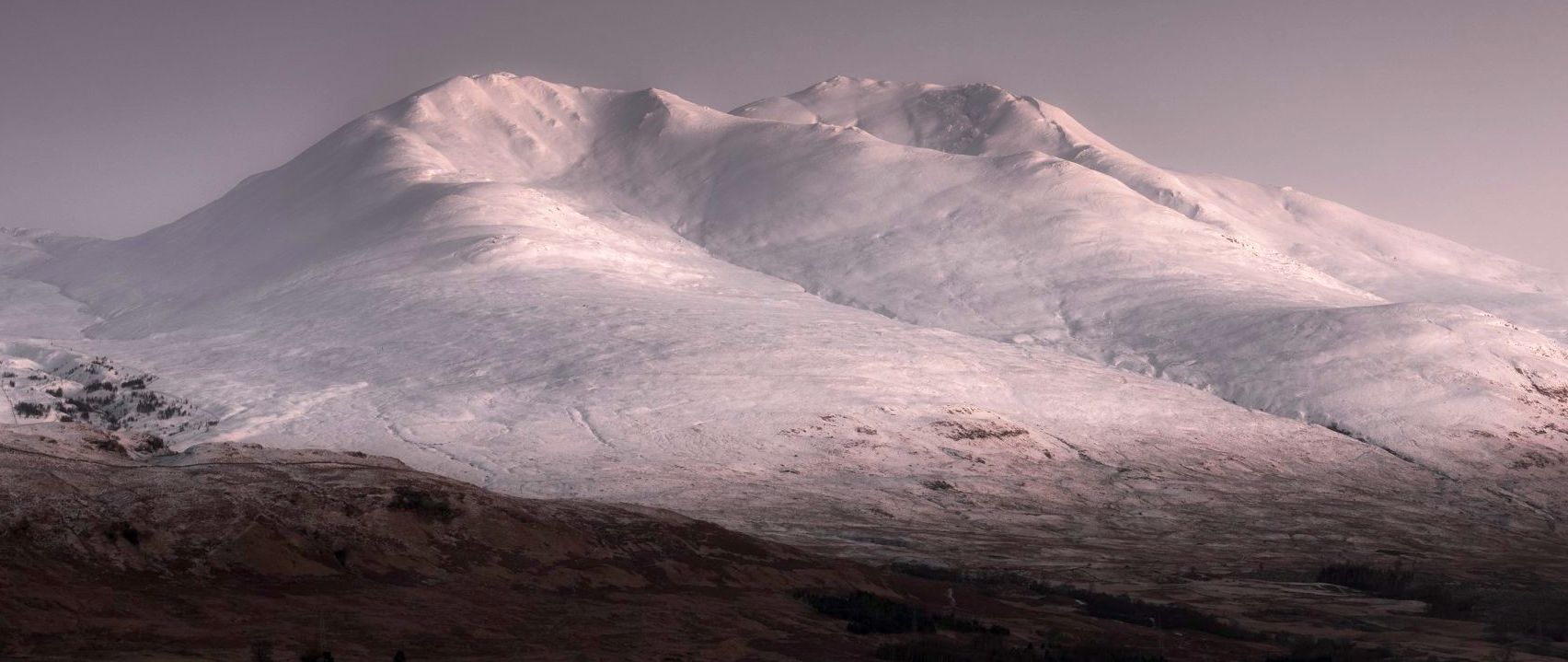
Ben Lawyers group above Loch Tay

Ben Lawers group above Loch Tay


Ben Lawyers group above Loch Tay

Ben Lawers group above Loch Tay


Ben Lawyers group above Loch Tay

Ben Lawers group from Beinn Each


Ben Lawyers

Ben Lawers


Falls of Dochart in Killin

Falls of Dochart at Killin


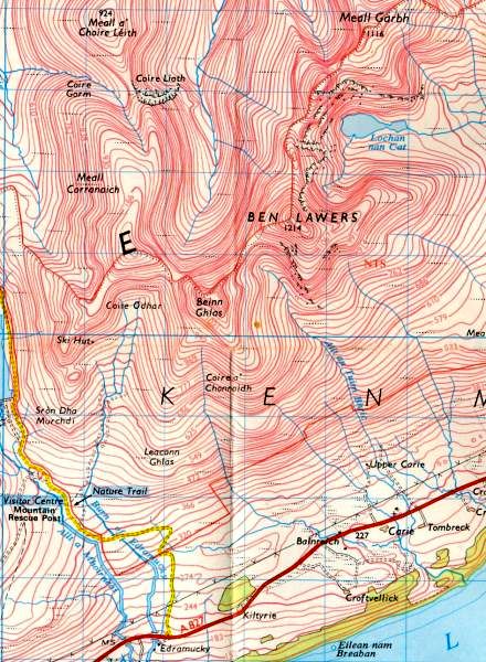
Map of Ben Lawyers

Map of Ben Lawers


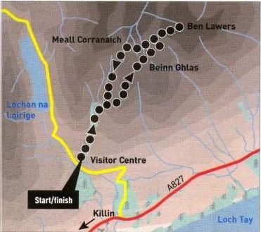
Route Map for Ben Lawyers and Beinn Ghlas

Route Map for Ben Lawers and Beinn Ghlas


BEN LAWERS & BEINN GHLAS - ROUTE DESCRIPTION:

Location: Killin, Loch Tay
Map: OS Landranger 51 [ GR 608379 ]
Distance: 11km [ 6 1/2 miles ]
Time: 5 hours
Terrain: Paths


Ben Lawers is the 10th highest mountain in the UK and forms the centrepiece of a great massif comprising seven separate mountains, all of which are Munros.
There are various ways to its lofty summit but the easiest and most commonly climbed route is that from the National Trust for Scotland’s visitor centre
on the road between Loch Tay and Glen Lyon. The ascent also takes in Beinn Ghlas and although both mountains are over 1,000m in height, the visitor
centre car park lies at a height of 430m, so the ascent is not particularly arduous and is also assisted by a good path.
From the pay and display car park, free to NTS members, follow a path north-east into a fenced-in area of planted trees and up the left side of the Burn of Edramucky.
The path crosses the burn and exits the fenced enclosure to climb easy slopes on to the south ridge, which leads to the summit of Beinn Ghlas ( 1,l03m ).
Ahead, the great pyramidal summit cone of Ben Lawers reveals itself 1.5km away and is easily reached by descending the north-east ridge to gain a flat col at around 1,000m.
Here a path ascends the south-west ridge to gain the splendid summit of Ben Lawers ( l,214m ).
This climb is a bit of a slog and feels longer than it actually is, but once gained the summit is a fine place to relax awhile and take in the expansive views.
Return down the south-west ridge to the col at 1,000m, then either retrace the route over Beinn Ghlas, or better, take the path which drops into the corrie to the west.
This path traverses down and across the northern slopes of Beinn Ghlas to gain the deep col between it and Meall Corranaich. From here a path
descends southwards, well above the burn, along the western flanks of Beinn Ghlas, to join the ascent path out in front of the fenced enclosure, and this is then
followed back to the start.
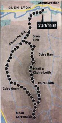


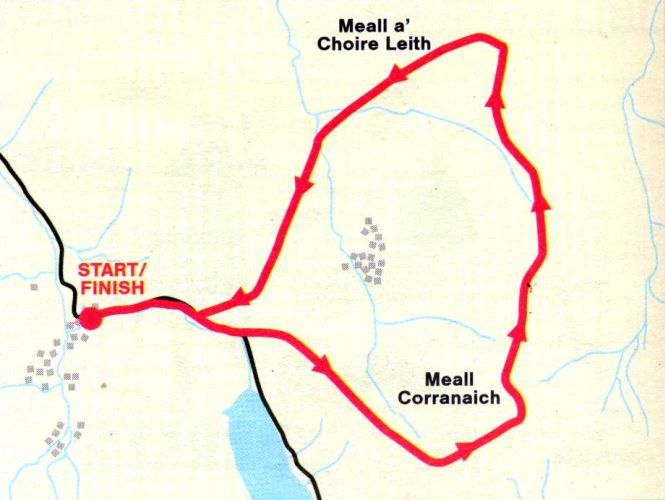
Route Map  for Meall Corranaich and Meall a' Choire Leith

Route Map for Meall Corranaich
and 
Meall a' Choire Leith


MEALL CORRANAICH & MEALL a'CHOIRE LEITH - ROUTE DESCRIPTION:

Location: Glen Lyon
Map: OS Landranger 51 ( GR619 477 )
Distance: 11 miles ( 18km )
Time: six hours
Terrain: tracks and paths


Meall Corrauaich and Meall a' Choire Leith form the western side of the Ben Lawers range and are often climbed together from a high point on the road from Loch Tay to Glen Lyon at Lochan na Lairige.
But there can be something profoundly unsatisfying about hills where more than half the ascent has been made by car.
Exactly why is hard to say. In part it must be the denial of the satisfiaction gained from steady progress up the flanks of a big hill that's been viewed from the glen. So, for anyone looking for a little more from these two hills than a quick up and down from the car, then an approach from beautiful Glen Lyon to the north is highly recommended.
The route starts from a vehicle bridge over the River Lyon immediately south of Camusvrachan at grid ref 62G477.
To access the bridge coming from Bridge of Balgie in the west, turn right just after a house. Roromore Farm, and before a sign Roro and a bridge on the road, and follow a tarmac track down through woodland to the river and a parking area on the right.
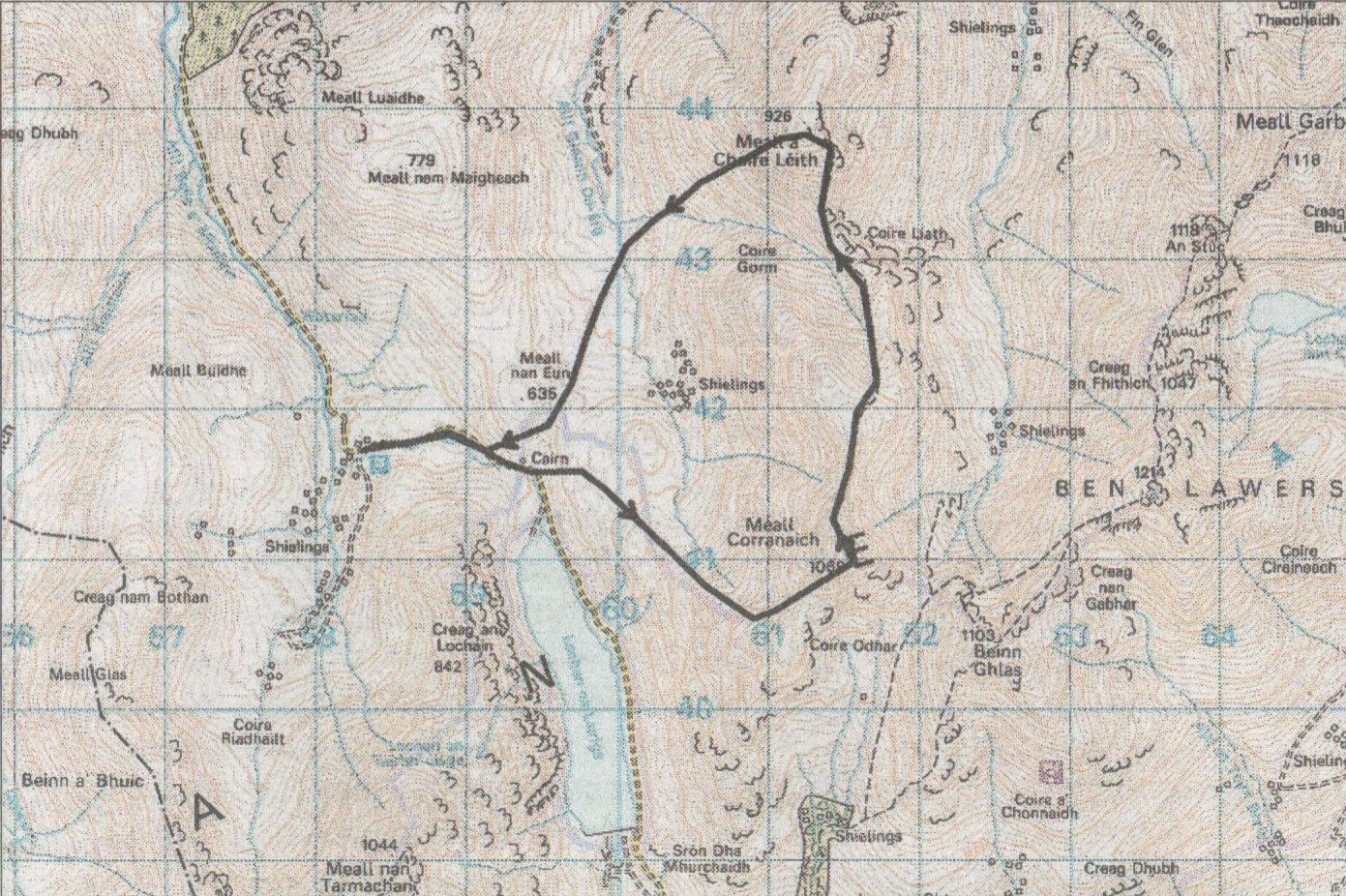
Cross the bridge, up the other side and onto to a T-junction. Turn right and continue on the estate road past a lochan on the left to a white coltage on the right, just before the big white farm house of Roroyere. Opposite the cottage a track is followed up into Gleann Da-Eig to a wall on the western flanks of Meall a' Choire Leith. Ascend the hillside beyond this to gain the broad ridge above Sron Eich and follow it to the edge of thecorrie. then up and right onto the broad dome-like smnmit of Meall a’ Choire Leith.
The ridge and the summit offer fine views to the higher tops of Ben Lawers and Meall Corranaich.
Descend back left to the corrie edge and the col from where a steady ascent skirts the left side of Coire Gorm to pass over Point 1018m to gain a rockier crest leading to the summit of Meall Corranaich.
Retrace your route to Point 1018m, then veer northwest down the broad ridge towards the floor of the glen and follow it north.
A continuation of the track taken at the start is soon met and followed back to the start. Along the route lie the remains of many walled shielings.


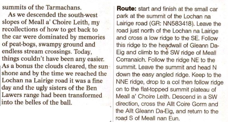
Route Map for Meall Corranaich and Meall a' Choire Leith

Route Map for Meall Corranaich and Meall a' Choire Leith


Route Map for Meall Corranaich and Meall a' Choire Leith

Route Map for Meall Corranaich and Meall a' Choire Leith


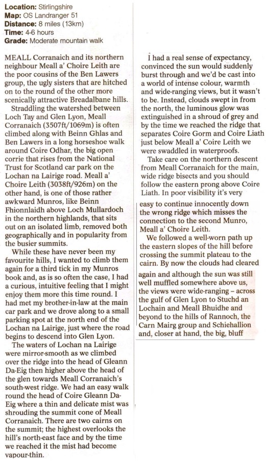
Route Description for Meall Corranaich and Meall a' Choire Leith

Route Description for Meall Corranaich and Meall a' Choire Leith


Route Description for Meall Corranaich and Meall a' Choire Leith

Route Description for Meall Corranaich and Meall a' Choire Leith


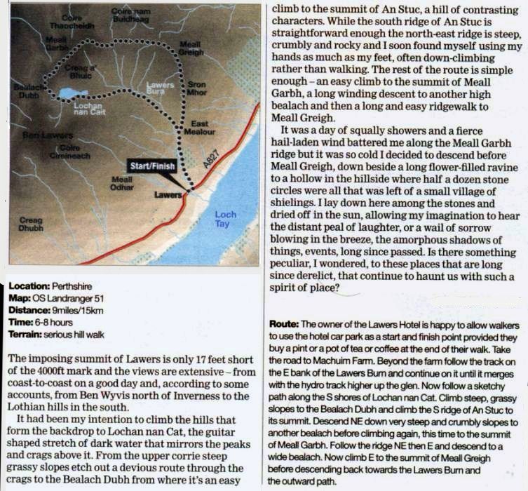
Map and Route Description for a Lochan na Cat Circuit in the Lawyers Group

Map and Route Description for a Lochan na Cat Circuit


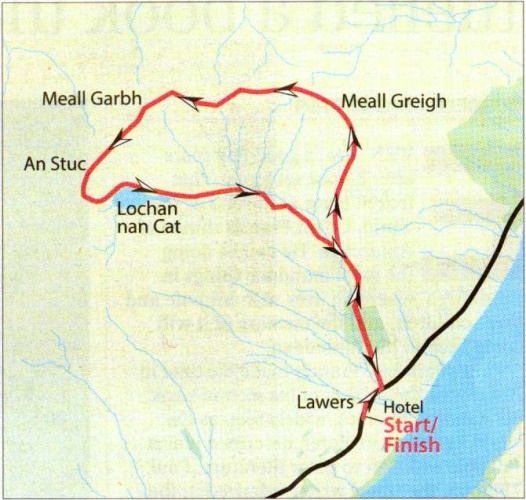
Map for circuit of Meall Garbh and An Stuc

Map for circuit of Meall Garbh and An Stuc


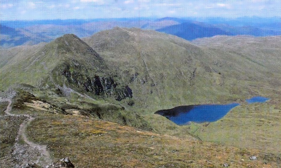
An Stuc and Meall Garbh

An Stuc and Meall Garbh


Route Description for circuit of Meall Garbh and An Stuc

Route Description for circuit of Meall Garbh and An Stuc


Route Description for circuit of Meall Garbh and An Stuc

Route Description for circuit of Meall Garbh and An Stuc


Ben Lawers Gallery Photo Gallery

<< BackSouthern Highlands : Next >>


Scotland Index :: Scottish Peaks :: Scotland Walks

Isle of Skye :: Isle of Arran :: West Highland Way

Knoydart :: Glencoe :: Ben Nevis :: NW Highlands :: Eastern Highlands :: Central Highlands


Worldwide Mountaineering :: Adventure Travel :: Site Index

fb icon  google+ icon Linkedin icon  twitter


Guide Books & Maps - Scotland:-


Ben Lawyers & Glen Lyon - OS Explorer Map  Ben Lawyers & Glen Lyon OS Map

Arrochar Alps - Map Glasgow Popular Hills - Map West Highland Way - Map Loch Lomond North - Tyndrum, Crianlarich, Arrochar - OS Explorer Map Loch Lomond and Inverary OS Landranger Map

Isle of Arran OS Explorer Map Isle of Arran OS Landranger Map Arran - Official Tourist MapIona & Mull MapWestern Scotland & the Western Isles OS Road Map Northern Scotland OS Road MapSouthern Scotland OS Road Map


The High Mountains of Britain & Ireland

Munros Tables SMC The Munros - Scotland's Highest Mountains  Scotland - Lonely Planet  NW Highlands - SMC Guide  Exploring the Far NW of Scotland  Guide to Walks in NW Highlands

Walking in Scotland - Lonely Planet Mountain: Exploring Britain's High Places  National 3 Peaks Walk Scottish Highlands Hillwalking Guide The Scottish Islands Bouldering in Scotland

Central Highlands: Six Long Distance Walks West Highland Way: Official GuideWest Highland Way: Rucksac ReadersWest Highland Way: TrailblazerThe West Highland WayWest Highland Way: Footprint MapWest Highland Way - Map West Highland Way - Map 100 Hillwalks around Glasgow

Pathfinder Guide: Fort William and Glen Coe Walks Rambler's Guide: Ben Nevis and Glen CoeGlencoe Rock & Ice Climbing The Munros: Scottish Mountaineering Club The Munros and Tops The Corbetts - SMC Munros & Corbetts Chart The High Mountains of Britain and Ireland Munro Almanac

The Munros - Scotland's highest mountains Call of the Corbetts Magic of the Munros Hamish's Mountain WalkThe Munros in WinterMy Scotland by Hamish MacInnes

Scottish Mountains - 50 Classic Routes50 More Routes on Scottish Mountains The High Mountains of Britain and Ireland Scotlands 100 Best Walks Scottish Mountains - 100 Best RoutesBig Walks of Great Britain Classic Walks in Britain & Ireland

Scottish Hill & Mountain Names Classic Mountain Scrambles in Scotland Classic Climbs - Central & Southern Highlands Mountaineering in Scotland and Undiscovered Scotland by W.H.MurrayMore Wilderness Walks Wilderness Walks Wilderness Walks 2 - Video Ski Mountaineering in Scotland

Ski Touring in ScotlandScrambles in Lochaber Rock Climbing in Scotland Rock Climbing SkillsThe FACE: Six Great Climbing Adventures Ben Nevis: Rock & Ice ClimbsGreat Snow & Ice Climbs of the British Isles100 Best Routes on Scottish Mountains One Man's Mountains - Tom Patey

A Mountaineer's Tale - W.H.MurrayDougal Haston: Philosophy of RiskThe Glens of Rannoch Southern Highlands - MapNorthern Highlands Central Highlands West Highlands Central Highlands SMCNW Highlands SMC

Scotland - Lonely PlanetScotland's Highlands & Islands - Lonley Planet Scotland's Highlands & Islands - Rough Guide Highlands & Islands of Scotland - Hidden Places Rough Guide ScotlandScottish Highlands & Islands - Rough Guide Rough Guide: Scotland Lonely Planet, Walking in ScotlandLonely Planet - Walking in Britain

50 Walks in the Scottish Highlands & Islands 100 Walks in ScotlandVisit Scotland - Touring Guide Scotland: Where to Stay - Hotels & Guest Houses Scotland: Where to Stay - Bed & Breakfast Hillwalker: The MunrosHillwalker: The Corbetts

Weather for Hillwakers & Climbers Mountain Weather Guide to the Weather Weather: Collins Gem Hillwalking Handbook for Mountain Leaders Hillwalkers Manual Hillwalkers Guide to Mountaineering First Aid on Mountains


Google Analytics


Google Analytics

extremetracking
 eXTReMe Tracker


extremetracking
Sitelock
SiteLock
Sitelock